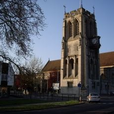
Epping, Market town in Essex, England
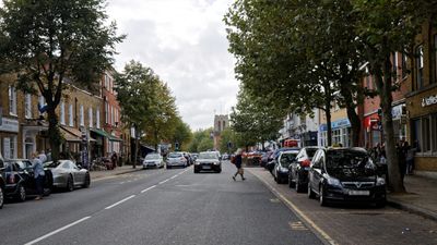
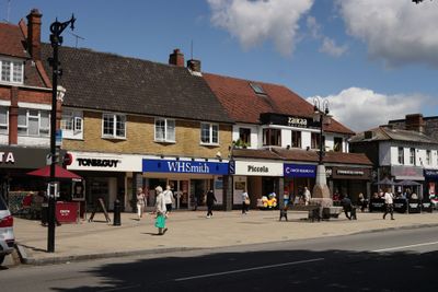
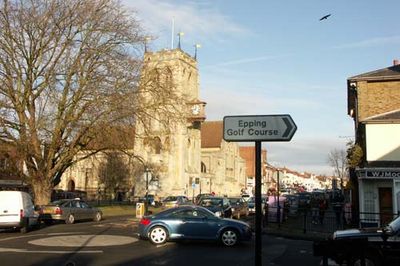
Epping is a market town in Essex, England, located at a key junction between London and the surrounding forest landscape. The town has an established marketplace with regular stalls and is surrounded by green spaces that preserve the feeling of where town and nature meet.
The place was already known as Epinga in 1066 and received its market charter from King Henry III in 1253, marking its transition from forest land to an established trading town.
The market square serves as the social hub where residents gather regularly for shopping and community interaction. Weekly market activities shape local life and reflect the town's enduring connection to its rural surroundings.
The town is easily reached via the London Underground Central Line with good bus connections to surrounding areas. Visitors should check the market opening times, as the market square forms the center for exploration.
The marketplace had an active livestock trading section until 1961, making the town a major supply hub for surrounding communities for centuries. This sector faded as farming practices changed and the town shifted toward retail focus.
Location: Epping Forest
Website: http://eppingtowncouncil.gov.uk
GPS coordinates: 51.70040,0.10870
Latest update: December 6, 2025 21:27
Copped Hall
2.9 km
Ambresbury Banks
2.8 km
Roughtalley's Wood
3.3 km
Gernon Bushes
2.1 km
Thornwood Common Flood Meadow
2.6 km
Church of All Saints
2.6 km
Church of St John the Baptist
227 m
Parish Church of St Mary
3.2 km
Saint Alban's Church
1.7 km
Theydon Oak Inn
1.6 km
Church of All Saints Table Tomb In Churchyard Approximately 100 Feet North East Of Chancel To Sir Thomas Coxhead 1811
3.2 km
Church of All Saints
3.2 km
Queen Victoria Public House
3.2 km
Epping War Memorial
639 m
The Bull Public House
3.2 km
North Weald Airfield Museum
3.5 km
Parsonage Farmhouse
3.3 km
Church of All Saints Tombstone In Churchyard To Mrs E Rogers 1759 And R Rogers 1773
3.2 km
Water Tower
484 m
Copped Hall ancillary buildings and gardens
2.9 km
Gaynes Park
2.7 km
Church of All Saints, Tombstone In Churchyard 60 Feet North Of Stair Tower
3.2 km
The Toll House
2.7 km
Milestone, 400m E of Upshire Road jct
2.6 km
Milestone, Epping Road, 500m W of M11 bridge
2.2 km
Milestone, High Road, opp jct with Bury Lane (B182)
973 m
Milestone, fronting Redgrove House
670 m
Milestone, Woodside
2.2 kmVisited this place? Tap the stars to rate it and share your experience / photos with the community! Try now! You can cancel it anytime.
Discover hidden gems everywhere you go!
From secret cafés to breathtaking viewpoints, skip the crowded tourist spots and find places that match your style. Our app makes it easy with voice search, smart filtering, route optimization, and insider tips from travelers worldwide. Download now for the complete mobile experience.
A unique approach to discovering new places❞
— Le Figaro
All the places worth exploring❞
— France Info
A tailor-made excursion in just a few clicks❞
— 20 Minutes