Chest opened
+${chestReward.xp} XP
Explorer
NOUVEAU ×${chestReward.collectible.quantity}
tapez pour fermer

See the monuments around you in AR Open chests in the app

Around Us is built for your phone — point your camera at the streets and discover the monuments and places around you in augmented reality. Around Us is built for your phone — chests unlock when you walk, explore and capture nearby places.

Enable Location

We need your location to show you interesting places around you

Discover nearby places

Find interesting locations and hidden gems around you

Precise directions

Get accurate directions and distances to places

Your location is never shared with other users. It's only used when you tap the location button.

Log in to your account

Start exploring — it's free

Trusted by 85,262 travelers worldwide

Continue with Google
Continue with Apple
or

We will send you a code to connect

By continuing, you accept our Terms and Conditions and our Privacy Policy

Check your inbox

We've sent a pincode in your inbox. Please enter the code below.

North East Derbyshire
Discussion Reviews Photo
83.9k Popularity

North East Derbyshire, Parliamentary constituency in East Midlands, United Kingdom

North East Derbyshire is a constituency of the House of Commons in the East Midlands that covers Clay Cross, Dronfield, Killamarsh, Staveley and nearby areas. The seat brings together former industrial towns and rural countryside spread across the region.

The seat was created in 1885 under the Redistribution of Seats Act and elected Liberal members at first. From 1935 onward, Labour held the constituency for most of the time until the Conservatives won in 2017.

Mining traditions shaped the local identity until 1970, influencing employment patterns, community development, and social structures throughout the East Midlands region.

The constituency serves around 72,000 registered voters and holds regular parliamentary elections. Residents can visit local polling stations during official election dates.

From 2005 to 2017 the seat changed hands narrowly between parties, with winning margins never exceeding 5.7 percent. This long stretch of close contests turned the constituency into a watched indicator of national political mood.

The community of curious travelers

AroundUs brings together thousands of curated places, local tips, and hidden gems, enriched daily by 60,000 contributors worldwide.

Start exploring
Location
Inception
November 24, 1885
GPS coordinates
53.24000,-1.55000
Latest update
August 30, 2026 10:20
Around this place
United Kingdom

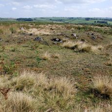
Cairn cemetery on Gibbet Moor, 1100m south west of Stonelow Farm

1.2 mi
United Kingdom

Methodist Chapel

1 mi
United Kingdom

Cairnfield 800m west of Nether Rodknoll Farm

1 mi
United Kingdom

Stone Low

0.7 mi
Wayside cross known as Whibbersley Cross
United Kingdom

Wayside cross known as Whibbersley Cross

0.8 mi
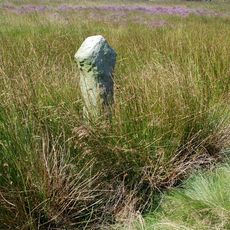
Guide Post At Sk303 720
United Kingdom

Guide Post At Sk303 720

0.4 mi
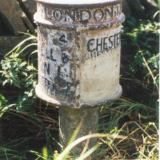
Milepost, SE of Wadshelf near Brampton Boundary
United Kingdom

Milepost, SE of Wadshelf near Brampton Boundary

1.3 mi
United Kingdom

Rodknoll fancy barrow

1 mi
Bronze Age settlement and ceremonial remains on Gibbet Moor, 980m north east of Swiss Cottage
United Kingdom

Bronze Age settlement and ceremonial remains on Gibbet Moor, 980m north east of Swiss Cottage

1.4 mi
United Kingdom

Cairn complex 780m south of Dalebrook House

0.7 mi
United Kingdom

Cairn 400m north west of Newbridge Farm

1.1 mi
United Kingdom

Cairnfield, field system and ring cairn 650m east of Moorside Farm

1.3 mi
United Kingdom

Cairnfield and field system 530m south of Dalebrook House

0.6 mi
Milepost, opp. entrance to Stonelow Farm, E of Derbys Dales boundary
United Kingdom

Milepost, opp. entrance to Stonelow Farm, E of Derbys Dales boundary

0.7 mi
United Kingdom

Cairn 500m west of Newbridge Farm

1.1 mi
Milestone, opp. Royal Oak PH, Wigley
United Kingdom

Milestone, opp. Royal Oak PH, Wigley

1.1 mi
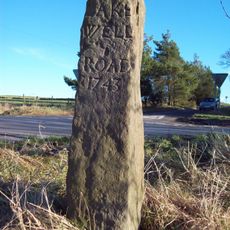
Milestone, Clodhall Lane, near Whibbersley Cross
United Kingdom

Milestone, Clodhall Lane, near Whibbersley Cross

0.9 mi
United Kingdom

Cairnfield on Gibbet Moor west of Umberley Brook, 1.2km south west of Dalebrook House

1 mi
United Kingdom

Birley Grange Farmhouse

1.3 mi
United Kingdom

Wigley Farmhouse

0.9 mi
United Kingdom

Temperance House

1 mi
United Kingdom

Cruck Barn At The Bungalow

1 mi
United Kingdom

Wigley Hall

1 mi
United Kingdom

Outbuilding At Hallcliff Farm

1.2 mi
United Kingdom

L-Shaped Range Of Outbuildings To West Of Hollins House

1.4 mi
United Kingdom

Birley Grange Cottage Farm

1.3 mi
United Kingdom

Outbuilding To The North West Of Hollins House

1.4 mi
United Kingdom

Guide Post At Sk 307 718

0.5 mi
Show the full map
Reviews
Share your experience

No review yet

Discussions
Start a discussion...

No discussion yet

« North East Derbyshire - Parliamentary constituency in East Midlands, United Kingdom » is provided by Around Us (aroundus.com). Images and texts are derived from Wikimedia project under a Creative Commons license. You are allowed to copy, distribute, and modify copies of this page, under the conditions set by the license, as long as this note is clearly visible.

Discover hidden gems everywhere you go!

From secret cafés to breathtaking viewpoints, skip the crowded tourist spots and find places that match your style. Our app makes it easy with voice search, smart filtering, route optimization, and insider tips from travelers worldwide. Download now for the complete mobile experience.

Around Us App Screenshot

A unique approach to discovering new places

Le Figaro

All the places worth exploring

France Info

A tailor-made excursion in just a few clicks

20 Minutes

Around Us
Travel Guide & Maps
Download

Send to your phone

QR Code
1

Open the camera app on your mobile.

2

Point at the QR code with your camera. A notification will appear.

3

Tap the notification to open the link.