Chest opened
+${chestReward.xp} XP
Explorer
NOUVEAU ×${chestReward.collectible.quantity}
tapez pour fermer
Chest locked

Open chests in the app

Around Us is built for your phone — chests unlock when you walk, explore and capture nearby places.

Enable Location

We need your location to show you interesting places around you

Discover nearby places

Find interesting locations and hidden gems around you

Precise directions

Get accurate directions and distances to places

Your location is never shared with other users. It's only used when you tap the location button.

London Oxford Airport

Log in to your account

Start exploring — it's free

Trusted by 73,053 travelers worldwide

Continue with Google
Continue with Apple
or

We will send you a code to connect

By continuing, you accept our Terms and Conditions and our Privacy Policy

Check your inbox

We've sent a pincode in your inbox. Please enter the code below.

London Oxford Airport
Discussion Reviews 2 Photos
25.8k Popularity

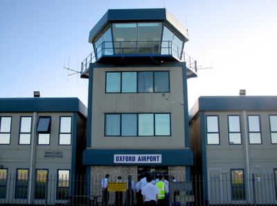
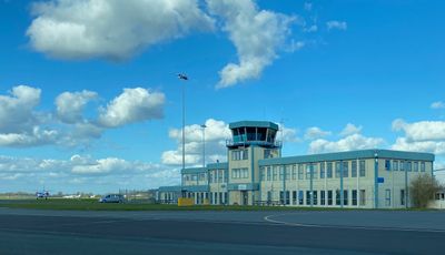
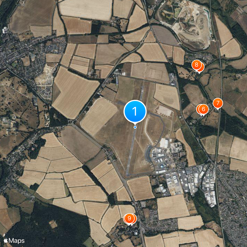
London Oxford Airport, Commercial airport in Kidlington, United Kingdom.

London Oxford Airport is an active aerodrome located near Kidlington, approximately 11 kilometers northwest of Oxford. The facility features a 5,092-foot runway and handles both general aviation and business flights.

Oxford purchased the land in 1935 and opened the airport for operations in 1938. The formal inauguration took place in July 1939.

Multiple flight schools and aviation businesses operate from this location. It serves as the UK headquarters for Airbus Helicopters, shaping the local aviation scene.

The airport operates from 6:30 AM to 10:30 PM and provides AVGAS and JET fuel services. All aircraft require mandatory ground handling services.

The airport recorded over 65,000 aircraft movements in 2022, showing substantial growth. These figures reflect recovery following a period of reduced activity.

The community of curious travelers

AroundUs brings together thousands of curated places, local tips, and hidden gems, enriched daily by 60,000 contributors worldwide.

Start exploring
Location
Official opening
1935
Reference
OXF
GPS coordinates
51.83694,-1.32000
Latest update
December 20, 2025 16:04
Around this place
Church of St Michael
United Kingdom

Church of St Michael

1.7 km
Church of Holy Cross
United Kingdom

Church of Holy Cross

1.4 km
Church of St Philip
United Kingdom

Church of St Philip

1.7 km
The Boat Public House
United Kingdom

The Boat Public House

1.1 km
1-9 Canal Road, Thrupp
United Kingdom

1-9 Canal Road, Thrupp

1.2 km
Thrupp Yard Cottages and attched outbuilding
United Kingdom

Thrupp Yard Cottages and attched outbuilding

1.4 km
The Manor and attached outbuildings
United Kingdom

The Manor and attached outbuildings

1.4 km
United Kingdom

Chest Tomb Approximately 8 Metres East Of Chancel Of Church Of St Michael

1.6 km
United Kingdom

St Philip's Priory

1.6 km
United Kingdom

Sparrowgap Bridge, Oxford Canal

1.1 km
Dovecote and granary approximately 15 metres east of Manor Farmhouse
United Kingdom

Dovecote and granary approximately 15 metres east of Manor Farmhouse

1.3 km
Base And Shaft Of Churchyard Cross Approximately 9 Metres South Of South Door Of Church Of St Michael
United Kingdom

Base And Shaft Of Churchyard Cross Approximately 9 Metres South Of South Door Of Church Of St Michael

1.7 km
United Kingdom

Haeadstone Approximately 8 Metres South South West Of South Door Of Church Of St Michael

1.7 km
Railway Bridge At Sp 4832 1529
United Kingdom

Railway Bridge At Sp 4832 1529

1.4 km
United Kingdom

Thrupp Cross

1.1 km
Shipton-on-Cherwell churchyard cross
United Kingdom

Shipton-on-Cherwell churchyard cross

1.4 km
United Kingdom

Lower Farmhouse And Attached Granary Outbuilding

977 m
United Kingdom

Kitchen Garden Walls Approximately 20 Metres North North East Of The Manor

1.5 km
United Kingdom

Shipton Slade Farmhouse

1.9 km
Milestone, Oxford Road; Blenheim Lower Park, opp. Long Close
United Kingdom

Milestone, Oxford Road; Blenheim Lower Park, opp. Long Close

1.9 km
Milestone, Grove Road; by No.49, Hensington
United Kingdom

Milestone, Grove Road; by No.49, Hensington

1.8 km
United Kingdom

Eagle Lodge

1.7 km
United Kingdom

Cowyards Cottage The Cowyards

1.8 km
United Kingdom

Blenheim Villa, a Roman villa and associated field system 200m north east of Little Cote

1.4 km
United Kingdom

Barn And Stable Approximately 15 Metres North East Of Manor Farmhouse

1.3 km
United Kingdom

Shipton Slade Farm, Barn Approximately 50 Metres South West Of Farmhouse

1.8 km
United Kingdom

Manor Farmhouse

1.3 km
United Kingdom

Grave Slab Approximatel 5 Metres South Of South Door Of Church Of St Michael

1.7 km
Show the full map
Reviews
Share your experience

No review yet

Discussions
Start a discussion...

No discussion yet

« London Oxford Airport - Commercial airport in Kidlington, United Kingdom » is provided by Around Us (aroundus.com). Images and texts are derived from Wikimedia project under a Creative Commons license. You are allowed to copy, distribute, and modify copies of this page, under the conditions set by the license, as long as this note is clearly visible.

Discover hidden gems everywhere you go!

From secret cafés to breathtaking viewpoints, skip the crowded tourist spots and find places that match your style. Our app makes it easy with voice search, smart filtering, route optimization, and insider tips from travelers worldwide. Download now for the complete mobile experience.

Around Us App Screenshot

A unique approach to discovering new places

Le Figaro

All the places worth exploring

France Info

A tailor-made excursion in just a few clicks

20 Minutes

Around Us
Travel Guide & Maps
Download

Send to your phone

QR Code
1

Open the camera app on your mobile.

2

Point at the QR code with your camera. A notification will appear.

3

Tap the notification to open the link.