Enable Location

We need your location to show you interesting places around you

Discover nearby places

Find interesting locations and hidden gems around you

Precise directions

Get accurate directions and distances to places

Your location is never shared with other users. It's only used when you tap the location button.

Coventry Canal

Log in to your account

Start exploring — it's free

Trusted by 62,561 travelers worldwide

Continue with Google
Continue with Apple
or

We will send you a code to connect

By continuing, you accept our Terms and Conditions and our Privacy Policy

Check your inbox

We've sent a pincode in your inbox. Please enter the code below.

Coventry Canal

Coventry Canal, Waterway network in Midlands, England.

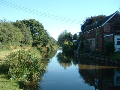
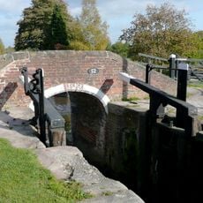
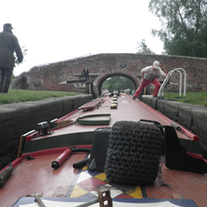
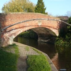
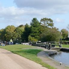
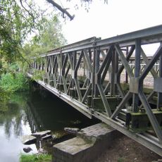
The Coventry Canal is a narrow waterway that runs from Coventry to Fradley Junction, linking several industrial regions across the Midlands. The route passes through a dense network of locks, bridges, and aqueducts designed to navigate changes in elevation.

The project began in 1768 under engineer James Brindley but faced financial setbacks that slowed progress. Thomas Yeoman took over the work and finally completed the waterway in 1790.

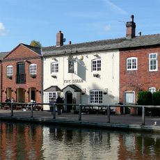
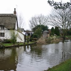
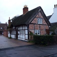
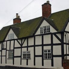
The waterway served as the main transport route for goods between industrial towns in the region. Visitors can observe today how the canal shaped the layout and growth of the communities it passes through.

The canal can be explored on foot or by bicycle using the towpaths that run alongside the waterway. Parking and access points are located at regular intervals, making it easy to visit different sections.

At Hawkesbury Junction, the waterway runs in an unusual parallel configuration alongside the Oxford Canal, a result of historical disputes between rival operators. This rare layout allows visitors to see the physical evidence of old competition between canal companies.

The community of curious travelers

AroundUs brings together thousands of curated places, local tips, and hidden gems, enriched daily by 60,000 contributors worldwide.

Start exploring
Location
GPS coordinates
52.72360,-1.79340
Latest update
December 8, 2025 13:44
Around this place
All Saints Church, Alrewas
United Kingdom

All Saints Church, Alrewas

3 km
Bridge Number 52 And Shade House Lock
United Kingdom

Bridge Number 52 And Shade House Lock

387 m
Trent And Mersey Canal Bridge Number 53  Trent And Mersey Canal Woodend Lock
United Kingdom

Trent And Mersey Canal Bridge Number 53 Trent And Mersey Canal Woodend Lock

1.4 km
The Swan And Attached Buildings
United Kingdom

The Swan And Attached Buildings

24 m
Bridge Cottage
United Kingdom

Bridge Cottage

3.2 km
Alrewas War Memorial
United Kingdom

Alrewas War Memorial

3.1 km
Trent And Mersey Canal Gaskell's Bridge Number 46 At Sk 1699
United Kingdom

Trent And Mersey Canal Gaskell's Bridge Number 46 At Sk 1699

3.2 km
Alrewas Hayes Farmhouse
United Kingdom

Alrewas Hayes Farmhouse

793 m
The George And Dragon
United Kingdom

The George And Dragon

3.2 km
Workshops Approximately 250 Yards East Of The Swan
United Kingdom

Workshops Approximately 250 Yards East Of The Swan

212 m
3, Post Office Road
United Kingdom

3, Post Office Road

3.2 km
Orgreave Hall And Attached Stables
United Kingdom

Orgreave Hall And Attached Stables

2.2 km
RAF Lichfield Memorial
United Kingdom

RAF Lichfield Memorial

1.8 km
112, Main Street
United Kingdom

112, Main Street

3.2 km
110, Main Street
United Kingdom

110, Main Street

3.2 km
69, Main Street
United Kingdom

69, Main Street

3.2 km
Mile Post At Ngr Sk 14881563
United Kingdom

Mile Post At Ngr Sk 14881563

1.8 km
Middle Lock
United Kingdom

Middle Lock

227 m
138 And 140, Main Street
United Kingdom

138 And 140, Main Street

3 km
Alrewas Statfold Lane River Trent bridge
United Kingdom

Alrewas Statfold Lane River Trent bridge

3.3 km
The Tudor Of Lichfield
United Kingdom

The Tudor Of Lichfield

3.2 km
Milepost, NE of Hilliard's Cross
United Kingdom

Milepost, NE of Hilliard's Cross

2.4 km
Milepost, 200m S of A513 Handsacre road jct
United Kingdom

Milepost, 200m S of A513 Handsacre road jct

3.1 km
Milepost, Streethay
United Kingdom

Milepost, Streethay

3.2 km
Milepost, near Trent & Mersey Canal, W end of Alrewas village
United Kingdom

Milepost, near Trent & Mersey Canal, W end of Alrewas village

2.5 km
Milepost, between Eastfields & Lupin Farm, E of Kings Bromley
United Kingdom

Milepost, between Eastfields & Lupin Farm, E of Kings Bromley

2.6 km
Milepost, S of canal
United Kingdom

Milepost, S of canal

2.6 km
Milepost, S of Crown Inn Farm
United Kingdom

Milepost, S of Crown Inn Farm

2.5 km
Show the full map
« Coventry Canal - Waterway network in Midlands, England » is provided by Around Us (aroundus.com). Images and texts are derived from Wikimedia project under a Creative Commons license. You are allowed to copy, distribute, and modify copies of this page, under the conditions set by the license, as long as this note is clearly visible.

Discover hidden gems everywhere you go!

From secret cafés to breathtaking viewpoints, skip the crowded tourist spots and find places that match your style. Our app makes it easy with voice search, smart filtering, route optimization, and insider tips from travelers worldwide. Download now for the complete mobile experience.

Around Us App Screenshot

A unique approach to discovering new places

Le Figaro

All the places worth exploring

France Info

A tailor-made excursion in just a few clicks

20 Minutes

Around Us
Travel Guide & Maps
Download

Send to your phone

QR Code
1

Open the camera app on your mobile.

2

Point at the QR code with your camera. A notification will appear.

3

Tap the notification to open the link.