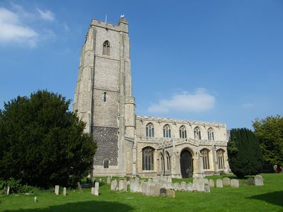
Mildenhall, Market town in West Suffolk, England
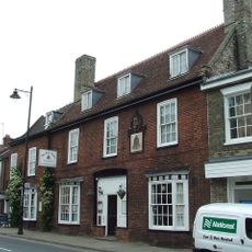
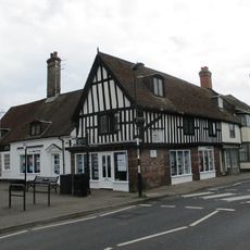
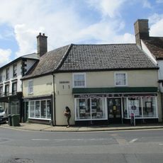
Mildenhall is a market town in West Suffolk positioned along the River Lark at the edge of the Fens, surrounded by farmland and nature reserves. The town spreads across flat terrain in a rural setting, with the A11 road providing road access to the area.
Settlement in this location dates back to the Bronze Age and flourished during Roman times when valuable silver hoards were buried here. These Roman artifacts indicate the place held economic importance in ancient times.
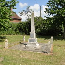
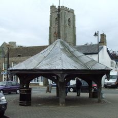
The name comes from Anglo-Saxon roots meaning a settlement in open grassland. The weekly Friday market continues to be a social focal point where locals gather for fresh produce and goods.
Head to the central marketplace near the hexagonal market cross to experience the Friday market and see the heart of the town. The flat terrain makes walking around easy, and good road connections via the A11 make it simple to reach.
A major United States Air Force base has operated here since 1934 and continues to shape the character of the place today. Military aircraft and international personnel are part of the everyday landscape for residents.
Location: Mildenhall High
Website: http://mildenhall.suffolk.gov.uk
GPS coordinates: 52.34461,0.50890
Latest update: December 20, 2025 12:28
St Mary's Church, Mildenhall
204 m
Rex Graham nature reserve
2.7 km
Norah Hanbury-Kelk Meadows
845 m
The Riverside Hotel
382 mBarn 100 Metres South East Of Wamil Hall
1.5 km
Mildenhall War Memorial, Suffolk
188 m
Beck Row War Memorial
3 kmBarton Hall
1.2 kmBeck House
2.5 km
The Bell Hotel
225 m
17 And 19, High Street
183 m
34, High Street
261 m
Market Cross
159 m
Hanmer Almshouses
203 m
Lloyds Bank
295 m14, High Street
118 m
National Building Society
183 m1 and 2, Market Place
136 mHutchinson Opticians Sugar And Spice
283 m30 And 32 High Street
245 m16, High Street
125 mThe Chess Gallery
97 mSpringvale
95 m
The Priory
242 m3, Market Place
137 mEntrance Gateway 15 Metres North Of Wamil Hall, With Attached Flanking Walls Which Return Towards Wamil Hall
1.5 kmBarn, 40 Metres East Of Holywell Farmhouse
2.3 kmTwo bowl barrows east of Dale Hole Plantation, 480m north of Pump House
3.2 kmVisited this place? Tap the stars to rate it and share your experience / photos with the community! Try now! You can cancel it anytime.
Discover hidden gems everywhere you go!
From secret cafés to breathtaking viewpoints, skip the crowded tourist spots and find places that match your style. Our app makes it easy with voice search, smart filtering, route optimization, and insider tips from travelers worldwide. Download now for the complete mobile experience.
A unique approach to discovering new places❞
— Le Figaro
All the places worth exploring❞
— France Info
A tailor-made excursion in just a few clicks❞
— 20 Minutes