Pontypridd, Market town in South Wales, United Kingdom.
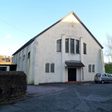
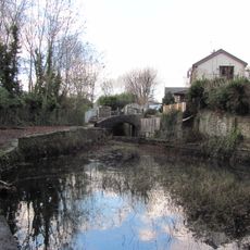
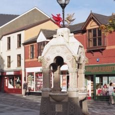
Pontypridd is a Welsh market town in the south where two river valleys meet and steep green hills shape the surroundings. The main street runs through a compact center with red brick shops, small cafes, and a market square, while residential streets climb the slopes.
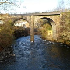
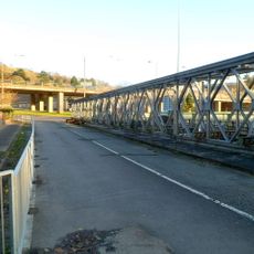
The settlement grew around a new stone arch bridge in the 18th century that carried travelers over the river. Mining brought thousands of workers to the area in the 19th century, and the small hamlet turned into a busy trading center for the surrounding valleys.
The name comes from an old bridge near the place where two rivers meet, and translates as the bridge by the house of the earthdweller. Welsh is still spoken in shops and streets, especially on market days when locals do their shopping.
The area can be explored on foot, with the center fairly flat while residential streets on the hillsides are steeper. Saturdays see busy market activity, so arriving earlier helps if you prefer a quieter walk around.
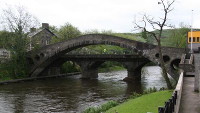
An old stone bridge spanned the river with a single wide arch and was considered the longest of its kind in Europe for nearly eighty years. Today it still connects the eastern and western banks, though traffic now uses a newer road.
Location: Pontypridd Town
Website: http://pontypriddtowncouncil.org.uk
GPS coordinates: 51.59672,-3.33682
Latest update: December 4, 2025 23:05
Ynysangharad Park
436 m
St Dyfrig's Church
861 m
St Catherine's Church
743 m
Pontypridd Library
830 m
The Groggshop
537 m
Memorial to Evan and James James
644 m
Sardis Welsh Independent Chapel
551 m
Libanus Welsh Baptist Church
824 m
Market Tavern Hotel
685 m
Muni Arts Centre
899 m
Tabernacle Welsh Baptist Chapel
889 m
Lido at Ynysangharad Park
556 m
St Dyfrig's Church Hall
886 m
Lloyds TSB Bank, Market Square branch
649 m
St Catherine's Church Parish Rooms
741 m
Pontypridd Register Office
504 m
Platform 11
470 m
Bridge over Glamorganshire Canal W of Newbridge Chainworks basin
729 m
Welch Regimental War Memorial
856 m
Rhondda Viaduct
790 m
Drinking Fountain
781 m
Railway Bridge beneath Pontypridd Railway Station
433 m
National Westminster Bank
576 m
Machine Bridge (also Known As Pont Y Doctor)
916 m
Taff Vale Railway Viaduct Over Mill Street Including Masonry Weir
729 m
Sunday School
777 m
Le Crazy Croissant
656 m
Calvary English Baptist Church
419 mVisited this place? Tap the stars to rate it and share your experience / photos with the community! Try now! You can cancel it anytime.
Discover hidden gems everywhere you go!
From secret cafés to breathtaking viewpoints, skip the crowded tourist spots and find places that match your style. Our app makes it easy with voice search, smart filtering, route optimization, and insider tips from travelers worldwide. Download now for the complete mobile experience.
A unique approach to discovering new places❞
— Le Figaro
All the places worth exploring❞
— France Info
A tailor-made excursion in just a few clicks❞
— 20 Minutes