Wellington, Market town in Somerset, England
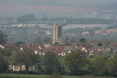
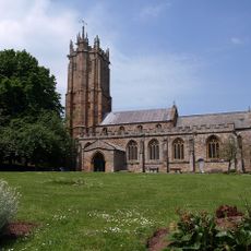
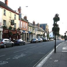
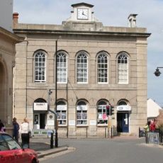
Wellington is a market town in Somerset, England, situated near the Devon border with Georgian buildings defining its character. The town centre features a market square surrounded by traditional structures, and independent shops and cafes line the main streets.
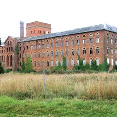
Wellington received its market charter in 1215, which established it as an important trading centre. The town later became a significant wool manufacturing hub during the Industrial Revolution, particularly through the operations of Fox Brothers' Mill.
The Wellington Monument sits prominently on the Blackdown Hills and serves as a landmark that connects the town to its namesake, the Duke of Wellington. Locals and visitors alike recognize this structure as central to how the place defines itself in the countryside.
The town centre offers numerous independent shops, cafes, and a weekly market that animate the space throughout the week. Regular buses connect it to nearby Taunton and surrounding villages, making it accessible without a car.
Fox, Fowler and Company operated as a private bank in the town until 1921, holding the rare privilege of printing its own banknotes. This detail reveals how the place was financially important during the Industrial Revolution.
Location: Somerset
Website: http://wellingtontowncouncil.co.uk
GPS coordinates: 50.97550,-3.22430
Latest update: December 17, 2025 11:13
Church of St John the Baptist, Wellington
634 m
Tonedale Mills
1.7 km
Tone Dale House
1.6 km
Wellington Museum
0 m
Longforth Farm
1.4 km
Church of St Peter and St Paul, Runnington
2.7 km
Wellington Town Hall, Somerset
422 mUnited Reformed Church
381 mBlue Mantle House Hotel
412 mThe Vintage Public House
380 m
Wellesley Theatre
476 mHigh Path
1.2 kmThree Cups Hotel
407 mSwallowfield
1.4 kmWestford House
2.1 kmCloth Finishing Works At Tone Mills, North Range, Including Dyehouse And Reservoirs
2.2 km1-3 Westford Court, Payton Road
2 km41, Fore Street
437 mUnidentified Chest Tomb In Churchyard, About 2 Metres North-East Of Chancel, Church Of St Peter
2.7 km12, High Street
419 mHarpford Farmhouse
3.3 km18, Fore Street
377 m8, High Street
408 m14, High Street
420 m
Water Tower (Easternmost Of Pair)
1.5 kmLongforth Farmhouse
1.3 kmTonedale Mills (east Complex)
1.7 km49-55, High Street
525 mVisited this place? Tap the stars to rate it and share your experience / photos with the community! Try now! You can cancel it anytime.
Discover hidden gems everywhere you go!
From secret cafés to breathtaking viewpoints, skip the crowded tourist spots and find places that match your style. Our app makes it easy with voice search, smart filtering, route optimization, and insider tips from travelers worldwide. Download now for the complete mobile experience.
A unique approach to discovering new places❞
— Le Figaro
All the places worth exploring❞
— France Info
A tailor-made excursion in just a few clicks❞
— 20 Minutes