Enable Location

We need your location to show you interesting places around you

Discover nearby places

Find interesting locations and hidden gems around you

Precise directions

Get accurate directions and distances to places

Your location is never shared with other users. It's only used when you tap the location button.

Chevening

Log in to your account

Start exploring — it's free

Trusted by 62,167 travelers worldwide

Continue with Google
Continue with Apple
or

We will send you a code to connect

By continuing, you accept our Terms and Conditions and our Privacy Policy

Check your inbox

We've sent a pincode in your inbox. Please enter the code below.

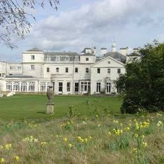
Chevening, Historic country house in Sevenoaks, Kent, England

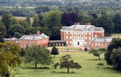
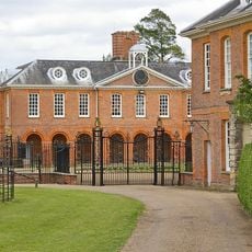
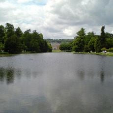
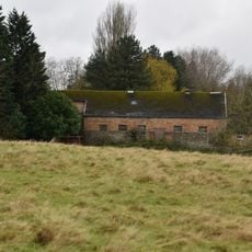
Chevening is a red brick country house at the foot of the North Downs in Kent, rising three floors with classical symmetry. The building stands within extensive parkland spreading over 1200 hectares (3000 acres), combining woodland, lakes and formal garden layouts.

A settlement has been recorded here since the late 12th century, while the current main building rose in the early 17th century. After World War Two, an act of parliament transferred the property into state management, and it has served since as a residence for senior government members.

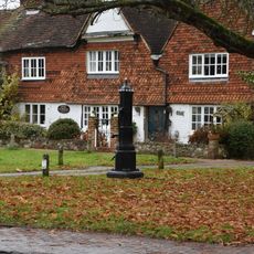
The name comes from the Old English word for pine sapling, reflecting the wooded character that has shaped the surroundings for centuries. Visitors today see parkland shaped over generations according to English garden ideals, still showing that traditional design language.

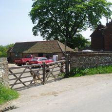
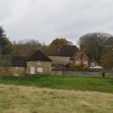
The estate is not permanently open to the public, as it serves as an official residence, but guided tours are sometimes offered. Those passing by can at least glimpse the facade and surrounding fields from the road.

Inside, paintings and furniture from several centuries remain from former residents and now form part of the state collection. The double hexagonal walled kitchen garden is a rare layout, showing an unusual geometric solution for growing vegetables and fruit.

The community of curious travelers

AroundUs brings together thousands of curated places, local tips, and hidden gems, enriched daily by 60,000 contributors worldwide.

Start exploring
Location
GPS coordinates
51.29870,0.13165
Latest update
December 13, 2025 17:17
Around this place
Dryhill Nature Reserve
United Kingdom

Dryhill Nature Reserve

2.8 km
St Katharine's Church, Knockholt
United Kingdom

St Katharine's Church, Knockholt

2.3 km
Chatham Vase
United Kingdom

Chatham Vase

368 m
Church of St Botolph, Chevening
United Kingdom

Church of St Botolph, Chevening

213 m
Church of St Mary
United Kingdom

Church of St Mary

2.7 km
Church of St Martin
United Kingdom

Church of St Martin

2.9 km
18-22, Church Road
United Kingdom

18-22, Church Road

2.4 km
Combe Bank
United Kingdom

Combe Bank

2 km
The Old Hall
United Kingdom

The Old Hall

2.4 km
Knockholt War Memorial
United Kingdom

Knockholt War Memorial

2.3 km
1, Chevening Road
United Kingdom

1, Chevening Road

271 m
Lennard Lodge
United Kingdom

Lennard Lodge

170 m
East Side Of Bridge Over River Darenth
United Kingdom

East Side Of Bridge Over River Darenth

1.9 km
Brasted Hill Farm House
United Kingdom

Brasted Hill Farm House

2.4 km
Combe Bank Lodge
United Kingdom

Combe Bank Lodge

2.7 km
The White House
United Kingdom

The White House

2.9 km
Outbuilding To North East Of Dryhill Farmhouse
United Kingdom

Outbuilding To North East Of Dryhill Farmhouse

2.9 km
Sundridge Place
United Kingdom

Sundridge Place

2.8 km
Wrought Iron Screen And Gates To North Of Entrance Courtyard Of Chevening House
United Kingdom

Wrought Iron Screen And Gates To North Of Entrance Courtyard Of Chevening House

66 m
Pump In Middle Of Village Green
United Kingdom

Pump In Middle Of Village Green

2.8 km
The Chatham Vase On East Side Of Lake Near Its South End
United Kingdom

The Chatham Vase On East Side Of Lake Near Its South End

367 m
Large Barn To South East Of Sundridge Place With Outbuildings Adjoining
United Kingdom

Large Barn To South East Of Sundridge Place With Outbuildings Adjoining

2.9 km
Milestone, London Road, by " Great Dunton House" just N of Rose and Crown, Dunton Green
United Kingdom

Milestone, London Road, by " Great Dunton House" just N of Rose and Crown, Dunton Green

2 km
Milestone, London Road, Riverhead, by Sevenoaks Tropical Marine, N of jct with Hamlin Road
United Kingdom

Milestone, London Road, Riverhead, by Sevenoaks Tropical Marine, N of jct with Hamlin Road

2.8 km
Milestone, Main Road, by No. 134, "Milestone", W of Social Club
United Kingdom

Milestone, Main Road, by No. 134, "Milestone", W of Social Club

2.4 km
White Hart Cottages
United Kingdom

White Hart Cottages

2.8 km
Dry Hill Cottage  The Old Cottage
United Kingdom

Dry Hill Cottage The Old Cottage

2.8 km
Well Cottage
United Kingdom

Well Cottage

2.7 km
Show the full map
« Chevening - Historic country house in Sevenoaks, Kent, England » is provided by Around Us (aroundus.com). Images and texts are derived from Wikimedia project under a Creative Commons license. You are allowed to copy, distribute, and modify copies of this page, under the conditions set by the license, as long as this note is clearly visible.

Discover hidden gems everywhere you go!

From secret cafés to breathtaking viewpoints, skip the crowded tourist spots and find places that match your style. Our app makes it easy with voice search, smart filtering, route optimization, and insider tips from travelers worldwide. Download now for the complete mobile experience.

Around Us App Screenshot

A unique approach to discovering new places

Le Figaro

All the places worth exploring

France Info

A tailor-made excursion in just a few clicks

20 Minutes

Around Us
Travel Guide & Maps
Download

Send to your phone

QR Code
1

Open the camera app on your mobile.

2

Point at the QR code with your camera. A notification will appear.

3

Tap the notification to open the link.