St Catherine's Castle
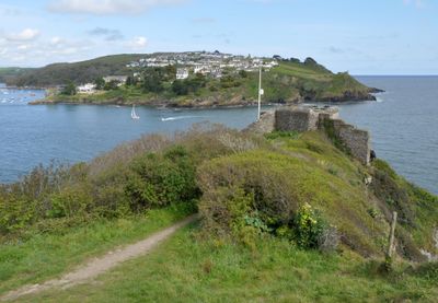
St Catherine's Castle, Artillery fort on St Catherine's Point, Fowey, England
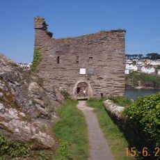
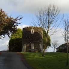
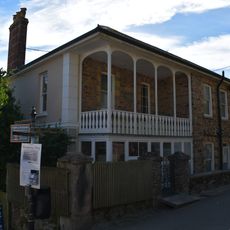
St Catherine's Castle is a stone fortification built on a headland at the entrance to Fowey Harbour. The structure has a distinctive D-shaped design with five gun-ports facing the water.
Thomas Treffry built the fort between 1538 and 1540 under Henry VIII to defend the coast against French and imperial naval forces. The structure later received military enhancements during the Crimean War and World War II that reflected changing defense technologies.
The structure illustrates the transition in England's coastal defense strategy from local community management to direct involvement of the Crown under Henry VIII.
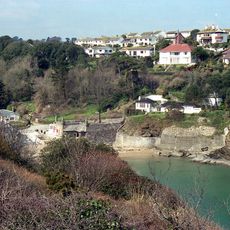
The ruins can be reached by a walking path of roughly three quarters of a mile from the Ready Money Beach car park, following woodland trails to the elevated site. The route is straightforward but involves some uphill sections on the approach.
The fort was modified during three distinct military periods, with each era adding different defensive features based on the technology of the time. These changes reveal how coastal defense strategy evolved across centuries of warfare.
Location: Fowey
Inception: 1538
Website: https://english-heritage.org.uk/visit/places/st-catherines-castle
GPS coordinates: 50.32820,-4.64453
Latest update: December 8, 2025 19:50
Readymoney Cove
99 m
Polruan Blockhouse
488 m
Safe Harbour Inn
984 m
2 and 3, Church Avenue
987 m
Methodist Chapel
576 m
Whitehouse Point light
708 m
St Catherine's Point light
212 m
Fowey Hall
728 m
Former Windmill In The Grounds Of Fowey Hall
749 m
52-56, Lostwithiel Street
962 m
76-80, Esplanade
419 m
29-41, Esplanade
849 m
Marina Villa Hotel
917 m
7 And 9, Esplanade
946 m
5 And 7, Lostwithiel Street
985 m
Former Limekiln
187 m
The Little House
866 m
Rockleigh
964 m
Fowey Church Hall
972 m
Point Neptune
161 m
26-30, Lostwithiel Street
962 m
43, 45 And 47, Esplanade
804 m
25, Esplanade
874 m
Boundary Wall And Gate-Piers And Gates At Point Neptune
171 m
The Haven
704 m
18, Lostwithiel Street
975 m
Medieval wayside cross on Fore Street, Polruan
910 m
14, Lostwithiel Street
982 mVisited this place? Tap the stars to rate it and share your experience / photos with the community! Try now! You can cancel it anytime.
Discover hidden gems everywhere you go!
From secret cafés to breathtaking viewpoints, skip the crowded tourist spots and find places that match your style. Our app makes it easy with voice search, smart filtering, route optimization, and insider tips from travelers worldwide. Download now for the complete mobile experience.
A unique approach to discovering new places❞
— Le Figaro
All the places worth exploring❞
— France Info
A tailor-made excursion in just a few clicks❞
— 20 Minutes