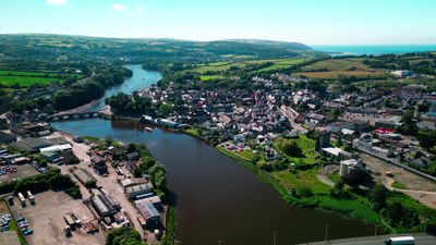
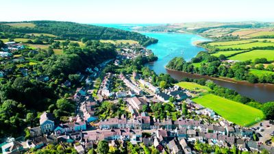
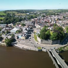
River Teifi, Protected waterway in Ceredigion, Wales.
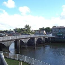
River Teifi is a waterway stretching about 75 kilometers from the Cambrian Mountains through woodlands, wetlands, and farmland before reaching Cardigan Bay. Multiple walking trails provide access along the banks to observe the diversity of wildlife and habitats throughout the year.
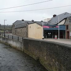
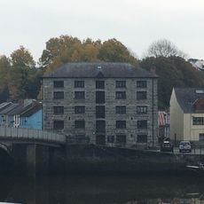
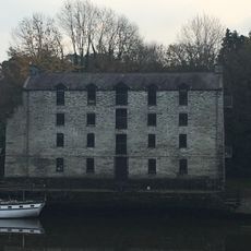
For centuries, this waterway has served as the natural border between three Welsh counties: Ceredigion, Carmarthenshire, and parts of Pembrokeshire. This boundary role shaped its importance in regional geography and administration.
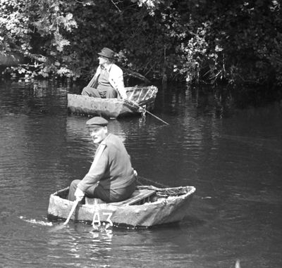
Local fishermen still practice traditional methods to catch salmon and sea trout, skills passed down through generations in this region. These customs shape the rhythm of life along the banks and connect people to the river.
Visit during warmer months when the trails are drier and wildlife is most active throughout the day. Wear sturdy shoes and weather-appropriate clothing since trail conditions change with the seasons.
The area earned its protected status because of an extensive network of tributaries and diverse habitats that support numerous plant species. This biological richness makes it valuable for nature conservation work.
Location: Ceredigion
GPS coordinates: 52.08333,-4.66667
Latest update: December 7, 2025 20:48
Cardigan Castle
467 m
Cardigan Priory
747 m
Castle Green House
457 m
St Mary's Church
726 m
Guildhall
392 m
Bethania Welsh Baptist Church
526 m
Theatr Mwldan
501 m
Mount Zion English Baptist Church
491 m
Tabernacl Chapel
433 m
Capel Mair Welsh Independent Chapel
610 m
Hope
506 m
Cardigan Library
551 m
The Grosvenor Hotel, Bridge Street
411 m
Canfas
392 m
The Black Lion Hotel, High Street
390 m
Castle Chambers (Previously Listed With The Gosvenor Hotel) Bridge Street
406 m
Cardigan Bridge, Bridge Street
503 m
Graystone, Priory Street
477 m
No.11 High Street (Midland Bank)
365 m
Pantywylan, Cambrian Quay
395 m
Bridge Warehouse
534 m
Tŷ Mawr, High Street
382 m
Railings,gates & Gatepiers At Bethania Baptist Chapel,william Street
528 m
Stanley House, Including Garden Wall, Gatepiers and Gate, North Road
585 m
Bridgend Warehouse,Castle Street
496 m
1 & 2 Green Street, including attached stable and boundary wall
429 m
Outbuildings at Castle Green House Stable Yard, Bridge Street
487 m
The Old Shire Hall, high Street
382 mVisited this place? Tap the stars to rate it and share your experience / photos with the community! Try now! You can cancel it anytime.
Discover hidden gems everywhere you go!
From secret cafés to breathtaking viewpoints, skip the crowded tourist spots and find places that match your style. Our app makes it easy with voice search, smart filtering, route optimization, and insider tips from travelers worldwide. Download now for the complete mobile experience.
A unique approach to discovering new places❞
— Le Figaro
All the places worth exploring❞
— France Info
A tailor-made excursion in just a few clicks❞
— 20 Minutes