The Sanctuary

Log in to your account

AroundUs is a community-driven map of interesting places, built by curious explorers like you. It grows with every review, story, and photo you share.
Connect to save your favorite spots, contribute locations, and create personalized routes.
Continue with Google
Continue with Apple
Continue with X
Continue with Facebook
Continue with email
By continuing, you accept our Terms and Conditions and our Privacy Policy
Create an account
Add to collection
Map
Suggest a change
Share

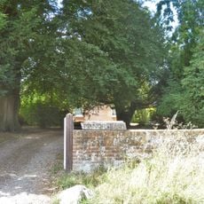
The Sanctuary, Archaeological site at Overton Hill, Avebury, England.

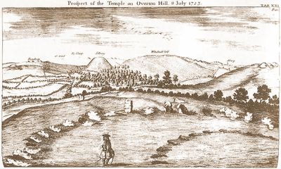
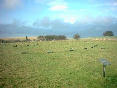
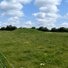
The Sanctuary is an archaeological site on Overton Hill near Avebury, marked by concrete posts showing where wooden poles and stone structures once stood. The site displays six concentric rings that together outline the original layout of this Neolithic location.

Construction began around 3000 BCE with wooden posts arranged in distinct patterns across the site. Stone structures were added later, suggesting the location served ceremonial purposes over an extended period.

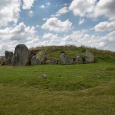
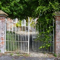
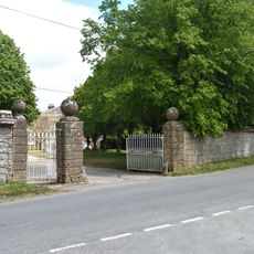
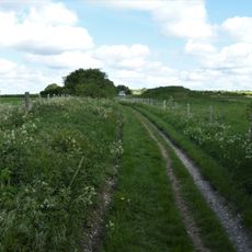
The monument forms part of the Stonehenge and Avebury World Heritage Site, connected to Avebury by the 2.5-kilometer Kennet Avenue.

The site is open throughout the year for visitors to explore and observe the concrete markers that show the original layout. Walking paths through the rings allow you to see the different circles clearly.

Excavations in the 1930s revealed 162 post holes suggesting this location was a hub for ritual gatherings. The arrangement of these holes shows deliberate planning for ceremonies during the Neolithic era.

Location: Avebury

Part of: Stonehenge, Avebury and Associated Sites, Avebury and Associated Monuments

Website: https://english-heritage.org.uk/visit/places/the-sanctuary

GPS coordinates: 51.41115,-1.83134

Latest update: December 8, 2025 19:55

Photos
Around this place
West Kennet Long Barrow
United Kingdom

West Kennet Long Barrow

1.4 km
Christ Church
United Kingdom

Christ Church

582 m
Church of St Michael
United Kingdom

Church of St Michael

1.6 km
Group of six round barrows forming part of a Bronze Age cemetery 400m north-east of West Kennett Farm
United Kingdom

Group of six round barrows forming part of a Bronze Age cemetery 400m north-east of West Kennett Farm

654 m
2, Church Lane
United Kingdom

2, Church Lane

541 m
Yew Tree Cottage
United Kingdom

Yew Tree Cottage

1.2 km
Church Cottage  Overton Cottages
United Kingdom

Church Cottage Overton Cottages

748 m
Jasmine Cottage
United Kingdom

Jasmine Cottage

807 m
Church Hill Cottage
United Kingdom

Church Hill Cottage

1.5 km
Manor House
United Kingdom

Manor House

1.5 km
West Overton Farmhouse
United Kingdom

West Overton Farmhouse

1 km
Old Thatch
United Kingdom

Old Thatch

537 m
Orchard Farmhouse
United Kingdom

Orchard Farmhouse

635 m
Barns Formerly With Manor Farm, East Kennett
United Kingdom

Barns Formerly With Manor Farm, East Kennett

599 m
Cartshed At West Kennett Farm
United Kingdom

Cartshed At West Kennett Farm

659 m
West Kennett House
United Kingdom

West Kennett House

602 m
Dovecote At East Kennett Manor
United Kingdom

Dovecote At East Kennett Manor

454 m
Stable Yard Walls And Gate Piers, East Kennett Manor
United Kingdom

Stable Yard Walls And Gate Piers, East Kennett Manor

498 m
Bowl barrow east of the Ridgeway forming part of the Overton Hill Bronze Age round barrow cemetery.
United Kingdom

Bowl barrow east of the Ridgeway forming part of the Overton Hill Bronze Age round barrow cemetery.

481 m
West Kennet Farmhouse
United Kingdom

West Kennet Farmhouse

695 m
Milestone 400 Metres East Of The Ridgeway
United Kingdom

Milestone 400 Metres East Of The Ridgeway

427 m
K6 Telephone Kiosk To West Of The Old Schoolhouse
United Kingdom

K6 Telephone Kiosk To West Of The Old Schoolhouse

516 m
67 And 68
United Kingdom

67 And 68

1.3 km
West Overton House
United Kingdom

West Overton House

1.4 km
Manor Farm House
United Kingdom

Manor Farm House

912 m
Bowl barrow 50m south of The Sanctuary on Overton Hill, forming part of the Seven Barrow Hill round barrow cemetery
United Kingdom

Bowl barrow 50m south of The Sanctuary on Overton Hill, forming part of the Seven Barrow Hill round barrow cemetery

95 m
76 And 77
United Kingdom

76 And 77

1.5 km
North Farmhouse
United Kingdom

North Farmhouse

1.5 km
Show the full map
Reviews

Visited this place? Tap the stars to rate it and share your experience / photos with the community! Try now! You can cancel it anytime.

« The Sanctuary - Archaeological site at Overton Hill, Avebury, England » is provided by Around Us (aroundus.com). Images and texts are derived from Wikimedia project under a Creative Commons license. You are allowed to copy, distribute, and modify copies of this page, under the conditions set by the license, as long as this note is clearly visible.

Discover hidden gems everywhere you go!

From secret cafés to breathtaking viewpoints, skip the crowded tourist spots and find places that match your style. Our app makes it easy with voice search, smart filtering, route optimization, and insider tips from travelers worldwide. Download now for the complete mobile experience.

Around Us App Screenshot

A unique approach to discovering new places

Le Figaro

All the places worth exploring

France Info

A tailor-made excursion in just a few clicks

20 Minutes