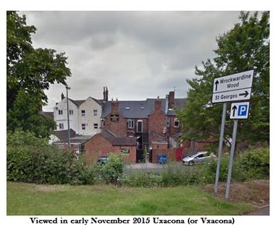
Uxacona, Archaeological site and scheduled monument in Shifnal, Great Britain
Uxacona is a Roman settlement in the Shropshire region, with remains partly hidden beneath modern fields. The site lay along the ancient Watling Street, a major route that connected various Roman centers.
The settlement developed in the early centuries following the Roman invasion of Britain and functioned as an important transport hub. The site was later abandoned as Roman presence on the island shifted.
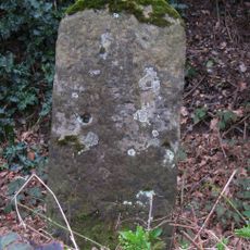
Excavations at the site reveal patterns of Roman daily life through recovered pottery, coins, and tools that are still studied today. These objects help archaeologists understand how people lived here nearly 2,000 years ago.
Access to the archaeological site is restricted because of its protected status and requires special permission to visit. Visitors should contact site managers in advance to arrange a visit.
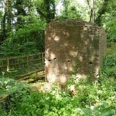
A mansio, or Roman rest station for officials and travelers, once stood at this location along the Watling Street. The remains of this important waystation lie buried beneath the fields today and remain valuable for research.
Location: Shifnal
Location: St George's and Priorslee
Location: Donnington and Muxton
GPS coordinates: 52.69480,-2.40403
Latest update: December 14, 2025 17:02
Lilleshall Abbey
3.4 km
Haughton Hall
2.8 km
Telford Town Park
3.8 km
Telford Ice Rink
3.7 km
Church of St Matthew
2.9 km
Church of St Mary
3.2 km
Church of St George
1.9 km
Church of St Peter
2.6 km
Holy Trinity Church
3.4 km
Church of St Andrew
3.9 km
Holy Trinity Church
3.5 km
Priorslee Hall
1.8 km
War Memorial Gates, Hartshill Park, Oakengates, Telford
3.4 km
8, 8A And 10, Market Place
3.9 km
Abbey Wall South East Of Lilleshall Abbey
3.3 km
Sheriffhales Manor
3.1 km
St Georges and Priorlee War Memorial Gates
1.7 km
Donnington War memorial
3.4 km
16, 18A And 18B, Market Place
3.9 km
2A, Market Place
3.8 km
Telford Borough War Memorial
3.8 km
Chest Tomb Approximately 1 Metre To South Of South Chapel Of Church Of St Andrew
3.9 km
Cross Base And Sundial Approximately 21 Metres To North Of Chancel Of Church Of St Mary
3.3 km
Coppice Green House
3.7 km
Site of pumping engine at Muxton Bridge colliery
2.5 km
2, Market Place
3.8 km
Milestone, Redhill; opp. Oaks Hotel
688 m
Milepost, Holyhead Road; Oakengates
3.2 kmVisited this place? Tap the stars to rate it and share your experience / photos with the community! Try now! You can cancel it anytime.
Discover hidden gems everywhere you go!
From secret cafés to breathtaking viewpoints, skip the crowded tourist spots and find places that match your style. Our app makes it easy with voice search, smart filtering, route optimization, and insider tips from travelers worldwide. Download now for the complete mobile experience.
A unique approach to discovering new places❞
— Le Figaro
All the places worth exploring❞
— France Info
A tailor-made excursion in just a few clicks❞
— 20 Minutes