Horley

Log in to your account

AroundUs is a community-driven map of interesting places, built by curious explorers like you. It grows with every review, story, and photo you share.
Connect to save your favorite spots, contribute locations, and create personalized routes.
By continuing, you accept our Terms and Conditions and our Privacy Policy
Add to collection
Map
Suggest a change
Share

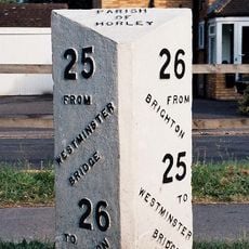
Horley, Civil parish and town in Reigate and Banstead, England

Horley is a town in the Reigate and Banstead area of Surrey, with a town center featuring numerous shops along a pedestrianized high street. The location sits between Reigate and Crawley, serving as a residential hub for the region.

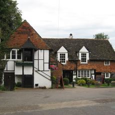
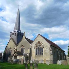
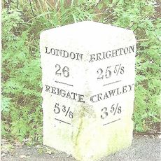
The town developed from a historic parish with agricultural roots, reflected today in preserved buildings and local landmarks throughout the area. Over time, it transformed into a modern residential community.

Local residents gather for annual celebrations in the town center, such as St George's Day Festival and Christmas Fairs that feature traditional market stalls. These events define how people experience and connect with the place.

The town is well served by direct rail connections and sits near Gatwick Airport, making it practical for professionals with workplaces in London or surrounding areas. Good transport links and housing options make it a convenient place to live.

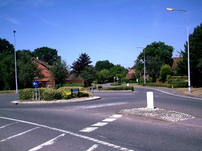
The modern residential development in Langshott introduces contemporary architecture alongside older neighborhoods, showing how the town continues to evolve. This mix of new and traditional sides makes the place distinctive.

Location: Reigate and Banstead

Shares border with: Crawley

Website: http://horleysurrey-tc.gov.uk

GPS coordinates: 51.17360,-0.17210

Latest update: December 6, 2025 22:05

Around this place
Show the full map
Beehive
United Kingdom

Beehive

3.3 km
Gatwick Aviation Museum
United Kingdom

Gatwick Aviation Museum

3.9 km
City Place Gatwick
United Kingdom

City Place Gatwick

3.2 km
Outwood Windmill
United Kingdom

Outwood Windmill

5.4 km
St Michael and All Angels Church, Lowfield Heath
United Kingdom

St Michael and All Angels Church, Lowfield Heath

3.1 km
Charlwood House
United Kingdom

Charlwood House

2.3 km
Church of St John the Baptist, Outwood
United Kingdom

Church of St John the Baptist, Outwood

5 km
Archway Theatre
United Kingdom

Archway Theatre

886 m
Providence Chapel, Charlwood
United Kingdom

Providence Chapel, Charlwood

3.8 km
Church of St Bartholomew
United Kingdom

Church of St Bartholomew

3.8 km
Ye Olde Six Bells
United Kingdom

Ye Olde Six Bells

480 m
Church of St Bartholomew
United Kingdom

Church of St Bartholomew

495 m
Gatwick Manor Inn
United Kingdom

Gatwick Manor Inn

3.9 km
St John's Church, Copthorne
United Kingdom

St John's Church, Copthorne

5.4 km
War Memorial Lych Gate, Emmanuel Church, Sidlow
United Kingdom

War Memorial Lych Gate, Emmanuel Church, Sidlow

4.2 km
Lowfield Heath War Memorial
United Kingdom

Lowfield Heath War Memorial

3.1 km
Rowley Farmhouse
United Kingdom

Rowley Farmhouse

3.6 km
Horley War Memorial
United Kingdom

Horley War Memorial

194 m
Gatwick North Terminal Pier 6 Bridge
United Kingdom

Gatwick North Terminal Pier 6 Bridge

1.9 km
Milestone, Reigate Road, 80m N of Horseshoe Farm, Duxhurst
United Kingdom

Milestone, Reigate Road, 80m N of Horseshoe Farm, Duxhurst

2.7 km
Staplehurst Farm House
United Kingdom

Staplehurst Farm House

5.3 km
Milepost, Pentridge Common, Horley Road, 200m N of jct with A2044 (was B2035)
United Kingdom

Milepost, Pentridge Common, Horley Road, 200m N of jct with A2044 (was B2035)

4 km
Charlwood Park Farmhouse
United Kingdom

Charlwood Park Farmhouse

2.3 km
Milepost, Brighton Road, opp. parish church, NE of Longbridge roundabout
United Kingdom

Milepost, Brighton Road, opp. parish church, NE of Longbridge roundabout

540 m
Milepost, Bonehurst Road, Salfords, just N of "X Ray House"
United Kingdom

Milepost, Bonehurst Road, Salfords, just N of "X Ray House"

2.6 km
Milestone, 400m N of Black Horse,  Hookwood
United Kingdom

Milestone, 400m N of Black Horse, Hookwood

1.6 km
Milestone, Povey Cross Road, Gatwick Airport, by "Greenvale" on emergency exit road
United Kingdom

Milestone, Povey Cross Road, Gatwick Airport, by "Greenvale" on emergency exit road

1.4 km
Milestone, Reigate Road, ¼ mile S of Sidlow Bridge
United Kingdom

Milestone, Reigate Road, ¼ mile S of Sidlow Bridge

4.1 km
Show the full map

Reviews

Visited this place? Tap the stars to rate it and share your experience / photos with the community! Try now! You can cancel it anytime.

« Horley - Civil parish and town in Reigate and Banstead, England » is provided by Around Us (aroundus.com). Images and texts are derived from Wikimedia project under a Creative Commons license. You are allowed to copy, distribute, and modify copies of this page, under the conditions set by the license, as long as this note is clearly visible.

Discover hidden gems everywhere you go!

From secret cafés to breathtaking viewpoints, skip the crowded tourist spots and find places that match your style. Our app makes it easy with voice search, smart filtering, route optimization, and insider tips from travelers worldwide. Download now for the complete mobile experience.

Around Us App Screenshot

A unique approach to discovering new places

Le Figaro

All the places worth exploring

France Info

A tailor-made excursion in just a few clicks

20 Minutes