Chest opened
+${chestReward.xp} XP
Explorer
NOUVEAU ×${chestReward.collectible.quantity}
tapez pour fermer
Chest locked

Open chests in the app

Around Us is built for your phone — chests unlock when you walk, explore and capture nearby places.

Enable Location

We need your location to show you interesting places around you

Discover nearby places

Find interesting locations and hidden gems around you

Precise directions

Get accurate directions and distances to places

Your location is never shared with other users. It's only used when you tap the location button.

River Test

Log in to your account

Start exploring — it's free

Trusted by 72,877 travelers worldwide

Continue with Google
Continue with Apple
or

We will send you a code to connect

By continuing, you accept our Terms and Conditions and our Privacy Policy

Check your inbox

We've sent a pincode in your inbox. Please enter the code below.

River Test
Discussion Reviews 1 Photos
23.7k Popularity

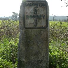
River Test, Chalk stream in Test Valley and New Forest, England

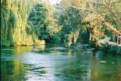
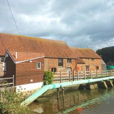
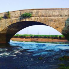
The River Test is a chalk stream running southward through Test Valley and the New Forest before reaching Southampton Water. The waterway flows through meadows and marshland, creating distinct sections with different characteristics along its course.

The river's name appeared in medieval records as Terstan and later Tarstan, with roots possibly tracing to words describing water flow. Over centuries, the waterway has remained an important feature of the local landscape.

The River Test appears in Richard Adams' 1972 novel Watership Down, where a character navigates downstream using a traditional punt.

The Test Way provides walking access along much of the river from the chalk downs to the tidal zones. The path conditions vary seasonally, so visiting during drier months makes for easier exploration.

The water remains cold and clear due to chalk filtration, supporting plants and wildlife not found in typical lowland rivers. Birdwatchers may spot uncommon species that nest in the reed beds and marshes.

The community of curious travelers

AroundUs brings together thousands of curated places, local tips, and hidden gems, enriched daily by 60,000 contributors worldwide.

Start exploring
Location
Location
Location
GPS coordinates
50.92510,-1.47920
Latest update
December 20, 2025 13:47
Around this place
SS Shieldhall
United Kingdom

SS Shieldhall

3.2 km
King George V Dry Dock
United Kingdom

King George V Dry Dock

3.2 km
Eling Tide Mill
United Kingdom

Eling Tide Mill

1.6 km
Shirley Parish Church
United Kingdom

Shirley Parish Church

3.6 km
Shirley Baptist Church
United Kingdom

Shirley Baptist Church

3.3 km
Eling Tide Mill Experience Visitor Centre
United Kingdom

Eling Tide Mill Experience Visitor Centre

1.6 km
Church of St Boniface
United Kingdom

Church of St Boniface

2.5 km
Church of St Winfred
United Kingdom

Church of St Winfred

1.1 km
Church of St Mary
United Kingdom

Church of St Mary

1.6 km
Church of St John
United Kingdom

Church of St John

3.4 km
Church of the Holy Trinity
United Kingdom

Church of the Holy Trinity

2.1 km
The Crown Public House
United Kingdom

The Crown Public House

3.2 km
The Cross Keys Public House
United Kingdom

The Cross Keys Public House

960 m
Redbridge Bridge
United Kingdom

Redbridge Bridge

478 m
No. 7 Pumping Station At King George V Dry Dock
United Kingdom

No. 7 Pumping Station At King George V Dry Dock

3.2 km
Regent Cinema
United Kingdom

Regent Cinema

3.1 km
Milestone, Redbridge Road, Redbridge
United Kingdom

Milestone, Redbridge Road, Redbridge

1.1 km
369 And 371A, Millbrook Road
United Kingdom

369 And 371A, Millbrook Road

2.9 km
The Old Rectory
United Kingdom

The Old Rectory

1.8 km
Milestone 150 Metres North Of Roundabout On End Of M271
United Kingdom

Milestone 150 Metres North Of Roundabout On End Of M271

3.5 km
Milestone, Brokenford; by No. 144 Ringwood Road
United Kingdom

Milestone, Brokenford; by No. 144 Ringwood Road

1.5 km
Milestone, Hunter's Inn Hill; N of jcn Deerleap lane
United Kingdom

Milestone, Hunter's Inn Hill; N of jcn Deerleap lane

3.5 km
Milestone, Sharves Hill
United Kingdom

Milestone, Sharves Hill

2.8 km
Milestone, W of jct of Crabbs Way with Ringwood Road
United Kingdom

Milestone, W of jct of Crabbs Way with Ringwood Road

3 km
Milestone, Tennis Centre,  Romsey Road, Nursling; opp. the Cedar School for the Physically handicapped,
United Kingdom

Milestone, Tennis Centre, Romsey Road, Nursling; opp. the Cedar School for the Physically handicapped,

2.4 km
Milestone, Shirley Road, Shirley
United Kingdom

Milestone, Shirley Road, Shirley

3.4 km
Milestone, Romsey Road, Maybush
United Kingdom

Milestone, Romsey Road, Maybush

2.3 km
Milestone, Rushington, jct of Spicers Hill and The Drive
United Kingdom

Milestone, Rushington, jct of Spicers Hill and The Drive

1.9 km
Show the full map
Reviews
Share your experience

No review yet

Discussions
Start a discussion...

No discussion yet

« River Test - Chalk stream in Test Valley and New Forest, England » is provided by Around Us (aroundus.com). Images and texts are derived from Wikimedia project under a Creative Commons license. You are allowed to copy, distribute, and modify copies of this page, under the conditions set by the license, as long as this note is clearly visible.

Discover hidden gems everywhere you go!

From secret cafés to breathtaking viewpoints, skip the crowded tourist spots and find places that match your style. Our app makes it easy with voice search, smart filtering, route optimization, and insider tips from travelers worldwide. Download now for the complete mobile experience.

Around Us App Screenshot

A unique approach to discovering new places

Le Figaro

All the places worth exploring

France Info

A tailor-made excursion in just a few clicks

20 Minutes

Around Us
Travel Guide & Maps
Download

Send to your phone

QR Code
1

Open the camera app on your mobile.

2

Point at the QR code with your camera. A notification will appear.

3

Tap the notification to open the link.