Chest opened
+${chestReward.xp} XP
Explorer
NOUVEAU ×${chestReward.collectible.quantity}
tapez pour fermer
Chest locked

Open chests in the app

Around Us is built for your phone — chests unlock when you walk, explore and capture nearby places.

Enable Location

We need your location to show you interesting places around you

Discover nearby places

Find interesting locations and hidden gems around you

Precise directions

Get accurate directions and distances to places

Your location is never shared with other users. It's only used when you tap the location button.

Log in to your account

Start exploring — it's free

Trusted by 72,887 travelers worldwide

Continue with Google
Continue with Apple
or

We will send you a code to connect

By continuing, you accept our Terms and Conditions and our Privacy Policy

Check your inbox

We've sent a pincode in your inbox. Please enter the code below.

Discussion Reviews Photo
58.7k Popularity

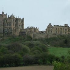
Bolsover, Parliamentary constituency in East Midlands, United Kingdom.

Bolsover is a parliamentary constituency in Derbyshire that includes the towns of Bolsover, Shirebrook, Clowne, and South Normanton, stretching across the former coalfields of the East Midlands. The constituency covers both rural areas and former industrial zones, linked by road networks and regional rail connections.

The constituency was formed in 1950 from parts of North East Derbyshire and Clay Cross, reflecting the region's political evolution. Dennis Skinner represented the area for nearly five decades until the electorate shifted in the late 2010s.

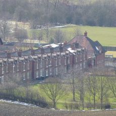
The electoral dynamics of Bolsover reflect the region's industrial heritage, transitioning from a coal mining community to a developing tourism and service sector.

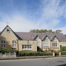
Polling stations are distributed across the constituency area, allowing all residents to vote within reasonable distance of their homes. Most polling places are located in schools and community centers that become accessible to the public on election days.

Labour's vote share in Bolsover experienced a significant shift, moving from 77 percent in 1970 to 36 percent in 2019, before recovering to 40.5 percent in 2024.

The community of curious travelers

AroundUs brings together thousands of curated places, local tips, and hidden gems, enriched daily by 60,000 contributors worldwide.

Start exploring
Location
Inception
February 23, 1950
GPS coordinates
53.23000,-1.30000
Latest update
December 13, 2025 19:32
Around this place
Bolsover Castle
United Kingdom

Bolsover Castle

271 m
Former Presbyterian Chapel
United Kingdom

Former Presbyterian Chapel

428 m
United Kingdom

Numbers 39-53 Including The Attached And Associated Back Yard Walls

283 m
United Kingdom

Numbers 88-102 Including The Attached And Associated Back Yard Walls

341 m
United Kingdom

Numbers 56-70 Including The Attached And Associated Back Yard Walls

288 m
Numbers 7-21 Including The Attached And The Associated Back Yard Walls
United Kingdom

Numbers 7-21 Including The Attached And The Associated Back Yard Walls

364 m
St Mary's House  The School House
United Kingdom

St Mary's House The School House

331 m
United Kingdom

Numbers 83-97 Including The Attached And Associated Back Yard Walls

253 m
United Kingdom

Numbers 99-113 Including The Attached And Associated Back Yard Walls

282 m
United Kingdom

Numbers 23-37 Including The Attached And Associated Back Yard Walls

323 m
United Kingdom

Numbers 120-134 Including The Attached And Associated Back Yard Walls

397 m
United Kingdom

Numbers 8-22 Including The Attached And Associated Back Yard Walls

375 m
United Kingdom

Numbers 104-118 Including The Attached And Associated Back Yard Walls

385 m
United Kingdom

Numbers 131-143 Including The Attached And Associated Back Yard Walls

348 m
United Kingdom

Numbers 2, 4 And 6 Including The Attached And Associated Back Yard Walls

402 m
United Kingdom

Numbers 24-38 Including The Attached And Associated Back Yard Walls

337 m
United Kingdom

Numbers 145-157 Including The Attached And Associated Back Yard Walls

375 m
United Kingdom

Numbers 115-129 Including The Attached And Associated Back Yard Walls

316 m
United Kingdom

Numbers 69-81 Including The Attached And Associated Back Yard Walls

230 m
United Kingdom

Bainbridge Hall

404 m
United Kingdom

Conduit House

356 m
United Kingdom

K6 Telephone Kiosk

399 m
United Kingdom

Numbers 40-54 Including The Attached And Associated Back Yard Walls

299 m
United Kingdom

Numbers 72-86 Including The Attached And Associated Back Yard Walls

313 m
United Kingdom

Former Cooperative Village Stores And Numbers 1-5 Including The Attached And Associated Back Yard Walls

398 m
United Kingdom

Numbers 159-173 Including The Attached And Associated Back Yard Walls

396 m
United Kingdom

The Villas

350 m
United Kingdom

Work of art, sculpture

278 m
Show the full map
Reviews
Share your experience

No review yet

Discussions
Start a discussion...

No discussion yet

« Bolsover - Parliamentary constituency in East Midlands, United Kingdom » is provided by Around Us (aroundus.com). Images and texts are derived from Wikimedia project under a Creative Commons license. You are allowed to copy, distribute, and modify copies of this page, under the conditions set by the license, as long as this note is clearly visible.

Discover hidden gems everywhere you go!

From secret cafés to breathtaking viewpoints, skip the crowded tourist spots and find places that match your style. Our app makes it easy with voice search, smart filtering, route optimization, and insider tips from travelers worldwide. Download now for the complete mobile experience.

Around Us App Screenshot

A unique approach to discovering new places

Le Figaro

All the places worth exploring

France Info

A tailor-made excursion in just a few clicks

20 Minutes

Around Us
Travel Guide & Maps
Download

Send to your phone

QR Code
1

Open the camera app on your mobile.

2

Point at the QR code with your camera. A notification will appear.

3

Tap the notification to open the link.