Chest opened
+${chestReward.xp} XP
Explorer
NOUVEAU ×${chestReward.collectible.quantity}
tapez pour fermer
Chest locked

Open chests in the app

Around Us is built for your phone — chests unlock when you walk, explore and capture nearby places.

Enable Location

We need your location to show you interesting places around you

Discover nearby places

Find interesting locations and hidden gems around you

Precise directions

Get accurate directions and distances to places

Your location is never shared with other users. It's only used when you tap the location button.

Log in to your account

Start exploring — it's free

Trusted by 72,888 travelers worldwide

Continue with Google
Continue with Apple
or

We will send you a code to connect

By continuing, you accept our Terms and Conditions and our Privacy Policy

Check your inbox

We've sent a pincode in your inbox. Please enter the code below.

Deifr
Discussion Reviews Photo
1.4k Popularity

Deifr, Ancient Celtic territory in Yorkshire, England

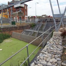
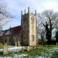
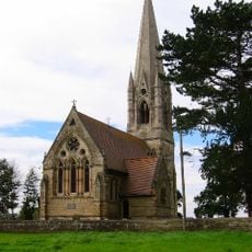
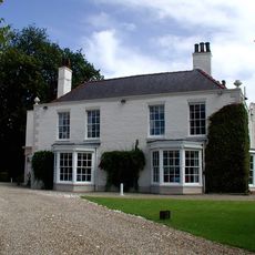
Deifr was an ancient Celtic territory in eastern England that stretched between the Humber and Tees rivers, with its center at present-day York. The region contained multiple archaeological sites and was shaped by natural waterways that marked its boundaries.

Following the Roman withdrawal from Britain in the 5th century, the territory transformed from a Celtic settlement into the Anglo-Saxon kingdom of Deira. This change marked a pivotal moment in the development of northern England.

The name Deifr comes from the Brythonic language and refers to waters or coastal regions, reflecting the geography of this eastern Yorkshire territory. People used the river landscapes as natural boundaries and important routes for travel and trade within their lands.

The best way to experience this place is to visit multiple archaeological sites spread across the eastern Yorkshire region, where walking paths connect different locations. With enough time, you can explore the entire area between the two rivers, as the terrain varies between rural and built-up zones.

Archaeological findings show that this territory initially centered around Petuaria, present-day Brough, before later shifting its focus elsewhere. This movement of importance reflects changing needs and strategy among the people during that era.

The community of curious travelers

AroundUs brings together thousands of curated places, local tips, and hidden gems, enriched daily by 60,000 contributors worldwide.

Start exploring
GPS coordinates
53.89000,-0.38800
Latest update
December 14, 2025 16:40
Around this place
Beverley and Barmston Drain
United Kingdom

Beverley and Barmston Drain

4.2 km
Church of All Saints
United Kingdom

Church of All Saints

3.9 km
Church of St Leonard
United Kingdom

Church of St Leonard

4.5 km
Tickton Grange
United Kingdom

Tickton Grange

2.9 km
United Kingdom

Bridge Over Moat At Scorborough Hall

4.4 km
United Kingdom

Square barrow cemetery, moated site, fishponds and medieval settlement remains at Scorborough

4.3 km
United Kingdom

Iron Age barrow 400m south east of Station Farm

3.6 km
United Kingdom

Hull Bridge Mills

3.3 km
Milestone, half way between Routh and White Cross TI
United Kingdom

Milestone, half way between Routh and White Cross TI

4.2 km
United Kingdom

Gravestone About 45 Metres North-West Of South East Corner Of Cemetery At Hall Garth

3.1 km
United Kingdom

Hayholme moated site

3.7 km
United Kingdom

Scorborough Hall

4.4 km
United Kingdom

Eske Manor

1.7 km
Milestone, by access road to Environment Agency
United Kingdom

Milestone, by access road to Environment Agency

3.1 km
Milestone, W of Meaux Lane
United Kingdom

Milestone, W of Meaux Lane

3.6 km
United Kingdom

Decoy Farhouse

2.6 km
United Kingdom

Barf Hill moated site

2.6 km
United Kingdom

Eske medieval settlement and field system, west and south of Eske Manor

1.8 km
United Kingdom

Aqueduct At Sandholme Farm

4.1 km
United Kingdom

Westfield

4.3 km
United Kingdom

Sunnyside

1.4 km
United Kingdom

Rose Cottage

3 km
United Kingdom

Causeway Bridge

4.1 km
United Kingdom

Former Lockington Railway Station

3.9 km
United Kingdom

Tophill Low

3.9 km
United Kingdom

Coach-House To Heigholme Hall

3.8 km
United Kingdom

Moated site 310m north east of Scorborough church

4.2 km
United Kingdom

Moated site 550m south east of Scorborough Hall

3.9 km
Show the full map
Reviews
Share your experience

No review yet

Discussions
Start a discussion...

No discussion yet

« Deifr - Ancient Celtic territory in Yorkshire, England » is provided by Around Us (aroundus.com). Images and texts are derived from Wikimedia project under a Creative Commons license. You are allowed to copy, distribute, and modify copies of this page, under the conditions set by the license, as long as this note is clearly visible.

Discover hidden gems everywhere you go!

From secret cafés to breathtaking viewpoints, skip the crowded tourist spots and find places that match your style. Our app makes it easy with voice search, smart filtering, route optimization, and insider tips from travelers worldwide. Download now for the complete mobile experience.

Around Us App Screenshot

A unique approach to discovering new places

Le Figaro

All the places worth exploring

France Info

A tailor-made excursion in just a few clicks

20 Minutes

Around Us
Travel Guide & Maps
Download

Send to your phone

QR Code
1

Open the camera app on your mobile.

2

Point at the QR code with your camera. A notification will appear.

3

Tap the notification to open the link.