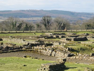
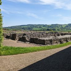
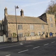
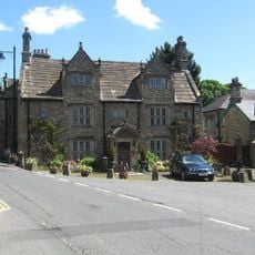
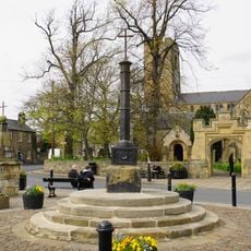
Coria, Roman archaeological site in Corbridge, England
This Roman archaeological site preserves the remains of a fort and settlement that developed over 350 years along the northern frontier of the Roman Empire near the River Tyne in Northumberland.
Established around AD 84 as a military fort at the junction of Dere Street and Stanegate, the site served as a supply depot and strategic outpost before developing into a civilian town during the 3rd century.
The settlement functioned as a trading hub and hosted various industries including pottery, lead, and iron production, with the Celtic name translating to hosting place reflecting its role as a meeting point at the empire's edge.
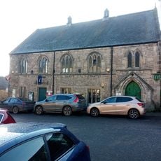
The site is open to the public year-round with a visitor center featuring archaeological exhibits, guided tours, and interpretive signs explaining the layout of granaries, temples, and military installations across the ruins.
Archaeologists discovered the Corbridge Hoard in 1964, a wooden chest buried by a Roman soldier approximately 1,800 years ago containing personal belongings that provide direct insight into individual military life on the frontier.
Location: Corbridge
Architectural style: ancient Roman architecture
Part of: borders of the Roman Empire, Hadrian's Wall
Website: https://english-heritage.org.uk/visit/places/corbridge-roman-town-hadrians-wall
GPS coordinates: 54.98050,-2.03308
Latest update: November 28, 2025 15:19
Corbridge Bridge
1.3 km
Corbridge Lion
341 m
Corbridge Vicar's Pele
1.2 km
Town Hall With Shops
1.2 km
Church of St Andrew
1.1 km
Corbridge Roman Site Museum
290 m
Market Place Chapel And Area Railings
1.1 km
Black Bull Inn
1.2 km
The Angel Inn
1.2 km
Corbridge War Memorial
1.3 km
The Golden Lion Public House
1.2 km
Wilson Tomb 3 Metres East Of Church Of St Andrew
1.1 km
Low Hall
1.4 km
Norma James Dress Shop And Attached Cottage To Rear
1.2 km
Corbridge Library
1.2 km
Monksholme
1.4 km
Walkers Pottery West Bottle Kiln
1.2 km
Old Market Cross Set Against Churchyard Wall 2 Metres East Of Vicars Pele
1.1 km
Hydrants And Trough At Junction With Orchard Crescent
1.3 km
Churchyard Wall With Hearse House And Entrance Gateway
1.1 km
Corbridge Market Cross
1.1 km
Lych Gate to Churchyard
1.1 km
9, Market Place
1.1 km
Heron House
1.1 km
14,16, Hill Street
1.2 km
4-6, Watling Street
998 m
Milepost, approach on S side of bridge
1.3 km
Lloyds Bank
1.2 kmReviews
Visited this place? Tap the stars to rate it and share your experience / photos with the community! Try now! You can cancel it anytime.
Discover hidden gems everywhere you go!
From secret cafés to breathtaking viewpoints, skip the crowded tourist spots and find places that match your style. Our app makes it easy with voice search, smart filtering, route optimization, and insider tips from travelers worldwide. Download now for the complete mobile experience.
A unique approach to discovering new places❞
— Le Figaro
All the places worth exploring❞
— France Info
A tailor-made excursion in just a few clicks❞
— 20 Minutes