Barnard Castle, Medieval ringwork castle in County Durham, England
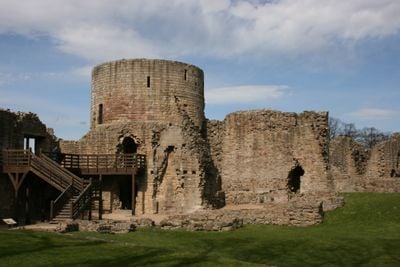
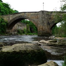
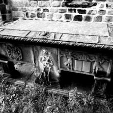
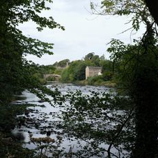
Barnard Castle is a medieval ringwork fortress perched on a rocky hill above the River Tees with structures spanning multiple levels. The ruins display a distinctive round defensive tower, hall remains, and extensive walls distributed across the terrain.
Bernard de Balliol built the original stone fortress between 1095 and 1125, transforming earlier earthwork defenses into a powerful stronghold. The castle expanded under various owners, most notably when King Richard III used it as a residence and improved its fortifications.
The castle takes its name from Bernard de Balliol, its founder, and has inspired writers who visited or researched the area. Visitors can see how the site served as a center of power and residence across the centuries.
The site opens daily from April through September and is maintained by English Heritage with educational panels throughout. Wear appropriate footwear since the paths across the hillside are uneven and can be muddy after rain.
The fortress was a favored retreat during the Wars of the Roses and played a role in power struggles between noble houses. Today visitors can still observe the strategic placement and improvements that reflected its importance during this turbulent period.
Location: Barnard Castle
Website: https://english-heritage.org.uk/visit/places/barnard-castle
GPS coordinates: 54.54333,-1.92667
Latest update: December 7, 2025 19:27
Market Cross
227 m
Church of Holy Trinity
528 m
Church of St Mary
296 m
Barnard Castle Bridge
80 m
The White Swan Public House And Swan Cottage
109 m
Deepdale Aqueduct
378 m
Post Office Post Office And Brampton House
203 m
Hopper Tomb Approximately 2 Metres South Of Church Of St Mary
291 m
Former Mill To Rear Of Number 22
263 m
Thorngate Footbridge
480 m
The Vicarage And Glebe Cottage
590 m
The Old Well
255 m
21, Galgate
270 m
24, The Bank
284 m
14 (Left Part), Market Place
193 m
South Boundary Wall To Grounds Of Bowes Museum And Church Of St Mary
594 m
60, Newgate
502 m
Pant
252 m
41, Newgate
480 m
Garden Walls To East Of Numbers 64 And 66, Spring Grove Garden Walls To Spring Grove, Newgate
544 m
Former Stable, Outbuildings And Walls To The Vicarage And Glebe Cottage
567 m
Milestone At Nz 0484 1631
140 m
Blagraves
294 m
31, 31A And 31B, Horse Market
185 m
2 And 4, Market Place
214 m
6, 6A And 6B, Galgate
216 m
31, Galgate
316 m
34, The Bank
302 mVisited this place? Tap the stars to rate it and share your experience / photos with the community! Try now! You can cancel it anytime.
Discover hidden gems everywhere you go!
From secret cafés to breathtaking viewpoints, skip the crowded tourist spots and find places that match your style. Our app makes it easy with voice search, smart filtering, route optimization, and insider tips from travelers worldwide. Download now for the complete mobile experience.
A unique approach to discovering new places❞
— Le Figaro
All the places worth exploring❞
— France Info
A tailor-made excursion in just a few clicks❞
— 20 Minutes