Baggeridge Country Park, Country park in Gospel End, South Staffordshire, England.
Description
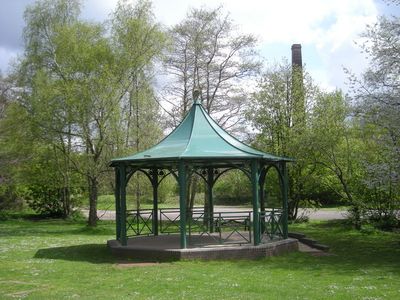
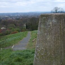
Baggeridge Country Park is a country park in South Staffordshire featuring woodlands, meadows, wetlands, and a central lake known as Bag Pool. The grounds span approximately 60 hectares and offer a network of walking trails that pass through different natural habitats.
History
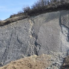
The site was once a coal mine called Baggeridge Colliery, which operated from 1936 until 1967 before closure. Following the mine's shutdown, the land underwent transformation and reopened as a public park in 1981.
Culture
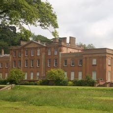
The park maintains its connection to the Himley Estate's heritage through preserved elements of Capability Brown's 18th-century landscape design.
Practical
The park offers several facilities including a café, children's play areas, a miniature railway, and camping grounds with parking spaces near the entrance. Visitors can find well-marked trails and plan half-day or full-day visits depending on their interests.
Did you know?
A high ropes course called Challenge Academy provides adventure experiences among the trees on the grounds of the former mine. This unusual contrast between the former mining site and modern recreational activities makes the location notable.
AroundUs brings together thousands of curated places, local tips, and hidden gems, enriched daily by 60,000 contributors worldwide. Discover all places nearby (United Kingdom).
Himley Hall
1.6 km
Wren's Nest
4 km
Barrow Hill Local Nature Reserve
3.5 km
St Bartholomew's Church
2.4 km
Church of St. James the Great, Sedgley
2.4 km
Church of St Benedict Biscop
2.1 km
Church of All Saints
2.1 km
Church of St Mary
3.3 km
Church of St Michael
2.3 km
Church of St Mary
3.6 km
Church of St Mark
3.9 km
Catholic Church of St Chad and All Saints and Attached Old School House
2.2 km
The Dudley Arms
2.3 km
Base of Lady Godiva's Cross to south of Church of St Bartholomew
2.4 km
Swan Inn Public House
2.1 km
Wombourne War Memorial
2.1 km
Himley House Hotel
2.3 km
Pensnett War Memorial
4 km
The Bratch Water Pumping Station
3.1 km
Churchyard cross approximately 5 metres to west of Church of St Bartholomew
2.4 km
Dormston House
2.3 km
Staffordshire And Worcestershire Canal Bratch Locks, Bridge Number 47 (Bratch Bridge) Staffordshire And Worcestershire Canal Upper Bratch Bridge And Associated Toll House
3.2 km
Pair Of Lodges And Attached Gates, Piers And Railings
1.7 km
Presbytery Of St Chad And All Saints Church
2.2 km
Milestone, Stourbridge Road, Lloyd Hill
2.7 km
The Old Rectory
2.3 km
Milestone, Clarence St; Upper Gornal; 10m E jcn Moden Hill by No. 9
2.2 km
Milestone, 50m S railway bridge on bend, N of Holbeche House driveway
2.6 kmDiscover hidden gems everywhere you go!
From secret cafés to breathtaking viewpoints, skip the crowded tourist spots and find places that match your style. Our app makes it easy with voice search, smart filtering, route optimization, and insider tips from travelers worldwide. Download now for the complete mobile experience.
A unique approach to discovering new places❞
— Le Figaro
All the places worth exploring❞
— France Info
A tailor-made excursion in just a few clicks❞
— 20 Minutes