Batham Gate, Roman road in Tideswell, England
Batham Gate is an ancient Roman road that extends from Templeborough to Buxton through Derbyshire, connecting multiple settlements across challenging terrain. The route follows a practical path that linked military forts and natural resources together.
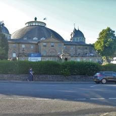
Roman engineers built this road during the first century to connect the military fort at Templeborough with the thermal springs at Buxton. The construction was part of Rome's systematic development of its British province.
The name Batham Gate reflects northern English language traditions, where 'gate' means 'road' rather than an entrance. This linguistic feature reveals how Roman infrastructure became embedded in local speech patterns.
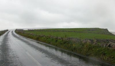
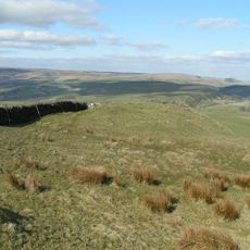
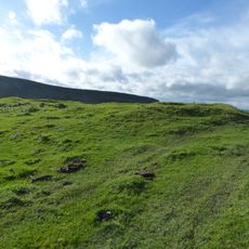
Visitors can observe sections of the original Roman construction near Peak Forest, where protected segments remain under scheduled monument status. The area is fairly accessible, but the terrain can be uneven and damp, especially after rain.
A Roman milestone found in Silverlands bears an inscription marking distance information and revealing details about how Roman surveyors measured their routes. Such artifacts are rare records of the precision that Roman road builders embedded into their work.
Location: Tideswell
GPS coordinates: 53.28090,-1.88510
Latest update: December 13, 2025 11:41
Buxton Crescent
3.1 km
The Bull Ring
2.2 km
Palace Hotel
3 km
Church of St Peter
2.1 km
Cavendish Arcade, Buxton
3.1 km
Wye House
2.9 km
The White Lion and attached stable block
2.9 km
Grove Hotel and Grove Parade
3 km
Samuel Turner Memorial Drinking Fountain
3.1 km
Longden Court To Rear Of Number 54 (Number 54 Not Included)
3 km
Lightwood Ridge (Number 199) and Woodlea (Number 201)
2.6 km
Drinking Well at Devonshire Royal Hospital
3.1 km
Screen wall to former train shed
3 km
Cherry Tree Farmhouse and adjoining house
2.1 km
Winster Place
3 km
Hogshaw Lane Viaduct
2.9 km
Dove Holes War Memorial
2 km
Lodge and gate to Devonshire Royal Hospital
3.1 km
The Old Court House shops and restaurant
3.1 km
Building to the south east of Devonshire Royal Hospital
3.1 km
Number 4 Cavendish Circus
3.1 km
Lady Low barrow
2.5 km
Cavanaleck (Number 195) and Overlaw (Number 197)
2.6 km
Cow Low bowl barrow
2.9 km
1-9, The Quadrant
3 km
9, Terrace Road
3.1 km
12 stone urns and linking walls and steps
3.1 km
Numbers 1-6 The Colonnade
3.1 kmVisited this place? Tap the stars to rate it and share your experience / photos with the community! Try now! You can cancel it anytime.
Discover hidden gems everywhere you go!
From secret cafés to breathtaking viewpoints, skip the crowded tourist spots and find places that match your style. Our app makes it easy with voice search, smart filtering, route optimization, and insider tips from travelers worldwide. Download now for the complete mobile experience.
A unique approach to discovering new places❞
— Le Figaro
All the places worth exploring❞
— France Info
A tailor-made excursion in just a few clicks❞
— 20 Minutes