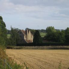
Babylon Hill, Geological site and hill in Over Compton, England
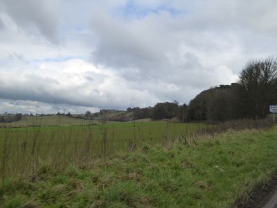
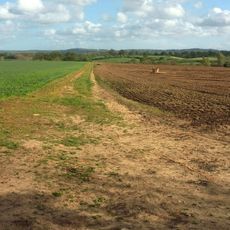
Babylon Hill is a 2.2-hectare site in Dorset featuring exposed rock layers along its northern slope that reveal the region's geological structure. These formations provide clear examples of how the area's landscape was shaped by natural forces over time.
The area saw military conflict during the English Civil War around 1642 when forces fought for control of the region. These events became part of the local story and shaped how people later understood the landscape.
The geological structures at Babylon Hill provide scientists and researchers with valuable data about the natural composition of Dorset's landscape.
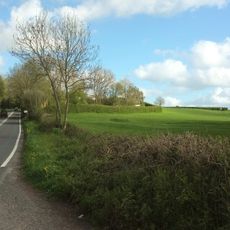
The site sits close to the A30 dual carriageway, which passes nearby and provides direct access for viewing. Best exploration happens from public footpaths and open areas, keeping in mind the active road running through the landscape.
The site gained protection as a scientific interest area in 1977 because of its rock formations and what they reveal about the region. This official recognition highlights why geologists consider this particular hillside worth studying and preserving.
Location: Over Compton
Location: Bradford Abbas
GPS coordinates: 50.93740,-2.60479
Latest update: December 14, 2025 11:01
Yeovil Railway Centre
1.6 km
Church of St John the Baptist, Yeovil
2 km
Newton Surmaville
886 m
The Old Police Station
1.9 km
Museum of South Somerset
2.1 km
Church of Saint Mary Magdalene
2.4 km
Parish Church of St Michael
2.3 km
172 And 174, Goldcroft Road
2.2 km
Church of St Andrew, Trent
3.3 km
Parish Church of St Nicholas
2.8 km
The Rose And Crown Inn
3.3 km
Parish Church of St Mary
1.7 km
Classic Yeovil
1.7 km
Yeovil Railway Centre
1.5 km
Smith's Bridge
2 km
Needle Obelisk At Ngr St 559 129
3 km
Odeon
2.1 km
Jack The Treacle Eater
1.8 km
Milestone In Boundary Wall
3 km
The Hundred Stone At Ngr St556177
3 km
Barn, 50 Metres North Of Key Farm House
2.9 km
Toll House With Boundary Walls, Gate And Railings
2.9 km
Milestone On A359 At Ngrst56571835
3 km
Cross 4 Metres South Of South Tower Of Church Of St Andrew
3.3 km
Toll-House On The County Boundary With Somerset, (A30)
569 m
Pavyotts Mill House
3.3 km
Milestone, Stoford village, opp. Garage
2.1 km
Clifton House
1.6 kmVisited this place? Tap the stars to rate it and share your experience / photos with the community! Try now! You can cancel it anytime.
Discover hidden gems everywhere you go!
From secret cafés to breathtaking viewpoints, skip the crowded tourist spots and find places that match your style. Our app makes it easy with voice search, smart filtering, route optimization, and insider tips from travelers worldwide. Download now for the complete mobile experience.
A unique approach to discovering new places❞
— Le Figaro
All the places worth exploring❞
— France Info
A tailor-made excursion in just a few clicks❞
— 20 Minutes