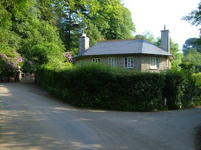
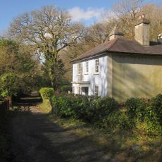
Black Hall, Grade II* listed country house in North Huish, England.
Black Hall is a country house in North Huish, Devon, built with rendered stone rubble, a hipped roof, parapet, and a distinctive domed cupola positioned to the right of center. The three-room deep floor plan defines its overall structure.
The building was constructed in the 1820s by architect R Brown of London for owner Hubert Cornish, built upon foundations of an earlier house that previously stood on the site. An extension was added in 1881, modifying the original composition.
The interior shows carefully preserved details such as molded cornices, an oval stairwell with a mahogany handrail, and several original fireplaces from different periods.
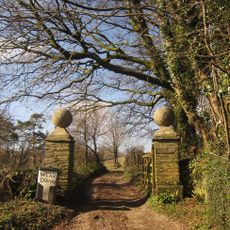
The house is located in southwest Devon in a rural area with limited public access as it remains private property. Viewing from the exterior is possible but requires respect for current use and sightlines from the nearby road.
The stairwell stands out for its unusual oval shape and is illuminated from above by a distinctive domed lantern with skylights. This rare geometric solution reflects the craft ambitions of 19th-century room design.
Location: North Huish
GPS coordinates: 50.40450,-3.81260
Latest update: December 14, 2025 16:47
St Mary's Church, North Huish
1.1 km
Church of St Petrock
3.1 km
Church of St James
637 m
Church of St Mary
1.7 km
Bridge Immediately South East Of Glazebrook Lodge
2.5 km
Devil's Backbone Bridge
796 m
Bickham Bridge Bickham Bridge
2.6 km
Glaze Brook Bridge
2.6 km
Woodland Farmhouse
667 m
Brent Mill Bridge
2.5 km
Ringwork and bailey castle 400m south of Langford Barton
1.7 km
Ivy Cottage
1.9 km
Guidestone, Aish Cross, corner of Aish Lane, 400m W of Old Brent Mill Bridge on old road to Wrangaton
2.7 km
Gate Piers Immediately South-East Of Fowelscombe Cottage
2.7 km
Ryes
1.8 km
The Rock
727 m
Pair Of Gate Piers About 200 Metres South East Of Weirdown
800 m
Milestone, 150m NE of Kitterford Cross, 20m E of field gate
2.4 km
Milestone, Avonwick, Higher Moor, Ugborough Road, SW edge of village
530 m
Milepost, Wrangaton Cross, jct with A3121 to A38 slip road, opp garage, nr Post Office
2.9 km
Gatepier and Guidestone at Aish Cross, corner of Aish Lane
2.7 km
Milestone, E end of old Brent Bridge, just off B3372, nr old toll house
2.5 km
Milestone, 90m W of Hookmoor Cross, in narrow lane
3.1 km
Milestone, 400m SE of Kitterford Cross
2.6 km
Milestone, 300m NE of turn to Charford Manor Hotel
1.6 km
Milestone, 50m W of entrance to Turtley Mill PH
2.1 km
Milestone, Avonwick, South Brent Road, NW edge of village
803 m
Guidestone, Sign of The Owl Cross (Sandowl Cross), Kingsbridge Road
2.5 kmVisited this place? Tap the stars to rate it and share your experience / photos with the community! Try now! You can cancel it anytime.
Discover hidden gems everywhere you go!
From secret cafés to breathtaking viewpoints, skip the crowded tourist spots and find places that match your style. Our app makes it easy with voice search, smart filtering, route optimization, and insider tips from travelers worldwide. Download now for the complete mobile experience.
A unique approach to discovering new places❞
— Le Figaro
All the places worth exploring❞
— France Info
A tailor-made excursion in just a few clicks❞
— 20 Minutes