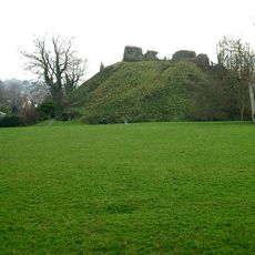
Boringdon Camp, Prehistoric hillfort in Shaugh Prior and Sparkwell, England
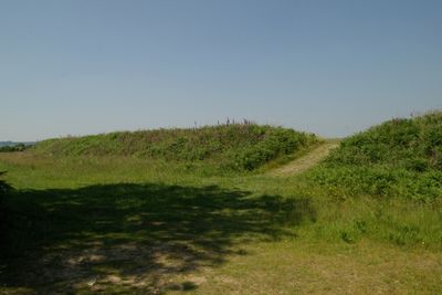
Boringdon Camp is a fortified settlement on elevated ground between Shaugh Prior and Sparkwell, featuring a raised rampart and surrounding ditch that enclose an irregular circular area of roughly 2 hectares. The structure sits on high terrain and shows the defensive design of this early settlement.
The camp began as a fortified settlement in the Iron Age and was later altered under Roman influence. In 1939 it received protected monument status and has been officially safeguarded since then.
Archaeological studies of Boringdon Camp reveal patterns of early British settlement practices through remnants of defensive structures and communal organization methods.
The site was open to visitors for many years but closed in 2016 due to erosion from foot traffic and grazing sheep needed for land management. Contact local authorities beforehand to ask about possible guided visits or current access conditions.
A former lead mining complex with a smelt mill sat nearby, pointing to medieval resource extraction in the area. Additionally, two historical deer parks from the 1600s and early 1700s surrounded the region, showing how the land was managed for hunting and farming over centuries.
The community of curious travelers
AroundUs brings together thousands of curated places, local tips, and hidden gems, enriched daily by 60,000 contributors worldwide.