Chest opened
+${chestReward.xp} XP
Explorer
NOUVEAU ×${chestReward.collectible.quantity}
tapez pour fermer
Chest locked

Open chests in the app

Around Us is built for your phone — chests unlock when you walk, explore and capture nearby places.

Enable Location

We need your location to show you interesting places around you

Discover nearby places

Find interesting locations and hidden gems around you

Precise directions

Get accurate directions and distances to places

Your location is never shared with other users. It's only used when you tap the location button.

Blackstone Edge Reservoir

Log in to your account

Start exploring — it's free

Trusted by 72,993 travelers worldwide

Continue with Google
Continue with Apple
or

We will send you a code to connect

By continuing, you accept our Terms and Conditions and our Privacy Policy

Check your inbox

We've sent a pincode in your inbox. Please enter the code below.

Blackstone Edge Reservoir
Discussion Reviews 1 Photos
1.8k Popularity

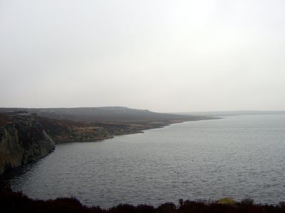
Blackstone Edge Reservoir, reservoir in Greater Manchester, England, UK

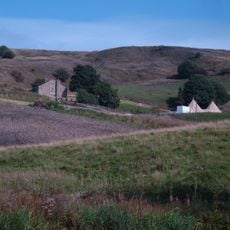
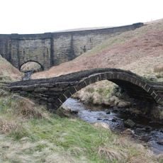
Blackstone Edge Reservoir is a water storage body in the Pennines at the border between Greater Manchester and Yorkshire, surrounded by open moorland and dark stone cliffs. The water sits in a scenic setting between rolling hills and is crossed by a network of walking trails, with the area marked by large boulders and open sky.

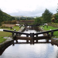
The reservoir was built in the late 1700s to supply water to the Rochdale Canal and help control flooding in the area. The landscape has been used by people for thousands of years, from Stone Age tribes to Roman times, with traces of quarrying and trade routes still visible today.

The name Blackstone Edge comes from the dark stone cliffs that define this moorland landscape. Today, visitors can see how people have shaped the area over time while the natural surroundings remain central to how locals use the place for walks and quiet moments.

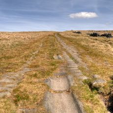
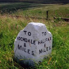
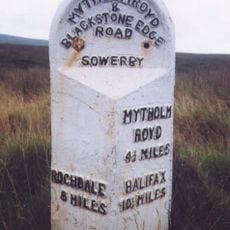
The main starting point is the car park near Blackstone Edge, from where you can follow the Pennine Way, a well-known footpath that leads to the top of the gritstone escarpment. The area has wide trails suitable for families with children and dogs, but weather can change quickly, so wear sturdy shoes and bring weather-appropriate clothing.

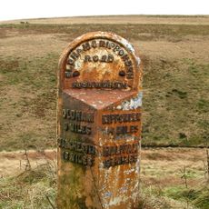
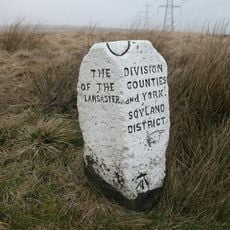
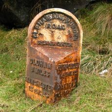
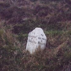
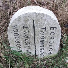
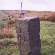
At the highest point stands a survey marker placed by cartographers on a location called Robin Hoods Bed to measure the landscape. Finding this unusual stone is an adventure for walkers wanting to connect with the area's measuring history.

The community of curious travelers

AroundUs brings together thousands of curated places, local tips, and hidden gems, enriched daily by 60,000 contributors worldwide.

Start exploring
Location
Elevation above the sea
387 m
GPS coordinates
53.66056,-2.04389
Latest update
February 9, 2026 08:20
Around this place
Handle Hall
United Kingdom

Handle Hall

3.2 km
Church of the Holy Trinity
United Kingdom

Church of the Holy Trinity

3.8 km
Church of St. James
United Kingdom

Church of St. James

3.1 km
Hare Hill Park Band Stand
United Kingdom

Hare Hill Park Band Stand

3.9 km
Lane Bottom Bridge
United Kingdom

Lane Bottom Bridge

4.1 km
Littleborough War Memorial
United Kingdom

Littleborough War Memorial

3.9 km
Rochdale Canal Stone House Bridge
United Kingdom

Rochdale Canal Stone House Bridge

3.9 km
Rochdale Canal Lock 33 Bottomley Lock
United Kingdom

Rochdale Canal Lock 33 Bottomley Lock

4.1 km
Littleborough Library
United Kingdom

Littleborough Library

3.9 km
Drinking Fountain At Hare Hill Park
United Kingdom

Drinking Fountain At Hare Hill Park

3.8 km
Steanor Bottom Toll House
United Kingdom

Steanor Bottom Toll House

3.1 km
Milestone 200 Metres To North East Of Oxygrains Bridge
United Kingdom

Milestone 200 Metres To North East Of Oxygrains Bridge

4.1 km
Littleborough Viaduct
United Kingdom

Littleborough Viaduct

3.8 km
Blackstone Edge Roman road
United Kingdom

Blackstone Edge Roman road

942 m
Boundary Stone 200 Metres From Junction With Turvin Road (B6138)
United Kingdom

Boundary Stone 200 Metres From Junction With Turvin Road (B6138)

545 m
Milestone 200 Metres To North East Of Spa Bridge
United Kingdom

Milestone 200 Metres To North East Of Spa Bridge

3.7 km
Milestone 3/4 Mile To East Of Junction With Turvin Road (B6138)
United Kingdom

Milestone 3/4 Mile To East Of Junction With Turvin Road (B6138)

1.2 km
Boundary Stone At Ngr Sd 945198
United Kingdom

Boundary Stone At Ngr Sd 945198

3 km
Rochdale Canal Lock 34 Warland Lower Lock And Attached Footbridge
United Kingdom

Rochdale Canal Lock 34 Warland Lower Lock And Attached Footbridge

3.5 km
Waterstalls
United Kingdom

Waterstalls

4 km
Milestone At Sd 998215 Sykes Gate Bottom
United Kingdom

Milestone At Sd 998215 Sykes Gate Bottom

4.2 km
Allescholes Guide Post At Ngr Sd 840 202
United Kingdom

Allescholes Guide Post At Ngr Sd 840 202

3.7 km
Milestone At Sd 988202 1/2 Mile To South West Of Wicken Hill Quarry
United Kingdom

Milestone At Sd 988202 1/2 Mile To South West Of Wicken Hill Quarry

2.6 km
Rochdale Canal Lock 35 Warland Upper Lock
United Kingdom

Rochdale Canal Lock 35 Warland Upper Lock

3.3 km
Oxygrains packhorse bridge, Rishworth
United Kingdom

Oxygrains packhorse bridge, Rishworth

4 km
Milestone, W end of Baitings Reservoir
United Kingdom

Milestone, W end of Baitings Reservoir

2.8 km
Milestone, Blackstone Edge Road, opp Turvin Clough
United Kingdom

Milestone, Blackstone Edge Road, opp Turvin Clough

2.6 km
Milestone, Reddyshore Scout Gate, W of A6033
United Kingdom

Milestone, Reddyshore Scout Gate, W of A6033

3.4 km
Show the full map
Reviews
Share your experience

No review yet

Discussions
Start a discussion...

No discussion yet

« Blackstone Edge Reservoir - reservoir in Greater Manchester, England, UK » is provided by Around Us (aroundus.com). Images and texts are derived from Wikimedia project under a Creative Commons license. You are allowed to copy, distribute, and modify copies of this page, under the conditions set by the license, as long as this note is clearly visible.

Discover hidden gems everywhere you go!

From secret cafés to breathtaking viewpoints, skip the crowded tourist spots and find places that match your style. Our app makes it easy with voice search, smart filtering, route optimization, and insider tips from travelers worldwide. Download now for the complete mobile experience.

Around Us App Screenshot

A unique approach to discovering new places

Le Figaro

All the places worth exploring

France Info

A tailor-made excursion in just a few clicks

20 Minutes

Around Us
Travel Guide & Maps
Download

Send to your phone

QR Code
1

Open the camera app on your mobile.

2

Point at the QR code with your camera. A notification will appear.

3

Tap the notification to open the link.