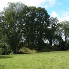
Bredwardine Castle, Medieval castle ruins in Bredwardine, England
Bredwardine Castle is a twelfth-century fortification located near the River Wye in Herefordshire, with stone remains that display typical medieval defensive features. The site contains partial walls and foundations that reveal the structure's original defensive layout.
The fortress was founded in the twelfth century and passed through several owners over the centuries, including the de Bredwardine, Baskerville, and Vaughan families. Later modifications transformed the original military structure into a residential building with multiple gables.
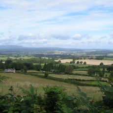
The ruins reflect how such fortifications shaped life and authority in the surrounding region during medieval times. You can see traces of the structure that once dominated the local landscape.
The site has protected monument status, so visitors should respect preservation guidelines and check access permissions beforehand. The location sits in open countryside near the river, so sturdy footwear and weather-appropriate clothing are advisable.
The site shows rare evidence of transformation from a purely military fortress into a residential manor with multiple gables. This shift demonstrates how fortifications evolved into dwellings during the later medieval period.
The community of curious travelers
AroundUs brings together thousands of curated places, local tips, and hidden gems, enriched daily by 60,000 contributors worldwide.