Bull Cross, The Frith and Juniper Hill

Log in to your account

AroundUs is a community-driven map of interesting places, built by curious explorers like you. It grows with every review, story, and photo you share.
Connect to save your favorite spots, contribute locations, and create personalized routes.
Continue with Google
Continue with Apple
Continue with X
Continue with Facebook
Continue with email
By continuing, you accept our Terms and Conditions and our Privacy Policy
Create an account

Bull Cross, The Frith and Juniper Hill

Add to collection
Map
Suggest a change
Share

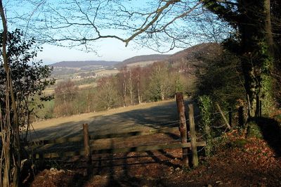
Bull Cross, The Frith and Juniper Hill, Protected ecological area in Gloucestershire, England.

Bull Cross, The Frith and Juniper Hill is a protected ecological area in Gloucestershire spanning approximately 42 hectares of calcareous grassland and broadleaved woodland dominated by beech trees. The site features multiple walking trails that pass through these different habitat types.

The site received its official designation as a Site of Special Scientific Interest in 1954. This designation marked a key moment in recognizing the ecological value of the landscape and its importance for scientific study.

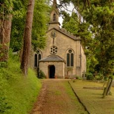
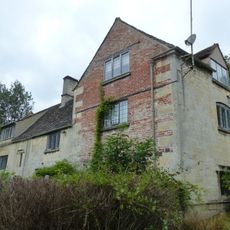
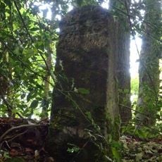
The area holds the remains of Pan's Lodge, an eighteenth-century retreat built by Benjamin Hyett in Frith Wood during the 1750s. This structure shows how wealthy people of that era valued private retreats within natural settings.

The site is accessible for hiking while strict conservation guidelines must be followed to protect the local ecosystem. Visitors should stay on marked trails and avoid disturbing the wildlife and plants.

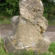
Frith Quarry provides access to Middle Jurassic rock formations that reveal geological information about the wider Cotswolds region. These exposed rocks allow researchers to study the earth history of this landscape directly.

GPS coordinates: 51.77370,-2.18619

Latest update: December 14, 2025 18:01

Photos
Around this place
Church of St Mary
United Kingdom

Church of St Mary

1.4 km
Church of Holy Trinity
United Kingdom

Church of Holy Trinity

990 m
Milestone
United Kingdom

Milestone

646 m
Four unidentified monuments circa 2 metres south of south aisle wall in the Churchyard of the Church of St Mary
United Kingdom

Four unidentified monuments circa 2 metres south of south aisle wall in the Churchyard of the Church of St Mary

1.4 km
The Old Bath House
United Kingdom

The Old Bath House

1.4 km
The Vicarage and flank wall
United Kingdom

The Vicarage and flank wall

1.4 km
K6 Telephone Kiosk
United Kingdom

K6 Telephone Kiosk

1.1 km
The Sheephouse
United Kingdom

The Sheephouse

1.3 km
Painswick Library
United Kingdom

Painswick Library

1.4 km
Golden Heart
United Kingdom

Golden Heart

1.4 km
School and school house with boundary walls
United Kingdom

School and school house with boundary walls

1 km
Red Stables
United Kingdom

Red Stables

364 m
Plate To Milestone On Boundary Wall To School
United Kingdom

Plate To Milestone On Boundary Wall To School

1.1 km
The Stocks
United Kingdom

The Stocks

1.4 km
Down Farmhouse
United Kingdom

Down Farmhouse

917 m
Tibbiwell House with attached workshop
United Kingdom

Tibbiwell House with attached workshop

1.4 km
The Old House
United Kingdom

The Old House

602 m
Gatepiers to churchyard of Church of St Mary
United Kingdom

Gatepiers to churchyard of Church of St Mary

1.4 km
Old Greenhouse Farm, Little Greenhouse, stable block (including Nos.1 and 2 Greenhouse Mews) and Coach House
United Kingdom

Old Greenhouse Farm, Little Greenhouse, stable block (including Nos.1 and 2 Greenhouse Mews) and Coach House

585 m
Painswick Mill House
United Kingdom

Painswick Mill House

975 m
Boundary wall and gates to Yew Tree House
United Kingdom

Boundary wall and gates to Yew Tree House

1.4 km
Kings Mill House
United Kingdom

Kings Mill House

1.4 km
Slad War Memorial
United Kingdom

Slad War Memorial

520 m
Yew Tree House
United Kingdom

Yew Tree House

1.4 km
Rose Bank
United Kingdom

Rose Bank

830 m
Milestone, Stepping Stone Lane
United Kingdom

Milestone, Stepping Stone Lane

905 m
Milestone, Slad; 10m W of Old Sunday School, opp pair of cottages
United Kingdom

Milestone, Slad; 10m W of Old Sunday School, opp pair of cottages

1 km
Milestone, by Redding Wood, on restricted byway between Steanbridge Lane & Catswood Lane
United Kingdom

Milestone, by Redding Wood, on restricted byway between Steanbridge Lane & Catswood Lane

1.1 km
Show the full map
Reviews

Visited this place? Tap the stars to rate it and share your experience / photos with the community! Try now! You can cancel it anytime.

« Bull Cross, The Frith and Juniper Hill - Protected ecological area in Gloucestershire, England » is provided by Around Us (aroundus.com). Images and texts are derived from Wikimedia project under a Creative Commons license. You are allowed to copy, distribute, and modify copies of this page, under the conditions set by the license, as long as this note is clearly visible.

Discover hidden gems everywhere you go!

From secret cafés to breathtaking viewpoints, skip the crowded tourist spots and find places that match your style. Our app makes it easy with voice search, smart filtering, route optimization, and insider tips from travelers worldwide. Download now for the complete mobile experience.

Around Us App Screenshot

A unique approach to discovering new places

Le Figaro

All the places worth exploring

France Info

A tailor-made excursion in just a few clicks

20 Minutes