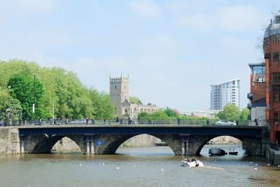
Bristol Bridge, Road bridge in Bristol, United Kingdom.
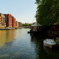
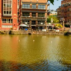
Bristol Bridge is a stone arch bridge that crosses the River Avon, linking the northern and southern sections of the city center through multiple traffic lanes. The structure accommodates vehicles, cyclists, and pedestrians moving across the river in different designated areas.
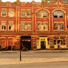
A medieval bridge built in the 13th century once stood at this location, with houses and shops lining its length until it was replaced by the current structure in 1768. This rebuilding improved crossing capacity to meet the city's growing needs.
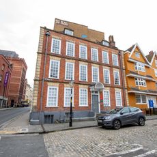
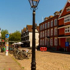
The bridge links two parts of the city center and serves as a natural focal point where people gather and orient themselves. Locals use it as a reference for directions, making it part of daily navigation throughout Bristol.
The bridge is always open and handles constant traffic from vehicles, cyclists, and pedestrians throughout the day. During peak hours it can become crowded, so plan accordingly and stay alert to different types of movement around you.
The bridge retains its original 18th-century design features while handling heavy modern traffic daily. This blend of historical stonework and contemporary use shows how older structures adapt to present-day demands without losing their character.
Location: City of Bristol
Official opening: 1768
GPS coordinates: 51.45360,-2.59130
Latest update: December 8, 2025 19:51
Llandoger Trow
231 m
The Old Duke
208 m
Granary, Bristol
190 m
St Nicholas, Bristol
80 m
St Thomas the Martyr, Bristol
100 m
6 King Street, Bristol
243 m
7 and 8 King Street, Bristol
261 m
St Nicholas' Almshouses
237 m
Three Brothers Burgers
175 m
The Llandoger Trow
234 m
The Market House Tavern
137 m
Bristol Bridge Inn
105 m
West India House
81 m
57, Queen Charlotte Street
283 m
65, Baldwin Street
108 m
Gas Lamp Post Approximately 2 Metres South Of Number 45
213 m
Section of City Wall, King Street
246 m
55, Queen Charlotte Street
278 m
Fish Market
168 m
K6 Telephone Kiosk To Top Of Steps Beside Number 13
143 m
Gas Lamp Post Approximately 2 Metres North Of Number 6
238 m
59, Queen Charlotte Street
287 m
Welsh Back Wharf Extending Approximately 450 Metres Between Bristol And Redcliffe Bridges
225 m
53, Queen Charlotte Street
272 m
59, 61 And 63, Baldwin Street
119 m
St. Nicholas Church Museum
125 m
Gas Lamp Post Approximately 2 Metres South Of St Nicholas' Almshouses
242 m
Buchanans Wharf
257 mVisited this place? Tap the stars to rate it and share your experience / photos with the community! Try now! You can cancel it anytime.
Discover hidden gems everywhere you go!
From secret cafés to breathtaking viewpoints, skip the crowded tourist spots and find places that match your style. Our app makes it easy with voice search, smart filtering, route optimization, and insider tips from travelers worldwide. Download now for the complete mobile experience.
A unique approach to discovering new places❞
— Le Figaro
All the places worth exploring❞
— France Info
A tailor-made excursion in just a few clicks❞
— 20 Minutes