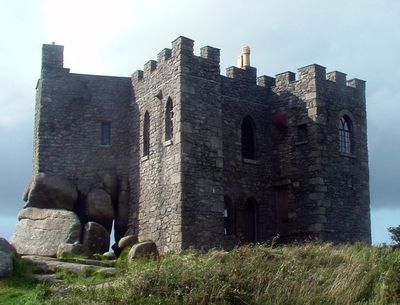
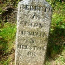
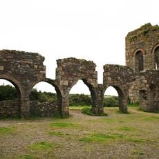
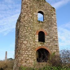
Carn Brea Castle, Medieval castle on Carn Brea hilltop near Redruth, United Kingdom
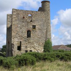
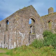
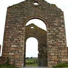
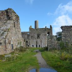
Carn Brea Castle is a stone building on a hilltop near Redruth, characterized by four rectangular towers surrounding a central structure with crenellated parapets. The foundation incorporates large granite boulders that shape an irregular layout adapted to the natural rock formations of the hill.
The structure began in 1379 as a chapel serving religious purposes, then underwent extensive reconstruction around 1790 when the Basset family converted it into a hunting lodge. This transformation marked a fundamental shift from spiritual to private use.
The location once served pilgrims and travelers as a sacred place, reflecting its origins as a chapel dedicated to spiritual purposes. The elevated position and stone walls still echo this former role in people's journeys through the region.
The location sits on an elevated hilltop with open views across the landscape and is accessible on foot, though sturdy footwear is recommended due to the rocky terrain. The area is exposed to the elements, so visitors should prepare for changing weather conditions.
The structure once served as a navigation landmark for sailors traveling between the coastal towns of St Ives and St Agnes, who recognized it by its silhouette and elevated position. This practical role as a beacon connects the site to the maritime history of the region.
Location: Carn Brea
Website: https://carnbreacastle.co.uk
GPS coordinates: 50.22250,-5.24483
Latest update: December 8, 2025 19:44
East Pool mine
1.6 km
Kresen Kernow
1.6 km
National Trust - East Pool Mine
1.5 km
Carn Brea Castle
4 m
Church of St Euny
599 m
Dunstanville Memorial
328 m
Regal Cinema
1.6 km
Murdoch House
1.6 km
Camborne and Redruth Mining District with Wheal Peevor and Portreath Harbour
746 m
Milestone Situated On The Southern Side Of The B3293, Set Into A Gap In The Forecourt Wall Of 32 West End, Redruth
1.4 km
Dry Approximately 50 Metres South-East Of Pump Engine House To Mariott's Shaft On South Wheal Basset Sett
1.6 km
East Pool Mine Michell Engine House
1.5 km
Compressor House Approximately 7 Metres West Of Pump Engine House To Marriott's Shaft On South Wheal Frances Sett
1.6 km
Milepost Opposite Turning To Carnkie At Sw 699 406
1.3 km
Buddle Floor Of Dressing Plant To West Basset Stamps On North Wheal Basset Sett, At Sw 687 401
700 m
Pump Engine House To Marriott's Shaft On South Wheal Frances Sett
1.6 km
Milepost On West Side Of Road At Sw 699 398
1.6 km
Winding Engine House To Lyle's Shaft At Sw 688 401
834 m
Chimney At Sw 688 400
839 m
Winding House Approximately 30 Metres East Of Pump Engine House To Marriott's Shaft On South Wheal Frances Sett
1.6 km
Gunpowder Magazine On The Northern Slopes Of Carn Brea
688 m
Milestone Immediately North Of Number 49
1 km
Redruth Viaduct
1.5 km
Carn Brea
178 m
Boiler House Attached To Chimney On East Side Of Pump Engine House To Marriott's Shaft On South Wheal Frances Sett
1.6 km
Pump Engine House To Lyle's Shaft At Sw 688 401
834 m
Part of the mining complex associated with Marriott's Shaft once part of South Wheal Francis tin and copper mine
1.6 km
Chimney Stack Approx. 30 Metres East Of Pump Engine House At Taylor's Shaft Of New East Pool Mine
1.6 kmVisited this place? Tap the stars to rate it and share your experience / photos with the community! Try now! You can cancel it anytime.
Discover hidden gems everywhere you go!
From secret cafés to breathtaking viewpoints, skip the crowded tourist spots and find places that match your style. Our app makes it easy with voice search, smart filtering, route optimization, and insider tips from travelers worldwide. Download now for the complete mobile experience.
A unique approach to discovering new places❞
— Le Figaro
All the places worth exploring❞
— France Info
A tailor-made excursion in just a few clicks❞
— 20 Minutes