·

Enable Location

We need your location to show you interesting places around you

Discover nearby places

Find interesting locations and hidden gems around you

Precise directions

Get accurate directions and distances to places

Your location is never shared with other users. It's only used when you tap the location button.

Clatworthy Reservoir

Log in to your account

Start exploring — it's free

Trusted by 62,655 travelers worldwide

Continue with Google
Continue with Apple
or

We will send you a code to connect

By continuing, you accept our Terms and Conditions and our Privacy Policy

Check your inbox

We've sent a pincode in your inbox. Please enter the code below.

Clatworthy Reservoir

Clatworthy Reservoir, lake in the United Kingdom

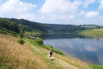
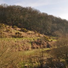
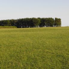
Clatworthy Reservoir is a large body of water in Somerset, built in 1959 and opened in 1961 to supply water to nearby communities. The dam crosses a valley flooded by the waters, with the landscape shaped by open fields, patches of woodland, and views toward Exmoor's hills.

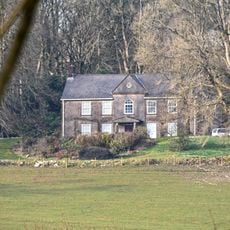
The reservoir was built in 1959 and opened in 1961 to supply water to nearby areas. Its creation flooded several villages and settlements, including Syndercombe, which had homes, a mill, and a farm that now lie underwater.

The name Clatworthy comes from Old English and refers to a farm where a plant called burdock grew. Today, visitors experience the place as a gateway to outdoor activities, blending its historical origins with how people use the water and land for recreation.

The site is easy to visit with parking available near the dam and toilets on hand, though there is no cafe at the location. The roads from Taunton are narrow and not suited for large vehicles, so plan to drive a regular car and allow extra time on winding country routes.

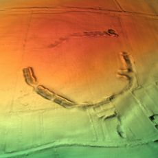
Below the water surface lie the remains of Syndercombe, a village flooded when the reservoir was created. The lost settlement is visible only through the land's shape and old pathways that now run underwater, connecting visitors to the place's hidden past.

The community of curious travelers

AroundUs brings together thousands of curated places, local tips, and hidden gems, enriched daily by 60,000 contributors worldwide.

Start exploring
GPS coordinates
51.07306,-3.36917
Latest update
February 9, 2026 08:24
Around this place
Elworthy Barrows
United Kingdom

Elworthy Barrows

3.7 km
Abbotsfield
United Kingdom

Abbotsfield

4.6 km
Church of St Martin, Elworthy
United Kingdom

Church of St Martin, Elworthy

5.5 km
Clatworthy Camp
United Kingdom

Clatworthy Camp

482 m
Church of St Michael, Raddington
United Kingdom

Church of St Michael, Raddington

5.7 km
Church of St Peter, Huish Champflower
United Kingdom

Church of St Peter, Huish Champflower

2.2 km
Church of All Saints
United Kingdom

Church of All Saints

4.2 km
Church of St Peter
United Kingdom

Church of St Peter

5.9 km
Church of St Mary
United Kingdom

Church of St Mary

4.4 km
Church of St Andrew
United Kingdom

Church of St Andrew

5.5 km
Church of St Mary Magdalene
United Kingdom

Church of St Mary Magdalene

5.8 km
Church of St Mary Magdalene
United Kingdom

Church of St Mary Magdalene

1.1 km
Church of St Giles
United Kingdom

Church of St Giles

5.3 km
Church of St John the Baptist
United Kingdom

Church of St John the Baptist

5.9 km
Church of St James
United Kingdom

Church of St James

5.2 km
Sign Post At Ngr St 0851 3480
United Kingdom

Sign Post At Ngr St 0851 3480

5.6 km
The Incline, lying between Brendon Hill and Comberow, and the remains of Combe Row Station
United Kingdom

The Incline, lying between Brendon Hill and Comberow, and the remains of Combe Row Station

3.9 km
Pepperpot Castle
United Kingdom

Pepperpot Castle

5.9 km
Churchyard Cross, Church Of St Andrew
United Kingdom

Churchyard Cross, Church Of St Andrew

5.5 km
Hartswell House
United Kingdom

Hartswell House

5.6 km
Burrow Farm iron mine and section of mineral railway trackbed, 350m north east of Burrow Farm
United Kingdom

Burrow Farm iron mine and section of mineral railway trackbed, 350m north east of Burrow Farm

4.5 km
Milestone At Ngr St 0144 3334
United Kingdom

Milestone At Ngr St 0144 3334

3.4 km
Milestone At Ngr St 0460 3613
United Kingdom

Milestone At Ngr St 0460 3613

4.9 km
Kingston Farmhouse
United Kingdom

Kingston Farmhouse

5.4 km
Burrow Farm Engine House And Remains Of Drying Shed About 10 Metres To West
United Kingdom

Burrow Farm Engine House And Remains Of Drying Shed About 10 Metres To West

4.6 km
Bowl barrow 700m north east of Burrow Farm
United Kingdom

Bowl barrow 700m north east of Burrow Farm

4.4 km
Churchyard Cross 10 Metres South East Of Church Of St John The Baptist
United Kingdom

Churchyard Cross 10 Metres South East Of Church Of St John The Baptist

5.9 km
Middleton Court
United Kingdom

Middleton Court

2.9 km
Show the full map
« Clatworthy Reservoir - lake in the United Kingdom » is provided by Around Us (aroundus.com). Images and texts are derived from Wikimedia project under a Creative Commons license. You are allowed to copy, distribute, and modify copies of this page, under the conditions set by the license, as long as this note is clearly visible.

Discover hidden gems everywhere you go!

From secret cafés to breathtaking viewpoints, skip the crowded tourist spots and find places that match your style. Our app makes it easy with voice search, smart filtering, route optimization, and insider tips from travelers worldwide. Download now for the complete mobile experience.

Around Us App Screenshot

A unique approach to discovering new places

Le Figaro

All the places worth exploring

France Info

A tailor-made excursion in just a few clicks

20 Minutes

Around Us
Travel Guide & Maps
Download

Send to your phone

QR Code
1

Open the camera app on your mobile.

2

Point at the QR code with your camera. A notification will appear.

3

Tap the notification to open the link.