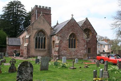
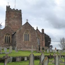
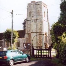
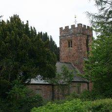
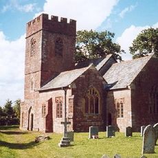
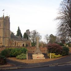
Church of All Saints, Nynehead, Medieval church building in Nynehead, England.
Church of All Saints is a medieval parish church in Nynehead featuring a square tower that houses six bells. The building is constructed from local red Permo-Triassic rock, which gives it a distinctive appearance.
The building came under the control of Montacute Priory in 1091, which took responsibility for its religious administration. This early monastic connection shaped the site's development for centuries to come.
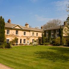
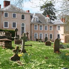
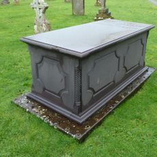
The interior displays memorials to the Sanford family, who held close ties to the neighboring manor house across centuries. These monuments reflect the family's long connection to the local community.
Access to the interior is available during regular worship services, which provide visitors with an opportunity to experience the building. It is advisable to check service times before visiting, as the church may be locked outside these hours.
One of the bells in the tower dates to 1500, serving as rare evidence of five centuries of continuous religious practice at this location. This ancient bell is often an unexpected discovery for visitors, as it powerfully documents the site's enduring continuity.
Location: Nynehead
Inception: 14 century
GPS coordinates: 50.99740,-3.22997
Latest update: December 8, 2025 20:03
Church of St. Peter, Langford Budville
2.6 km
Church of St John the Baptist, Wellington
1.8 km
Tonedale Mills
1.7 km
Tone Dale House
1.6 km
Nynehead Court
61 m
Wellington Museum
2.5 km
Bradford Bridge
3.4 km
Church of the Holy Cross
3.5 km
Church of St Michael, Milverton
3.6 km
Langford Heathfield
3.9 km
Longforth Farm
1.2 km
Church of St Peter and St Paul, Runnington
2.1 km
Church of St Bartholomew
2.9 km
Wellington Town Hall, Somerset
2.1 km
Tone Aqueduct
982 m
Church of St Giles
3.5 km
Lodge At Heatherton Park
3.6 km
Easton Family Memorial In Churchyard, About 3 Metres South Of Porch, Church Of St Giles
3.5 km
Wellesley Theatre
2.4 km
Bradford-On-Tone War Memorial
3.5 km
Tonedale Mills (west Complex)
1.7 km
Water Tower (Easternmost Of Pair)
2.9 km
Railway Bridge And Lodge Adjoining On South Front At Ngr St 1445 2174
1.2 km
Bindon House
3.7 km
Springfield House
3.7 km
Water Tower (Westernmost Of Pair)
3 km
Netherfield
3.5 km
Balgrove's Farmhouse And Adloining Walls To North West And South West
3 kmVisited this place? Tap the stars to rate it and share your experience / photos with the community! Try now! You can cancel it anytime.
Discover hidden gems everywhere you go!
From secret cafés to breathtaking viewpoints, skip the crowded tourist spots and find places that match your style. Our app makes it easy with voice search, smart filtering, route optimization, and insider tips from travelers worldwide. Download now for the complete mobile experience.
A unique approach to discovering new places❞
— Le Figaro
All the places worth exploring❞
— France Info
A tailor-made excursion in just a few clicks❞
— 20 Minutes