Enable Location

We need your location to show you interesting places around you

Discover nearby places

Find interesting locations and hidden gems around you

Precise directions

Get accurate directions and distances to places

Your location is never shared with other users. It's only used when you tap the location button.

Colt Crag Reservoir

Log in to your account

Start exploring — it's free

Trusted by 62,922 travelers worldwide

Continue with Google
Continue with Apple
or

We will send you a code to connect

By continuing, you accept our Terms and Conditions and our Privacy Policy

Check your inbox

We've sent a pincode in your inbox. Please enter the code below.

Colt Crag Reservoir
Discussion Reviews 1 Photos
1.7k Popularity

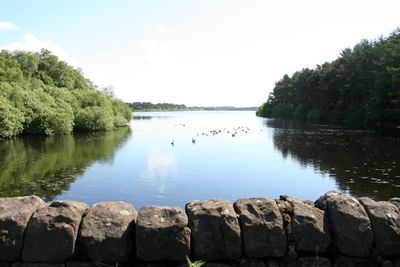
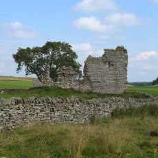
Colt Crag Reservoir, reservoir in Northumberland, England

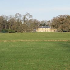
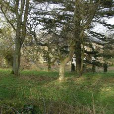
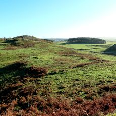
Colt Crag Reservoir is a water storage facility in Northumberland in northeast England, surrounded by trees and grassland. The water is connected to other reservoirs through aqueducts and supplies towns and cities including Newcastle and Gateshead.

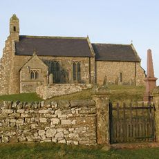
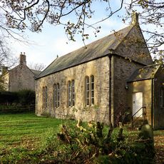
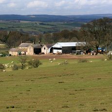
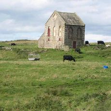
The reservoir was built in the 1880s for the Newcastle and Gateshead Water Company to store water for nearby cities. A small boathouse was added in 1884 on the eastern side, marking its early use for recreation and transport.

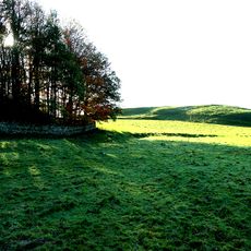
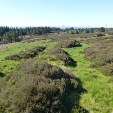
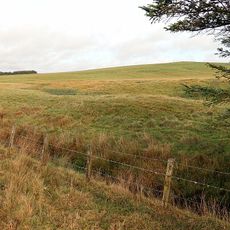
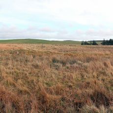
The name reflects the rocky terrain surrounding the water. Locals and visitors use the site mainly for walking and birdwatching, showing how the reservoir has become a place where people go to rest and connect with nature.

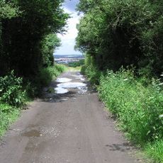
The paths around the reservoir are simple to follow and suitable for beginners and families, as they run across gentle terrain. Visitors should wear sturdy footwear and prepare for changeable weather, as conditions in Northumberland can shift quickly.

The boathouse on the eastern shore hosts 20 to 30 pairs of house martins that nest there each year, a rare example of wildlife using human structures. These birds are a sign of how nature has adapted to thrive at this spot, showing harmony between human-made and natural spaces.

The community of curious travelers

AroundUs brings together thousands of curated places, local tips, and hidden gems, enriched daily by 60,000 contributors worldwide.

Start exploring
Location
Elevation above the sea
202 m
GPS coordinates
55.09800,-2.10300
Latest update
February 9, 2026 08:19
Around this place
Dere Street
United Kingdom

Dere Street

5.2 km
Haughton Castle
United Kingdom

Haughton Castle

5.6 km
Church of St Christopher
United Kingdom

Church of St Christopher

4.4 km
Church of St Aidan, Throckington
United Kingdom

Church of St Aidan, Throckington

2.3 km
Presbyterian Church
United Kingdom

Presbyterian Church

5.3 km
Swinburne Castle And Attached Stable
United Kingdom

Swinburne Castle And Attached Stable

2.8 km
Hallington Hall
United Kingdom

Hallington Hall

5.3 km
Wester Hall
United Kingdom

Wester Hall

5.6 km
Univallate hillfort in Oxhill Plantation, 450m north-east of Great Swinburne
United Kingdom

Univallate hillfort in Oxhill Plantation, 450m north-east of Great Swinburne

2.5 km
Little Swinburne Tower
United Kingdom

Little Swinburne Tower

1.5 km
Great Wanney
United Kingdom

Great Wanney

5.2 km
Cross Base C 12 Yards South Of Church Of St Aidan
United Kingdom

Cross Base C 12 Yards South Of Church Of St Aidan

2.3 km
Roman milestone N of Waterfalls Farm
United Kingdom

Roman milestone N of Waterfalls Farm

4.1 km
Catreen Farmhouse, Outbuildings And Wall
United Kingdom

Catreen Farmhouse, Outbuildings And Wall

5 km
Tithe Barn
United Kingdom

Tithe Barn

2.4 km
Steward's House
United Kingdom

Steward's House

5.5 km
Burnt mound, 1km north-east of Quarry House
United Kingdom

Burnt mound, 1km north-east of Quarry House

4.1 km
Romano-British farmstead 750m NNE of Quarry House
United Kingdom

Romano-British farmstead 750m NNE of Quarry House

3.9 km
Dunn Crags farmstead and irregular enclosed field system, 950m north-west of Colwell
United Kingdom

Dunn Crags farmstead and irregular enclosed field system, 950m north-west of Colwell

2.2 km
Pair Of Milestones C. 1/4 Mile West Of A68
United Kingdom

Pair Of Milestones C. 1/4 Mile West Of A68

4.1 km
Milestone C 2 Miles West Of Little Bavington
United Kingdom

Milestone C 2 Miles West Of Little Bavington

3.4 km
Milestone, Fell House, Little Swinburn
United Kingdom

Milestone, Fell House, Little Swinburn

2.8 km
Milestone, Great Swinburne, by Peaslands Plantation
United Kingdom

Milestone, Great Swinburne, by Peaslands Plantation

2.5 km
Milestone, Thockrington
United Kingdom

Milestone, Thockrington

3.5 km
Milestone, Colwell
United Kingdom

Milestone, Colwell

4.1 km
Milestone, Barrasford, S of stone gate arch
United Kingdom

Milestone, Barrasford, S of stone gate arch

4.8 km
Milestone, N of Colwell
United Kingdom

Milestone, N of Colwell

3.2 km
Milestone, Colt Crag reservoir
United Kingdom

Milestone, Colt Crag reservoir

1 km
Show the full map
Reviews
Share your experience

No review yet

Discussions
Start a discussion...

No discussion yet

« Colt Crag Reservoir - reservoir in Northumberland, England » is provided by Around Us (aroundus.com). Images and texts are derived from Wikimedia project under a Creative Commons license. You are allowed to copy, distribute, and modify copies of this page, under the conditions set by the license, as long as this note is clearly visible.

Discover hidden gems everywhere you go!

From secret cafés to breathtaking viewpoints, skip the crowded tourist spots and find places that match your style. Our app makes it easy with voice search, smart filtering, route optimization, and insider tips from travelers worldwide. Download now for the complete mobile experience.

Around Us App Screenshot

A unique approach to discovering new places

Le Figaro

All the places worth exploring

France Info

A tailor-made excursion in just a few clicks

20 Minutes

Around Us
Travel Guide & Maps
Download

Send to your phone

QR Code
1

Open the camera app on your mobile.

2

Point at the QR code with your camera. A notification will appear.

3

Tap the notification to open the link.