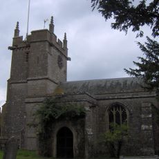
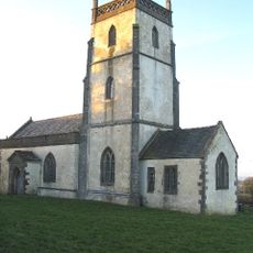
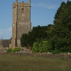
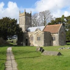
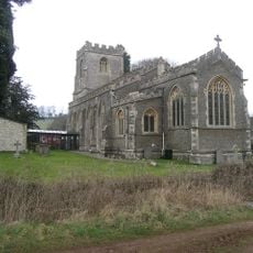
Church of St Mary Magdalene, Chewton Mendip, Grade I listed church building in Chewton Mendip, England.
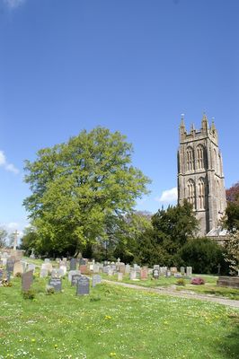
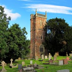
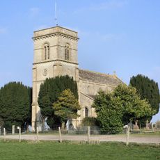
The Church of St Mary Magdalene stands as a Grade I listed building featuring a tall Somerset tower constructed in 1541 from Doulting stone, rising approximately 38 meters above the village landscape.
Originally established around 1050 with Saxon origins dating to 560, the church served as a Saxon minster with subordinate chapels before being granted to Jumièges Abbey in France following the Norman Conquest.
The church maintains its role as an active parish place of worship within the Diocese of Bath and Wells, hosting regular Holy Communion services on the fourth Sunday of each month.
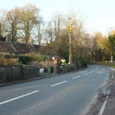
Visitors can access the church during daytime hours with parking facilities available within 250 meters, and the building provides level access to main areas for accessibility.
The church contains a medieval stone seat called a 'frid' built into the north wall, historically used by individuals seeking sanctuary protection under church law during times of trouble.
Location: Chewton Mendip
Inception: 11 century
GPS coordinates: 51.27610,-2.57990
Latest update: July 25, 2025 20:12
Gournay Court
5.2 km
Ston Easton Park
3 km
Harptree Court
3.9 km
Church of St Mary, Litton
1.6 km
Church of St James, Cameley
4.6 km
Eastwood Manor
3 km
Richmont Castle
4.2 km
Harptree Combe
4.4 km
Eastwood Manor Farm Steading
3.1 km
Smitham Chimney
4.5 km
Church of the Blessed Virgin Mary, Emborough
2.5 km
Church of St Laurence, East Harptree
4.2 km
Church of St Margaret, Hinton Blewett
3.9 km
Long Dole Wood and Meadows SSSI
3.3 km
Church of the Holy Trinity
4.2 km
Church of St Mary the Virgin, Ston Easton
2.7 km
Church of St John the Baptist
5.1 km
Church of St John the Baptist
4.6 km
Stile, 8 Metres North East Of Chancel, Church Of St Laurence
4.2 km
Churchyard Cross In Churchyard South Of South Porch Church Of St Mary Magdalene
21 m
The Old Parsonage
4.1 km
Milepost On B3139 At Ngr St 6063 5046
2.9 km
Milepost At Ngr St 6226 5397 On Roadside
2.7 km
Whitchurch Farmhouse
3.8 km
Milepost On A37 At Ngr St 6238 5242
2.8 km
5, High Street
2.7 km
Milestone At Ngr St 6280 5498 On Roadside
3.6 km
Milepost, near old railway bridge between Old Down and Gurney Slade
3.7 kmReviews
Visited this place? Tap the stars to rate it and share your experience / photos with the community! Try now! You can cancel it anytime.
Discover hidden gems everywhere you go!
From secret cafés to breathtaking viewpoints, skip the crowded tourist spots and find places that match your style. Our app makes it easy with voice search, smart filtering, route optimization, and insider tips from travelers worldwide. Download now for the complete mobile experience.
A unique approach to discovering new places❞
— Le Figaro
All the places worth exploring❞
— France Info
A tailor-made excursion in just a few clicks❞
— 20 Minutes