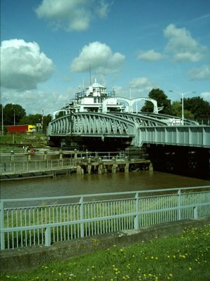
Crosskeys Bridge, Road bridge and Grade II* listed building in South Holland, England
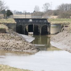
Crosskeys Bridge is a swing bridge spanning the River Nene that connects Lincolnshire and Norfolk, accommodating road traffic with pedestrian pathways. The structure includes a separately listed Hydraulic House containing the original mechanical systems that operate the swing mechanism.
The bridge was constructed in 1897 and originally carried both railway and road traffic across the river. After the railway line closed in 1965, it has served road transport exclusively.
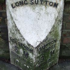
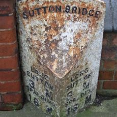
The bridge takes its name from a former public house that once stood nearby. Visitors can observe how the structure links the communities on both sides of the river today.
The bridge opens several times each week to permit vessels and recreational boats to pass toward the Port of Wisbech. Visitors should be aware that pedestrian access may be restricted during these opening periods.
The Hydraulic House was equipped with Armstrong Whitworth engines, making it a remarkable example of late 1800s engineering. These machines enabled the bridge to perform its innovative swinging function with precision.
Location: South Holland
GPS coordinates: 52.76639,0.19556
Latest update: December 11, 2025 18:06
St Peter's Church, Walpole St Peter
4.6 km
Ingleborough Tower Windmill
6.1 km
St Andrew's Church, Walpole
4 km
West Bank Lighthouse
4.8 km
East Bank Lighthouse
4.8 km
Church of St Matthew
408 m
Church of St Nicholas
6.7 km
Church of St Mary
5.3 km
Church of Saint John
7.7 km
Church of Saint Clement
7 km
Church of St Giles
7.1 km
Church of St Mary
4.4 km
Church of St James
7.5 km
Terrington St John War Memorial Cross
7.7 km
Tower to Church of Saint Clement
7 km
Milestone Opposite Yew Cottage
4.1 km
Walpole St Andrew War Memorial
4 km
Garnsgate Hall With Wall And Railings
6.5 km
Sneaths Mill
5.7 km
Dovecot Farmhouse
4.5 km
Footbridge, Road Bridge And Sluices
3.2 km
Milestone
6.7 km
Milestone
2.2 km
Lutton House
6.7 km
Milepost, London Road, outside churchyard
5.2 km
Bell Tower, South East Of Church Of St Giles
7.1 km
Milestone, Sutton Road, opp. No. 119
3.1 km
Milepost, Bridge Road, by No. 67
598 mVisited this place? Tap the stars to rate it and share your experience / photos with the community! Try now! You can cancel it anytime.
Discover hidden gems everywhere you go!
From secret cafés to breathtaking viewpoints, skip the crowded tourist spots and find places that match your style. Our app makes it easy with voice search, smart filtering, route optimization, and insider tips from travelers worldwide. Download now for the complete mobile experience.
A unique approach to discovering new places❞
— Le Figaro
All the places worth exploring❞
— France Info
A tailor-made excursion in just a few clicks❞
— 20 Minutes