Ellesmere Castle, Medieval motte-and-bailey castle in Ellesmere Urban, England.
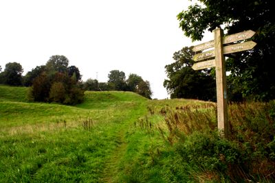
Ellesmere Castle is a Norman fortification with a distinctive mound and rectangular earthwork on a hill overlooking the Mere in Shropshire. The structure follows the classic motte-and-bailey design, where an elevated residential area was protected by a fortified outer court.
Roger de Montgomerie, Earl of Shrewsbury, founded the fortress after 1086 as part of Norman expansion in England. Over time, it changed hands between English and Welsh control before the le Strange family gained ownership and held it for centuries.
The castle remains show how Norman rulers made their authority visible through fortified structures and controlled local communities. This type of fortification was a key sign of rule in the 11th century.
The mound is now used as a bowling green, while the surrounding land offers walking paths through the historical grounds. It is an accessible site for a walk that helps you understand the layout and strategic location of the fortification.
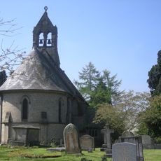
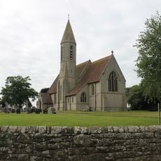
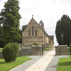
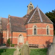
Archaeological evidence suggests a second, larger outer court existed on the west side and may have enclosed the nearby St Mary's Church. This expanded layout reveals a more complex defensive system than typically assumed for smaller motte-and-bailey sites.
Location: Ellesmere Urban
GPS coordinates: 52.90600,-2.88845
Latest update: December 9, 2025 12:24
St Mary's Church
186 m
St Michael and All Angels' Church, Welshampton
3.1 km
Tudor Court, Penley
4.7 km
Town Hall
375 m
Black Lion Hotel
425 m
Church of St Mary
4.4 km
Church of St Simon and St Jude
6.3 km
St John the Baptist's Church
5.9 km
Church of St Andrew
4.2 km
Church of St John the Evangelist
3.8 km
Cornhill Bridge
6.3 km
Dymock Arms
5.3 km
St Matthew
4.4 km
Rose Cottage
4.4 km
Lee Old Hall
2.2 km
Bettisfield Bridge
5.7 km
Cockshutt War Memorial
6.3 km
Milestone At Ngr Sj 3438 3672
6.3 km
Bettisfield Hall
6 km
Knolton Methodist Church
5 km
Mile Post Adjacent to Trotting Mare Public House, Ellesmere Road (W Side), South Knolton
4.7 km
Milestone At Ngr Sj 4574 3392
5.4 km
Canal Warehouse Of The Shropshire Union Canal (Llangollen Branch)
444 m
Beech House British Waterways Board Canal Maintenance Depot, Beech House (nos. 2-6), Shropshire Union Canal (south East Side) (l
471 m
Milestone, W of Tetchill Brook; E Newnes & industrial estate roundabout
1.4 km
Milestone, Welsh Frankton
4.6 km
Milestone, near Kinsall
6.2 km
Milestone, Balmer Heath
4 kmVisited this place? Tap the stars to rate it and share your experience / photos with the community! Try now! You can cancel it anytime.
Discover hidden gems everywhere you go!
From secret cafés to breathtaking viewpoints, skip the crowded tourist spots and find places that match your style. Our app makes it easy with voice search, smart filtering, route optimization, and insider tips from travelers worldwide. Download now for the complete mobile experience.
A unique approach to discovering new places❞
— Le Figaro
All the places worth exploring❞
— France Info
A tailor-made excursion in just a few clicks❞
— 20 Minutes