Gerrans Bay to Camels Cove

Log in to your account

AroundUs is a community-driven map of interesting places, built by curious explorers like you. It grows with every review, story, and photo you share.
Connect to save your favorite spots, contribute locations, and create personalized routes.
Continue with Google
Continue with Apple
Continue with X
Continue with Facebook
Continue with email
By continuing, you accept our Terms and Conditions and our Privacy Policy
Create an account
Add to collection
Map
Suggest a change
Share

Gerrans Bay to Camels Cove, Nature conservation site in Cornwall, England.

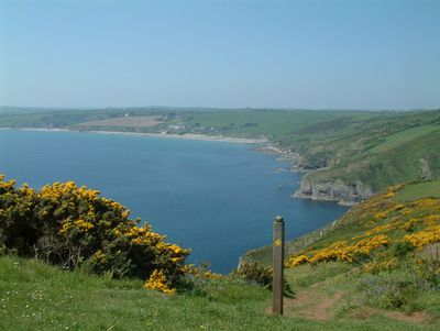
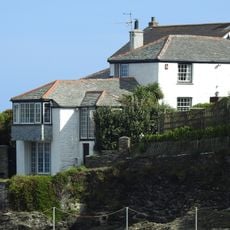
Gerrans Bay to Camels Cove is a coastal conservation site along south Cornwall featuring rocky shores, sandy coves, and dramatic cliffs that rise from the water. The terrain includes patches of grassland above the shore and rocky pools that fill with seawater at high tide.

The site gained protection status in 1951 when two separate conservation areas were joined into a single designated zone. This recognition reflected the coastline's unique natural features and importance for scientific study.

The National Trust maintains sections of the South West Coast Path through this region, enabling public connection with Cornwall's natural maritime heritage.

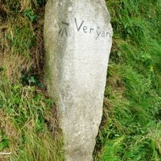
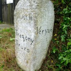
Walking routes run along the coast connecting the bays, with paths suitable for different fitness levels and interests. The low tide period reveals more of the shoreline and makes walking more comfortable along the rocky sections.

Gull Rock, an offshore rocky formation visible from the shore, serves as a nesting site for seabirds and adds to the area's ecological value. This natural feature can be spotted from walking routes and offers a notable landmark during a coastal walk.

GPS coordinates: 50.20610,-4.93040

Latest update: December 14, 2025 18:42

Photos
Around this place
Portscatho United Reformed Church
United Kingdom

Portscatho United Reformed Church

4.3 km
Church of St Symphorian
United Kingdom

Church of St Symphorian

1.6 km
Church of St Rumon, Ruanlanihorne
United Kingdom

Church of St Rumon, Ruanlanihorne

4.2 km
Church of St Gerrans
United Kingdom

Church of St Gerrans

4.7 km
Church of St Felix
United Kingdom

Church of St Felix

4.1 km
Portloe Church
United Kingdom

Portloe Church

3 km
Philleigh Post Office And Adjoining House
United Kingdom

Philleigh Post Office And Adjoining House

4.1 km
Proncha And Garden Walls
United Kingdom

Proncha And Garden Walls

3.2 km
Chyrond
United Kingdom

Chyrond

1.4 km
Milestone Circa 200M South-West Of Pendower Lodge
United Kingdom

Milestone Circa 200M South-West Of Pendower Lodge

1.9 km
Milestone Set Into Garden Wall Of Milestone House
United Kingdom

Milestone Set Into Garden Wall Of Milestone House

3.3 km
Milestone Approx 382M North-West Of Trelagossick Cottage
United Kingdom

Milestone Approx 382M North-West Of Trelagossick Cottage

4 km
Finger Signpost At Sw873351
United Kingdom

Finger Signpost At Sw873351

4.8 km
17 Victoria Terrace, The Lugger
United Kingdom

17 Victoria Terrace, The Lugger

4.3 km
Wayside cross in St  Gerran's churchyard
United Kingdom

Wayside cross in St Gerran's churchyard

4.7 km
Spring Parc
United Kingdom

Spring Parc

3 km
Milestone Approx 142M To The East Of Beruppa Farm
United Kingdom

Milestone Approx 142M To The East Of Beruppa Farm

2.4 km
3 River Street And Nos. 1 And 1A North Parade
United Kingdom

3 River Street And Nos. 1 And 1A North Parade

4.3 km
Cliff Villas
United Kingdom

Cliff Villas

3.1 km
Portloe Methodist Church Including Front Wall And Railings
United Kingdom

Portloe Methodist Church Including Front Wall And Railings

3.2 km
Sett Bridge
United Kingdom

Sett Bridge

4.6 km
9 Victoria Terrace, The Lugger
United Kingdom

9 Victoria Terrace, The Lugger

4.3 km
Blue House, 2 Lime Kilns And Cliff Garden
United Kingdom

Blue House, 2 Lime Kilns And Cliff Garden

3.1 km
The Anchorage
United Kingdom

The Anchorage

4.2 km
Boatmens Shelter
United Kingdom

Boatmens Shelter

4.3 km
Guidestone, Veryan Green, T jct, against bank
United Kingdom

Guidestone, Veryan Green, T jct, against bank

2.5 km
Guidestone, Trethennal, Treviskey turn
United Kingdom

Guidestone, Trethennal, Treviskey turn

3.2 km
Milestone, Crohans, the angle of the road fork
United Kingdom

Milestone, Crohans, the angle of the road fork

3.7 km
Show the full map
Reviews

Visited this place? Tap the stars to rate it and share your experience / photos with the community! Try now! You can cancel it anytime.

« Gerrans Bay to Camels Cove - Nature conservation site in Cornwall, England » is provided by Around Us (aroundus.com). Images and texts are derived from Wikimedia project under a Creative Commons license. You are allowed to copy, distribute, and modify copies of this page, under the conditions set by the license, as long as this note is clearly visible.

Discover hidden gems everywhere you go!

From secret cafés to breathtaking viewpoints, skip the crowded tourist spots and find places that match your style. Our app makes it easy with voice search, smart filtering, route optimization, and insider tips from travelers worldwide. Download now for the complete mobile experience.

Around Us App Screenshot

A unique approach to discovering new places

Le Figaro

All the places worth exploring

France Info

A tailor-made excursion in just a few clicks

20 Minutes