Enable Location

We need your location to show you interesting places around you

Discover nearby places

Find interesting locations and hidden gems around you

Precise directions

Get accurate directions and distances to places

Your location is never shared with other users. It's only used when you tap the location button.

Fairford Park

Log in to your account

Start exploring — it's free

Trusted by 68,106 travelers worldwide

Continue with Google
Continue with Apple
or

We will send you a code to connect

By continuing, you accept our Terms and Conditions and our Privacy Policy

Check your inbox

We've sent a pincode in your inbox. Please enter the code below.

Fairford Park
Discussion Reviews 1 Photos
1.4k Popularity

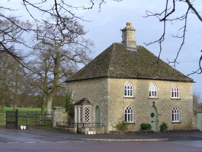
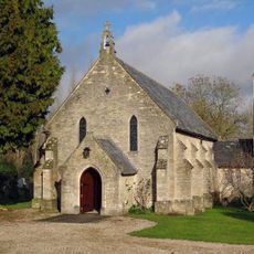
Fairford Park, Country estate in southern Cotswolds, Gloucestershire, England

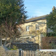
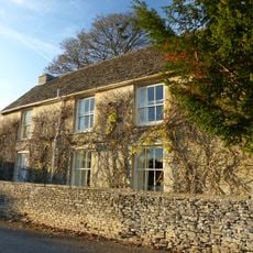
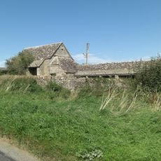
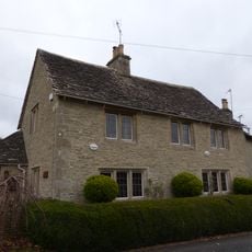
Fairford Park is a country estate spanning around 4,200 acres in the southern Cotswolds, stretching across farmland and woodlands along the River Coln valley. The property includes five working agricultural operations and approximately 260 acres of forest, currently managed by the Ernest Cook Trust.

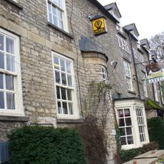
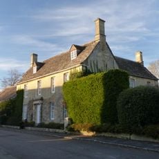
Andrew Barker, son of a Bristol merchant, built the original manor house in the 1660s after acquiring the property from Sir Robert Tracy of Toddington. The estate later served military and humanitarian purposes during the 20th century, reflecting changing uses across generations.

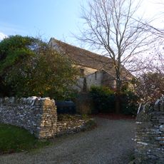
James Lambe enhanced the estate in the 1700s by creating gardens with serpentine walks, ornamental elements, fruit trees, and an obelisk marking the deer park.

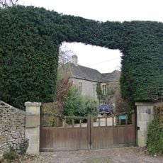
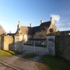
The estate is privately managed by the Ernest Cook Trust, so access may be limited to specific times or by arrangement. It is worth contacting ahead to learn which areas welcome visitors and how best to explore the grounds.

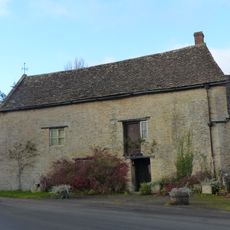
During World War II, the grounds became an American military hospital, and afterward housed Polish refugees in a camp until the late 1950s. This unexpected wartime role shaped the estate's modern story in ways many visitors never discover.

The community of curious travelers

AroundUs brings together thousands of curated places, local tips, and hidden gems, enriched daily by 60,000 contributors worldwide.

Start exploring
GPS coordinates
51.71240,-1.77990
Latest update
December 14, 2025 17:03
Around this place
St Mary's Church
United Kingdom

St Mary's Church

397 m
Church of St Anne
United Kingdom

Church of St Anne

3.1 km
Church of St Swithin
United Kingdom

Church of St Swithin

2.4 km
Roman Catholic Church of St Thomas of Canterbury
United Kingdom

Roman Catholic Church of St Thomas of Canterbury

1 km
The Bull Hotel
United Kingdom

The Bull Hotel

521 m
Stone stile and attached wall about 5 1/2 metres long, adjoining on east of wall of Quenington House
United Kingdom

Stone stile and attached wall about 5 1/2 metres long, adjoining on east of wall of Quenington House

2.7 km
The Old Rectory
United Kingdom

The Old Rectory

2.4 km
The Chanting House
United Kingdom

The Chanting House

538 m
Quenington House
United Kingdom

Quenington House

2.7 km
King and Randall Monuments, about 6 metres south west of south door in churchyard of Church of St Swithin
United Kingdom

King and Randall Monuments, about 6 metres south west of south door in churchyard of Church of St Swithin

2.4 km
Barn at Court Farm
United Kingdom

Barn at Court Farm

2.5 km
The Little House
United Kingdom

The Little House

2.6 km
Barn at Mawley House Cottage
United Kingdom

Barn at Mawley House Cottage

2.7 km
Mawley Farm House
United Kingdom

Mawley Farm House

2.6 km
The Mill
United Kingdom

The Mill

3.5 km
Bee Furlong Barn and shelter sheds
United Kingdom

Bee Furlong Barn and shelter sheds

3.1 km
Knights Hospitallers Gateway at Knights Gate
United Kingdom

Knights Hospitallers Gateway at Knights Gate

2.5 km
Presbytery Of Church Of St Thomas Of Canterbury
United Kingdom

Presbytery Of Church Of St Thomas Of Canterbury

1 km
Three Magpies
United Kingdom

Three Magpies

2.9 km
8, The Green
United Kingdom

8, The Green

2.8 km
The Long House
United Kingdom

The Long House

2.6 km
Milestone, near rt-angle bend in hedge 187 yds W of turning to Marston Hill.
United Kingdom

Milestone, near rt-angle bend in hedge 187 yds W of turning to Marston Hill.

2.4 km
Milestone, Village Green
United Kingdom

Milestone, Village Green

2.9 km
Milestone, Netherton
United Kingdom

Milestone, Netherton

2.8 km
Milestone, Fowler's Hill, by cemetery
United Kingdom

Milestone, Fowler's Hill, by cemetery

3.1 km
Milestone, NE Donkeywell Buildings
United Kingdom

Milestone, NE Donkeywell Buildings

3.1 km
Milestone, E of garage, E of Whelford turning.
United Kingdom

Milestone, E of garage, E of Whelford turning.

2.3 km
Milestone, E of entrance to football ground.
United Kingdom

Milestone, E of entrance to football ground.

797 m
Show the full map
Reviews
Share your experience

No review yet

Discussions
Start a discussion...

No discussion yet

« Fairford Park - Country estate in southern Cotswolds, Gloucestershire, England » is provided by Around Us (aroundus.com). Images and texts are derived from Wikimedia project under a Creative Commons license. You are allowed to copy, distribute, and modify copies of this page, under the conditions set by the license, as long as this note is clearly visible.

Discover hidden gems everywhere you go!

From secret cafés to breathtaking viewpoints, skip the crowded tourist spots and find places that match your style. Our app makes it easy with voice search, smart filtering, route optimization, and insider tips from travelers worldwide. Download now for the complete mobile experience.

Around Us App Screenshot

A unique approach to discovering new places

Le Figaro

All the places worth exploring

France Info

A tailor-made excursion in just a few clicks

20 Minutes

Around Us
Travel Guide & Maps
Download

Send to your phone

QR Code
1

Open the camera app on your mobile.

2

Point at the QR code with your camera. A notification will appear.

3

Tap the notification to open the link.