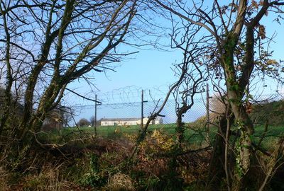
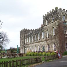
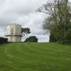
Fremington Army Camp, Military training facility in North Devon, England
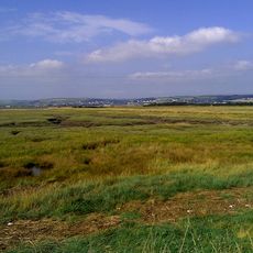
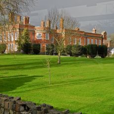
Fremington Army Camp was a military installation near Barnstaple featuring multiple buildings and training areas along the River Taw. The grounds comprised extensive training zones and military structures spread across several acres of land.
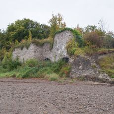
The camp was established in 1942 as an American Army base and later housed a military hospital providing care after the 1944 D-Day landings. Following the war, it developed into a key training center for specialized military operations.
The former camp served as a training center from 1946 where military personnel worked with naval and marine units on specialized operations. Today, the residential communities that occupy the site preserve memories of this operational heritage through place names and community gatherings.
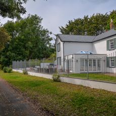
The site is no longer open to public visits as it has been transformed into residential neighborhoods including Riverside Park and Water's Edge. These communities offer shared facilities and recreational spaces available to residents and their visitors.
A young person discovered an active World War II hand grenade on the estate in 2021, which required a controlled explosion. Such wartime discoveries at the site reveal how deeply the war's aftermath remained embedded in the landscape.
GPS coordinates: 51.07500,-4.12600
Latest update: December 14, 2025 11:06
Yelland Stone Rows
2.2 km
Church of St Peter
225 m
Church of St Augustine
3 km
Church of St Peter
3.4 km
United Reform Church
2.3 km
Heanton Court
2.2 km
Milestone, Old Bideford Road, Roundwell, opp. Hazeldene, by bus stop, 20m W of Meadow Brook jct
2.6 km
Milestone, Old Bideford Road, 60m E of crossroads at Myrtle Cottage
2 km
Milestone, Old Barnstable Road, Huish Moor, 20m S of small bridge, 25m N of field gate
2.9 km
Gravestone To Edward Capern, Approximately 12 Metres South Of East End Of Heanton Punchardon Church
2.9 km
Double stone alignment on Isley Marsh 535m north of Lower Yelland Farm
2 km
The Old Windmill
3.5 km
Rookabeare Cottage
2.2 km
Fremington War Memorial
298 m
Ellerslie Lookout Tower
2.5 km
Churchyard Cross Circa 35 Metres South Of South Porch Of Heanton Punchardon Parish Church
2.9 km
Strand House
2.5 km
The New Inn
390 m
Limekiln Circa 10 Metres North Of The Disused Railway Track On The West Bank Of The Entry To Fremington Pill Estuary
459 m
Lychgate to Church of St Peter
247 m
Churchyard Cross Approximately 20 Metres South Of West Tower Of Heanton Punchard Parish Church
2.9 km
Fremington Manor House Including Entrance Gateway Attached To West Side
238 m
Milestone, Bickington Road, by No. 7
2.1 km
Milestone, between Fremlington and Yelland, opp. private road to Gibbs Barton
1.2 km
Milestone, village, 80m E of Red Lane, by Vicarage, opp. Broady Strap
509 m
Milestone, Yelland, opp. Welches Lane and No. 5 Clonmere B&B; 30m W of turn to Estuary Business Park
2.7 km
Milestone, Roundswell, S of Upcott Farm
3.4 km
Milestone, Exeter Road, Wrafton, a quarter mile NW of Chivenor Cross
2.8 kmVisited this place? Tap the stars to rate it and share your experience / photos with the community! Try now! You can cancel it anytime.
Discover hidden gems everywhere you go!
From secret cafés to breathtaking viewpoints, skip the crowded tourist spots and find places that match your style. Our app makes it easy with voice search, smart filtering, route optimization, and insider tips from travelers worldwide. Download now for the complete mobile experience.
A unique approach to discovering new places❞
— Le Figaro
All the places worth exploring❞
— France Info
A tailor-made excursion in just a few clicks❞
— 20 Minutes