Harrington Bridge, Road bridge in Lockington-Hemington, Great Britain.
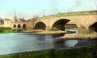
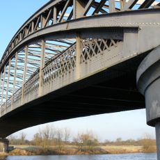
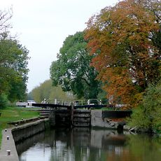
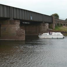
Harrington Bridge is a stone structure crossing the River Trent that combines masonry sections from its original construction with modern steel additions. The crossing displays layers of different engineering approaches, with older arched spans working alongside later reinforcements.
The bridge was completed in 1790 as an entirely stone structure spanning the river. Severe flooding in 1904 caused major damage that forced a substantial rebuild using steel reinforcement for the main spans.
The bridge maintains Grade II listed status, placing it among the numerous protected structures that form England's architectural and engineering legacy.
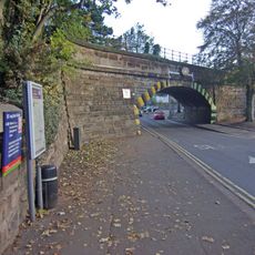
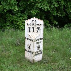
The bridge can be reached by way of Tamworth Road, which functions as a key link in the local road network of Leicestershire. As a protected structure, it remains in active use while maintaining its heritage status and showing visible signs of its age and modifications.
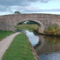
The southern ramp still features its original parapets and retaining walls from 1790, offering direct insight into 18th-century construction methods. These elements survived the extensive rebuilding work and remain visible as authentic details from the bridge's earliest phase.
Location: Lockington-Hemington
Official opening: 1790
GPS coordinates: 52.87540,-1.30120
Latest update: December 14, 2025 13:07
Lockington Hall
3 km
Trent Viaducts
2.4 km
All Saints' Church, Sawley
202 m
Church of St Michael
2.6 km
Lockington Marshes
2.1 km
St James' Church, Long Eaton
2.7 km
Church of St Chad, Church Wilne
2.4 km
Church of St Nicholas
3.2 km
Sawley Aqueduct
931 m
Tamworth Road Bridge (Spc6 19)
1.5 km
West Park Cemetery Chapels
3 km
The Navigation Inn
2.9 km
Long Eaton Library
2.9 km
Canal Bridge At Sk 496 313
2.6 km
Trent Corn Mills
3.1 km
Trent And Mersey Canal, Canal Milepost On Opposite Side Of Canal To Ivy House At Sk 443 303
2.8 km
Gate Piers And Railings To West Park Cemetery
3.1 km
Milepost At Junction With A453
2.3 km
Redhill Tunnel North Portal
2.4 km
Trent And Mersey Canal Derwent Mouth Lock
1.7 km
Long Horse Bridge
1.3 km
Packhorse Bridge Redhill Lock
2.2 km
Bothe Hall
361 m
M1 River Trent Viaduct
574 m
The Old Vicarage
3.2 km
Milepost Approximately 400 Metres South East Of Junction With Netherfield Lane
2.3 km
Sawley Railway Viaduct
768 m
Shardlow Gas Pipe Bridge
2.3 kmVisited this place? Tap the stars to rate it and share your experience / photos with the community! Try now! You can cancel it anytime.
Discover hidden gems everywhere you go!
From secret cafés to breathtaking viewpoints, skip the crowded tourist spots and find places that match your style. Our app makes it easy with voice search, smart filtering, route optimization, and insider tips from travelers worldwide. Download now for the complete mobile experience.
A unique approach to discovering new places❞
— Le Figaro
All the places worth exploring❞
— France Info
A tailor-made excursion in just a few clicks❞
— 20 Minutes