Chest opened
+${chestReward.xp} XP
Explorer
NOUVEAU ×${chestReward.collectible.quantity}
tapez pour fermer
Chest locked

Open chests in the app

Around Us is built for your phone — chests unlock when you walk, explore and capture nearby places.

Enable Location

We need your location to show you interesting places around you

Discover nearby places

Find interesting locations and hidden gems around you

Precise directions

Get accurate directions and distances to places

Your location is never shared with other users. It's only used when you tap the location button.

Log in to your account

Start exploring — it's free

Trusted by 72,880 travelers worldwide

Continue with Google
Continue with Apple
or

We will send you a code to connect

By continuing, you accept our Terms and Conditions and our Privacy Policy

Check your inbox

We've sent a pincode in your inbox. Please enter the code below.

Heavy Woollen District
Discussion Reviews Photo
6.2k Popularity

Heavy Woollen District, Industrial heritage district in West Yorkshire, England

The Heavy Woollen District is a textile manufacturing region in West Yorkshire spanning several towns including Dewsbury, Batley, Heckmondwike, and Ossett. The area forms a concentrated zone where wool production shaped both the built environment and the economy for generations.

The area was transformed in 1813 by the invention of machinery in Batley for grinding discarded rags, which established the region as a center for shoddy production. This breakthrough made the recycling of textile waste commercially viable and drew many manufacturers to settle in the district.

The district's identity centers on deep-rooted sports traditions, particularly football and cricket leagues that began in Batley and remain woven into local community life. These sporting cultures continue to connect the separate towns and reflect how residents find pride in shared pastimes.

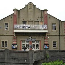
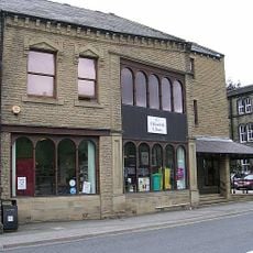
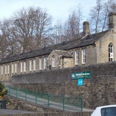
The region is best explored by visiting the individual towns, with Batley and Dewsbury serving as main entry points. Walking or driving between the towns allows visitors to see the remaining factory buildings and understand how the textile industry shaped the local landscape.

The word mungo comes from the Yorkshire dialect phrase 'munt go', describing unsuccessful attempts at blending different textile fibers during manufacturing. This local term reveals how production challenges became embedded in the region's everyday speech.

The community of curious travelers

AroundUs brings together thousands of curated places, local tips, and hidden gems, enriched daily by 60,000 contributors worldwide.

Start exploring
GPS coordinates
53.59300,-1.80100
Latest update
December 10, 2025 16:20
Around this place
Church of the Holy Trinity
United Kingdom

Church of the Holy Trinity

2.7 km
Holme Valley war memorial
United Kingdom

Holme Valley war memorial

1.9 km
Church of the Holy Trinity
United Kingdom

Church of the Holy Trinity

2.5 km
Church of St George
United Kingdom

Church of St George

1.9 km
Church of St John
United Kingdom

Church of St John

2.7 km
Church of All Saints
United Kingdom

Church of All Saints

1.3 km
Church of St James
United Kingdom

Church of St James

2.5 km
Church of St Mary the Virgin
United Kingdom

Church of St Mary the Virgin

1.4 km
St Mary's Church
United Kingdom

St Mary's Church

1.9 km
The Picturedrome
United Kingdom

The Picturedrome

2.7 km
Village Hall and 36 Wilshaw Road
United Kingdom

Village Hall and 36 Wilshaw Road

1.8 km
Brockholes War Memorial
United Kingdom

Brockholes War Memorial

2 km
Honley Library
United Kingdom

Honley Library

1.1 km
Holmfirth Library and Tourist Information Centre
United Kingdom

Holmfirth Library and Tourist Information Centre

2.7 km
Guide Stoop Junction With Wilshaw Road
United Kingdom

Guide Stoop Junction With Wilshaw Road

2.6 km
Brockholes Village Hall
United Kingdom

Brockholes Village Hall

2 km
Wall To Churchyard Of Holy Trinity And Gates At South East And South West Corners
United Kingdom

Wall To Churchyard Of Holy Trinity And Gates At South East And South West Corners

2.5 km
1 Mile Post (To North of Heyfield)
United Kingdom

1 Mile Post (To North of Heyfield)

2.2 km
1 Mile Stone Between Healey House and Bent Ley Mills
United Kingdom

1 Mile Stone Between Healey House and Bent Ley Mills

2.4 km
K6 Telephone Kiosk At Junction With Wilshaw Road
United Kingdom

K6 Telephone Kiosk At Junction With Wilshaw Road

1.8 km
4 Miles Post Opposite Junction With Far End Lane
United Kingdom

4 Miles Post Opposite Junction With Far End Lane

1.4 km
Ward Boundary Stone In Front Of No 24
United Kingdom

Ward Boundary Stone In Front Of No 24

1.9 km
5 Miles Post, 300 Yards North Of Junction With Calf Hill Road
United Kingdom

5 Miles Post, 300 Yards North Of Junction With Calf Hill Road

1.7 km
Ward Boundary Stone Opposite Junction With Bradshaw Road
United Kingdom

Ward Boundary Stone Opposite Junction With Bradshaw Road

1.5 km
Meltham Hall
United Kingdom

Meltham Hall

2.6 km
2 Miles Post Between Netherton And Healey House
United Kingdom

2 Miles Post Between Netherton And Healey House

2.4 km
6 Miles Post Oposite No 119
United Kingdom

6 Miles Post Oposite No 119

2.3 km
4.5 Mile Post Opposite Junction Of Brockholes Lane
United Kingdom

4.5 Mile Post Opposite Junction Of Brockholes Lane

1.8 km
Show the full map
Reviews
Share your experience

No review yet

Discussions
Start a discussion...

No discussion yet

« Heavy Woollen District - Industrial heritage district in West Yorkshire, England » is provided by Around Us (aroundus.com). Images and texts are derived from Wikimedia project under a Creative Commons license. You are allowed to copy, distribute, and modify copies of this page, under the conditions set by the license, as long as this note is clearly visible.

Discover hidden gems everywhere you go!

From secret cafés to breathtaking viewpoints, skip the crowded tourist spots and find places that match your style. Our app makes it easy with voice search, smart filtering, route optimization, and insider tips from travelers worldwide. Download now for the complete mobile experience.

Around Us App Screenshot

A unique approach to discovering new places

Le Figaro

All the places worth exploring

France Info

A tailor-made excursion in just a few clicks

20 Minutes

Around Us
Travel Guide & Maps
Download

Send to your phone

QR Code
1

Open the camera app on your mobile.

2

Point at the QR code with your camera. A notification will appear.

3

Tap the notification to open the link.