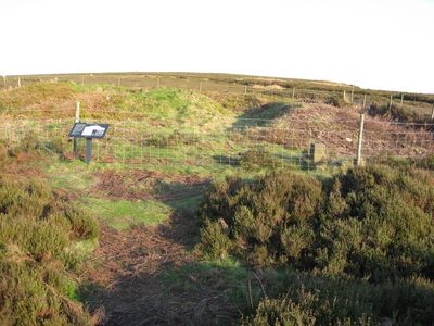
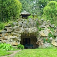
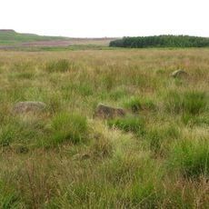
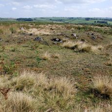
Hob Hurst's House, Bronze Age burial cairn in Beeley, England
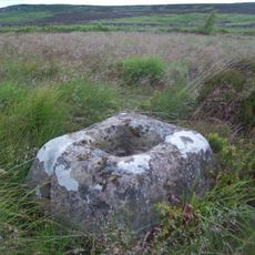
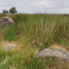
Hob Hurst's House is a Bronze Age burial mound on open moorland near Beeley. The rectangular structure measures roughly 8 meters long and 7.5 meters wide, rising about 1 meter above the ground, with a stone-lined chamber at its core that once held cremated remains.
The mound dates to the Bronze Age and was archaeologically examined in 1853 by Thomas Bateman. The investigation revealed two groups of cremated human remains and fragments of lead ore inside the chamber.
The name comes from local folklore about Hob Hurst, a supernatural figure said to inhabit the mound and help or play tricks on nearby farmers. These stories remain woven into how people in Beeley understand this place.
The site sits on a walking trail accessible from the B6012 near Beeley. Parking is available where the road meets the open moorland, making the spot straightforward to reach and explore.
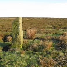
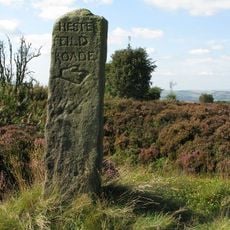
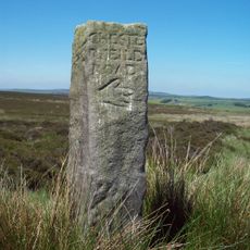
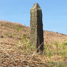
The site is marked with Victorian-era stone bollards engraved with the letters VR. These markers show it received official protection under the 1882 Ancient Monument Act, one of the first laws of its kind to safeguard such places.
Location: Beeley
Website: https://english-heritage.org.uk/visit/places/hob-hursts-house
GPS coordinates: 53.21940,-1.57098
Latest update: December 12, 2025 14:23
Chatsworth House
2.8 km
Church of St Anne
2.8 km
Beeley Lodge At South End Of Chatsworth Park
2.6 km
Flight of steps with urns and statues east of Orangery
2.8 km
The Hunting Tower
2.6 km
Giallo sarcophagus circa 60 metres north of the Dukes Greenhouse
2.7 km
Egyptian statue behind the Dukes Greenhouse 3 metres from the corner
2.8 km
Conduit House Cascade and adjoining statues
2.6 km
The Willow Tree Fountain
2.6 km
The First Duke's Greenhouse
2.8 km
One Arch Bridge
2.8 km
Grotto In Arboretum
2.4 km
Aqueduct
2.3 km
Guidepost at SK 289 693
326 m
Guidestone On Beeley Moor At Os 294674
2 km
Former Stables At Chatsworth House
2.7 km
Beeley Hilltop House
2 km
Group of 18 columns enclosing Rose Garden
2.8 km
Field system and stone circle on Rabbit Warren, 1150m south east of Park Farm
1 km
Series of herms and altars laid out in a Y to the east of the Ring Pond
2.7 km
Medieval cross base 780m south west of Arkwright Plantation
1.8 km
Guidestone At Os288696
474 m
Norman House Attached Cottage And Barn
2.7 km
Bronze Age settlement and ceremonial remains on Gibbet Moor, 980m north east of Swiss Cottage
1.9 km
Guidestone, SE end of Beeley Moor;
1.7 km
The Conservative Wall
2.8 km
Round cairn on Harland Edge
502 m
Milepost, opp. entrance to Stonelow Farm, E of Derbys Dales boundary
2.3 kmVisited this place? Tap the stars to rate it and share your experience / photos with the community! Try now! You can cancel it anytime.
Discover hidden gems everywhere you go!
From secret cafés to breathtaking viewpoints, skip the crowded tourist spots and find places that match your style. Our app makes it easy with voice search, smart filtering, route optimization, and insider tips from travelers worldwide. Download now for the complete mobile experience.
A unique approach to discovering new places❞
— Le Figaro
All the places worth exploring❞
— France Info
A tailor-made excursion in just a few clicks❞
— 20 Minutes