Chest opened
+${chestReward.xp} XP
Explorer
NOUVEAU ×${chestReward.collectible.quantity}
tapez pour fermer
Chest locked

Open chests in the app

Around Us is built for your phone — chests unlock when you walk, explore and capture nearby places.

Enable Location

We need your location to show you interesting places around you

Discover nearby places

Find interesting locations and hidden gems around you

Precise directions

Get accurate directions and distances to places

Your location is never shared with other users. It's only used when you tap the location button.

Kirkby Moor

Log in to your account

Start exploring — it's free

Trusted by 72,899 travelers worldwide

Continue with Google
Continue with Apple
or

We will send you a code to connect

By continuing, you accept our Terms and Conditions and our Privacy Policy

Check your inbox

We've sent a pincode in your inbox. Please enter the code below.

Discussion Reviews 1 Photos
1.9k Popularity

Kirkby Moor, Protected mountain and scientific site in Cumbria, England.

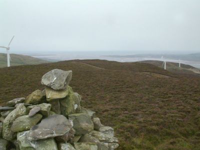
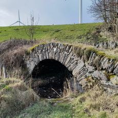
Kirkby Moor is a moorland site in southern Cumbria that spreads across both sides of the A5092 road and reaches an elevation of around 333 meters. The terrain is crossed by multiple public footpaths and is home to several wind turbines.

The moor was designated as a protected scientific site due to its ecological importance. In recent decades, wind turbines were installed across the landscape to balance energy generation with conservation.

The designation as a Site of Special Scientific Interest reflects the commitment to preserve the ecological features and natural habitats of this region.

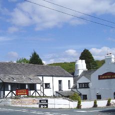
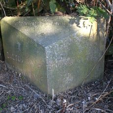
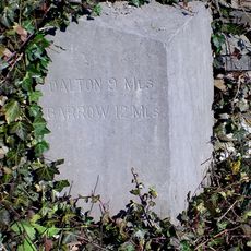
The moor can be easily explored through several public paths, with Kirkby Slate Road serving as the main access route. Visitors should prepare for changeable weather and wear sturdy footwear.

Lowick High Common in the southern part of the site has achieved special recognition in the global amateur radio community. It became the first summit in the UK to reach 100 activations for SOTA activities.

The community of curious travelers

AroundUs brings together thousands of curated places, local tips, and hidden gems, enriched daily by 60,000 contributors worldwide.

Start exploring
Elevation above the sea
333 m
GPS coordinates
54.24540,-3.13863
Latest update
December 14, 2025 11:22
Around this place
St John the Evangelist's Church, Osmotherley
United Kingdom

St John the Evangelist's Church, Osmotherley

2.6 km
St John the Baptist's Church, Blawith
United Kingdom

St John the Baptist's Church, Blawith

5.3 km
Blawith Knott
United Kingdom

Blawith Knott

4.6 km
St John the Evangelist's Church, Woodland
United Kingdom

St John the Evangelist's Church, Woodland

5.3 km
Kirkby Pool
United Kingdom

Kirkby Pool

3.5 km
Church of St Cuthbert
United Kingdom

Church of St Cuthbert

3 km
Church of St Luke
United Kingdom

Church of St Luke

3.8 km
Tottlebank Baptist Chapel
United Kingdom

Tottlebank Baptist Chapel

5.6 km
Farmer's Arms Public House
United Kingdom

Farmer's Arms Public House

4.4 km
Black Cock Inn
United Kingdom

Black Cock Inn

5.9 km
Obelisk And Stocks
United Kingdom

Obelisk And Stocks

5.9 km
Penny Bridge
United Kingdom

Penny Bridge

5.1 km
Lowick Hall
United Kingdom

Lowick Hall

3.4 km
Ashlack Hall And Outbuildings
United Kingdom

Ashlack Hall And Outbuildings

2 km
Newland Blast Furnace And Attached Ancillary Buildings
United Kingdom

Newland Blast Furnace And Attached Ancillary Buildings

5.9 km
Milestone Approximately 23 Metres To North East Of Penny Bridge
United Kingdom

Milestone Approximately 23 Metres To North East Of Penny Bridge

5.2 km
Devil's Bridge SW of Horrace
United Kingdom

Devil's Bridge SW of Horrace

4.3 km
Newland blast furnace, blacking mill, associated buildings and water management systems
United Kingdom

Newland blast furnace, blacking mill, associated buildings and water management systems

5.8 km
Kirkby Hall
United Kingdom

Kirkby Hall

2.4 km
Railway Footbridge At Kirby In Furness Station
United Kingdom

Railway Footbridge At Kirby In Furness Station

3.5 km
Milestone, Kirkby in Furness
United Kingdom

Milestone, Kirkby in Furness

3 km
Milestone, Chapels; N side by-passed loop
United Kingdom

Milestone, Chapels; N side by-passed loop

2.3 km
Milestone, Kirkby Pool, West Wreaks Causeway Bridge
United Kingdom

Milestone, Kirkby Pool, West Wreaks Causeway Bridge

3.6 km
Milestone, SW of Soutergate
United Kingdom

Milestone, SW of Soutergate

4 km
Milestone, Grizebeck
United Kingdom

Milestone, Grizebeck

2.6 km
Milestone, Boothwaite Nook, West Wreaks Farm
United Kingdom

Milestone, Boothwaite Nook, West Wreaks Farm

4.9 km
Milestone, N. of Greenodd
United Kingdom

Milestone, N. of Greenodd

5.9 km
Milestone, Arrad Foot
United Kingdom

Milestone, Arrad Foot

5.9 km
Show the full map
Reviews
Share your experience

No review yet

Discussions
Start a discussion...

No discussion yet

« Kirkby Moor - Protected mountain and scientific site in Cumbria, England » is provided by Around Us (aroundus.com). Images and texts are derived from Wikimedia project under a Creative Commons license. You are allowed to copy, distribute, and modify copies of this page, under the conditions set by the license, as long as this note is clearly visible.

Discover hidden gems everywhere you go!

From secret cafés to breathtaking viewpoints, skip the crowded tourist spots and find places that match your style. Our app makes it easy with voice search, smart filtering, route optimization, and insider tips from travelers worldwide. Download now for the complete mobile experience.

Around Us App Screenshot

A unique approach to discovering new places

Le Figaro

All the places worth exploring

France Info

A tailor-made excursion in just a few clicks

20 Minutes

Around Us
Travel Guide & Maps
Download

Send to your phone

QR Code
1

Open the camera app on your mobile.

2

Point at the QR code with your camera. A notification will appear.

3

Tap the notification to open the link.