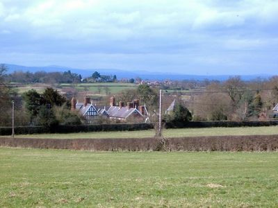
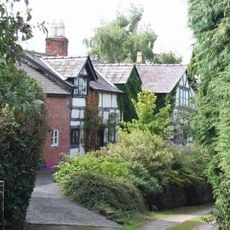
Lower Carden Hall, Grade I listed country house in Carden, England.
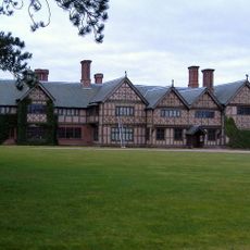
Lower Carden Hall is an English country house featuring timber framing with oak frames and plaster infill panels set on a sandstone base with projecting stone and brick chimneys. The structure spans from a 15th-century north wing to a mid-16th-century south cross-wing with later additions.
The north wing dates from the 15th century, with the south cross-wing added in the mid-16th century. The building underwent major restoration in 1984 to reinforce its structure with an inner brick layer and steel bracing.
The interior holds three late-medieval crown-post roof trusses of exceptional craftsmanship. This rare building form reflects the skilled carpentry techniques of its time.
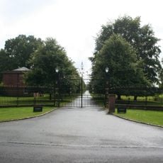
Access is limited as the property remains privately owned and is not regularly open to the public. You can best appreciate the exterior architecture from outside and observe the detailed timber framing and chimney features from different vantage points.
The drawing room displays early 18th-century panelling with fine detail, while the entrance hall features a stone ingle-nook and a 19th-century oak staircase. These details showcase interior furnishings added across different periods.
Location: Carden
Made from material: wood
GPS coordinates: 53.06457,-2.80695
Latest update: December 14, 2025 16:48
Broxton Old Hall
2.9 km
St Mary's Church, Tilston
1.7 km
Stretton Hall
1.4 km
Stretton Lower Hall
1.4 km
Cock of Barton Inn
2.3 km
Stretton Watermill
975 m
Sundial in Church of St Mary's churchyard
3.2 km
Barton Farmhouse
2.4 km
Lodge to Broxton Old Hall
3 km
Millhey Farmhouse
2.3 km
Coddington Mill And Mill Dam
2.9 km
Stretton Mill Stable
990 m
Kiosk adjacent to Village Institute
3.2 km
Rock Farmhouse
2.3 km
Stocks
2.3 km
Holford Charity, Farmhouse
2.3 km
Carden Lodge and wing walls
652 m
Clutton Lodge (East Lodge)
2.2 km
Higher Farmhouse
2.4 km
Coddington Old Rectory
3.2 km
Gate piers and railings at Clutton Lodge
2.2 km
Clutton Lodge (West Lodge)
2.2 km
Bowl barrow 120m north-east of Rose Farm
3.1 km
Milepost, 150m W of A41 intersection
3.1 km
Milepost, opp. Clutton School
2.2 km
Milepost, S of Duckington Grange, between roads to Duckington
2.9 km
Milepost, N of Caldecott Green
3.1 km
Milepost, S of Castletown Rough
3.1 kmVisited this place? Tap the stars to rate it and share your experience / photos with the community! Try now! You can cancel it anytime.
Discover hidden gems everywhere you go!
From secret cafés to breathtaking viewpoints, skip the crowded tourist spots and find places that match your style. Our app makes it easy with voice search, smart filtering, route optimization, and insider tips from travelers worldwide. Download now for the complete mobile experience.
A unique approach to discovering new places❞
— Le Figaro
All the places worth exploring❞
— France Info
A tailor-made excursion in just a few clicks❞
— 20 Minutes