London Defence Positions, Military fortification line in South East England.
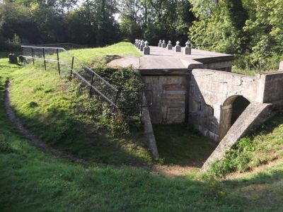
The London Defence Positions form a chain of fortified strongpoints spread across the southeastern landscape to protect the capital. The network links earthwork fortifications with smaller outposts that together created a connected defensive system.
The scheme emerged in the 1880s out of concern about possible invasion and was meant to guard the growing city. The project reflected a shift in British military strategy as new technologies and threats called for fresh approaches to city defence.
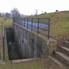
The fortification scheme reflects Victorian ideas about protecting London and shows how military planners used the landscape as a tool for city defence. The sites stand as evidence of an era when engineers believed that several small fortified points would work better than one large stronghold.
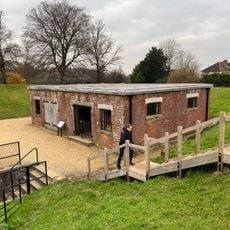
Many of the sites lie near villages and are partly accessible on foot, though some sit on private land or protected nature reserves. It is worth checking ahead which locations can be visited, as not all are freely open to the public.
The individual fortifications show interesting differences depending on terrain and local conditions, as they were not all built to a strict blueprint. This variety offers a window into the practical challenges engineers faced when building defence works across varying landscapes.
The community of curious travelers
AroundUs brings together thousands of curated places, local tips, and hidden gems, enriched daily by 60,000 contributors worldwide.