Chest opened
+${chestReward.xp} XP
Explorer
NOUVEAU ×${chestReward.collectible.quantity}
tapez pour fermer
Chest locked

Open chests in the app

Around Us is built for your phone — chests unlock when you walk, explore and capture nearby places.

Enable Location

We need your location to show you interesting places around you

Discover nearby places

Find interesting locations and hidden gems around you

Precise directions

Get accurate directions and distances to places

Your location is never shared with other users. It's only used when you tap the location button.

Log in to your account

Start exploring — it's free

Trusted by 72,989 travelers worldwide

Continue with Google
Continue with Apple
or

We will send you a code to connect

By continuing, you accept our Terms and Conditions and our Privacy Policy

Check your inbox

We've sent a pincode in your inbox. Please enter the code below.

Milecastle 76
Discussion Reviews Photo
1.1k Popularity

Milecastle 76, milecastle on Hadrian's Wall

Milecastle 76 is a small Roman fort located near the village of Drumburgh in Cumbria, England. It was part of a series of fortifications spaced about a Roman mile apart, each with a small garrison to control movement and monitor the surrounding land.

The fortification was built during Emperor Hadrian's reign as part of the major defensive system across northern Britain. The wall and its associated structures marked the northern boundary of the Roman province of Britannia and served as a control line and defensive barrier against tribal incursions.

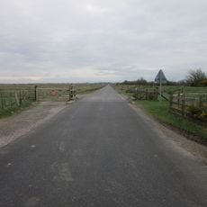
The exact site location is unconfirmed, though remains are believed to lie east of Drumburgh with only faint earthworks visible. The landscape here is often marshy and wet, so wear sturdy footwear and expect that archaeological traces are difficult to spot.

An associated watchtower called Turret 76A was located in 1948 east of an old schoolhouse but is now completely hidden underground. The second watchtower, Turret 76B, has never been clearly found, though experts estimate it lay about 90 meters south of where a former railway crossed the wall.

The community of curious travelers

AroundUs brings together thousands of curated places, local tips, and hidden gems, enriched daily by 60,000 contributors worldwide.

Start exploring
Part of
Hadrian's Wall
GPS coordinates
54.92815,-3.14559
Latest update
February 9, 2026 07:40
Around this place
Coggabata
United Kingdom

Coggabata

200 m
Drumburgh Castle
United Kingdom

Drumburgh Castle

205 m
Milecastle 75
United Kingdom

Milecastle 75

1.4 km
United Kingdom

Milecastle 78

2.6 km
United Kingdom

Milecastle 77

1.3 km
United Kingdom

Milecastle 74

2.9 km
United Kingdom

Easton Bridge

920 m
United Kingdom

Glasson Bridge

1.5 km
United Kingdom

Westfield House Adjoining Outbuildings And Cottage

2.1 km
United Kingdom

Boustead Hill Bridge

2.8 km
United Kingdom

Boustead Hill House

2.7 km
United Kingdom

Ole Croft

1.6 km
United Kingdom

Drumburgh Roman fort and Hadrian's Wall between Burgh Marsh and Westfield House in wall miles 76 and 77

912 m
United Kingdom

Croft House And Stables

2.7 km
United Kingdom

Hadrian's Wall and vallum between the access road to Glendale caravan park and the track south of Kirkland House in wall miles 7

2.7 km
United Kingdom

Easton Hall And Adjoining Outbuildings

1.3 km
United Kingdom

Fingland Farmhouse And Adjoining Barn

3 km
United Kingdom

Hillside Farmhouse

2.8 km
United Kingdom

Hadrian's Wall vallum between the watercourse 400m south east of Glasson and the access road to Glendale caravan park in wall mi

1.7 km
United Kingdom

High House

3 km
United Kingdom

Barracks House

1.5 km
United Kingdom

Hadrian's Wall between Apple Garth, Westfield, and the dismantled railway in wall mile 77

2.2 km
United Kingdom

Hadrian's Wall between the dismantled railway and the access road to Glendale caravan park in wall mile 77

2.4 km
United Kingdom

Marsh House And Adjoining Barn

1.2 km
United Kingdom

Garden Wall In Front Of Easton Hall

1.3 km
United Kingdom

Highfield

2.9 km
United Kingdom

Canal Aqueduct

1.8 km
United Kingdom

Bird hide, scenic viewpoint

1.7 km
Show the full map
Reviews
Share your experience

No review yet

Discussions
Start a discussion...

No discussion yet

« Milecastle 76 - milecastle on Hadrian's Wall » is provided by Around Us (aroundus.com). Images and texts are derived from Wikimedia project under a Creative Commons license. You are allowed to copy, distribute, and modify copies of this page, under the conditions set by the license, as long as this note is clearly visible.

Discover hidden gems everywhere you go!

From secret cafés to breathtaking viewpoints, skip the crowded tourist spots and find places that match your style. Our app makes it easy with voice search, smart filtering, route optimization, and insider tips from travelers worldwide. Download now for the complete mobile experience.

Around Us App Screenshot

A unique approach to discovering new places

Le Figaro

All the places worth exploring

France Info

A tailor-made excursion in just a few clicks

20 Minutes

Around Us
Travel Guide & Maps
Download

Send to your phone

QR Code
1

Open the camera app on your mobile.

2

Point at the QR code with your camera. A notification will appear.

3

Tap the notification to open the link.