Enable Location

We need your location to show you interesting places around you

Discover nearby places

Find interesting locations and hidden gems around you

Precise directions

Get accurate directions and distances to places

Your location is never shared with other users. It's only used when you tap the location button.

Marriott's Way

Log in to your account

Start exploring — it's free

Trusted by 63,070 travelers worldwide

Continue with Google
Continue with Apple
or

We will send you a code to connect

By continuing, you accept our Terms and Conditions and our Privacy Policy

Check your inbox

We've sent a pincode in your inbox. Please enter the code below.

Marriott's Way
Discussion Reviews 1 Photos
5.5k Popularity

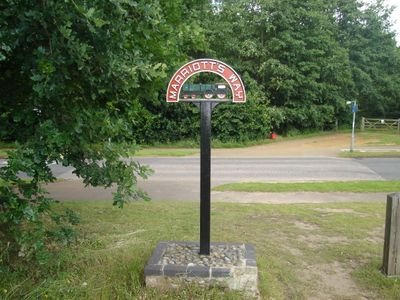
Marriott's Way, long-distance foot, cycle path and bridleway between Norwich and Aylsham

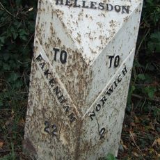
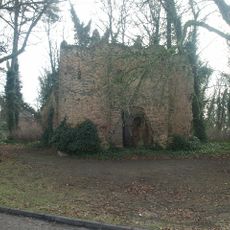
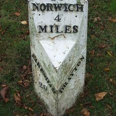
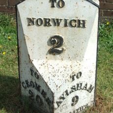
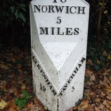
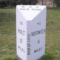
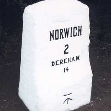
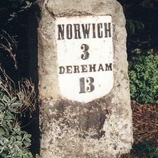
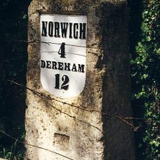
Marriott's Way is a long-distance trail in Norfolk spanning about 26 miles from Norwich to the town of Aylsham, following two former railway lines. The route is mostly flat and passes through open farmland and woodland, with remnants of old railway bridges and station buildings visible along the path.

The railway line was built in the late 1800s and carried freight and passenger trains through the region, supporting the growth of surrounding villages. It closed in the 1960s and was later converted into a public walking trail.

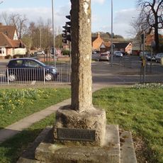
The trail is named after William Marriott, a railway worker whose memory is preserved in the local landscape. It connects small villages and farmland, reflecting how the railway shaped rural life and trade in the region.

The trail is consistently flat and accessible to most visitors, including families with children seeking easy walks. With limited facilities along the route, bring water and snacks, and use the rest areas at villages to break your journey.

The trail is decorated with art made from old railway pieces, including sculptures placed at mile markers and wind-up boxes hidden under some bridges that play sounds from the railway era. These details turn a simple walk into a discovery of the region's industrial past.

The community of curious travelers

AroundUs brings together thousands of curated places, local tips, and hidden gems, enriched daily by 60,000 contributors worldwide.

Start exploring
Location
GPS coordinates
52.66260,1.22970
Latest update
February 7, 2026 11:00
Around this place
Costessey Hall
United Kingdom

Costessey Hall

2.3 km
Manor Park, Horsford
United Kingdom

Manor Park, Horsford

2.7 km
The Gatehouse
United Kingdom

The Gatehouse

3.3 km
Sweetbriar Road Meadows, Norwich
United Kingdom

Sweetbriar Road Meadows, Norwich

3.3 km
City of Norwich Aviation Museum
United Kingdom

City of Norwich Aviation Museum

3.6 km
Parish Church of All Saints
United Kingdom

Parish Church of All Saints

3.5 km
Parish Church of St Edmund
United Kingdom

Parish Church of St Edmund

3 km
Church of St Edmund
United Kingdom

Church of St Edmund

857 m
Parish Church of St Margaret
United Kingdom

Parish Church of St Margaret

1.7 km
Parish Church of St Mary
United Kingdom

Parish Church of St Mary

2.1 km
The Red Lion
United Kingdom

The Red Lion

1.6 km
Taverham War Memorial
United Kingdom

Taverham War Memorial

3 km
Costessey War Memorial
United Kingdom

Costessey War Memorial

849 m
Drayton War Memorial
United Kingdom

Drayton War Memorial

1.7 km
Hellesdon War Memorial
United Kingdom

Hellesdon War Memorial

2.2 km
Horsford War Memorial
United Kingdom

Horsford War Memorial

3.5 km
Remains of Bowthorpe Church
United Kingdom

Remains of Bowthorpe Church

3.1 km
Wayside cross at the junction of Boundary Road and Drayton High Road
United Kingdom

Wayside cross at the junction of Boundary Road and Drayton High Road

2.5 km
Village cross 160m south of St Margaret's Church
United Kingdom

Village cross 160m south of St Margaret's Church

1.5 km
Milepost, 190yds W of entrance to Royal Norwich Golf Club. Opp. school playing fields
United Kingdom

Milepost, 190yds W of entrance to Royal Norwich Golf Club. Opp. school playing fields

1.9 km
Drayton Lodge
United Kingdom

Drayton Lodge

1.1 km
Milepost, 20yds W of jct with Taverham Rd
United Kingdom

Milepost, 20yds W of jct with Taverham Rd

1.6 km
Milepost, Cromer Road, by No. 158
United Kingdom

Milepost, Cromer Road, by No. 158

2.9 km
Milepost, Fakenham Road, opp. No. 230
United Kingdom

Milepost, Fakenham Road, opp. No. 230

3.1 km
Milepost, 100m S of jct with Drayton Lane
United Kingdom

Milepost, 100m S of jct with Drayton Lane

3.3 km
Milestone, 90m W of jct with Marlpit Lane, 20m E of Tollhouse Cottage
United Kingdom

Milestone, 90m W of jct with Marlpit Lane, 20m E of Tollhouse Cottage

2.6 km
Milestone, 50yds W of jct with Three Mile Lane, on slip rd N of roundabout
United Kingdom

Milestone, 50yds W of jct with Three Mile Lane, on slip rd N of roundabout

2.2 km
Milestone, 10m E of drive to Lodge Farm
United Kingdom

Milestone, 10m E of drive to Lodge Farm

2.7 km
Show the full map
Reviews
Share your experience

No review yet

Discussions
Start a discussion...

No discussion yet

« Marriott's Way - long-distance foot, cycle path and bridleway between Norwich and Aylsham » is provided by Around Us (aroundus.com). Images and texts are derived from Wikimedia project under a Creative Commons license. You are allowed to copy, distribute, and modify copies of this page, under the conditions set by the license, as long as this note is clearly visible.

Discover hidden gems everywhere you go!

From secret cafés to breathtaking viewpoints, skip the crowded tourist spots and find places that match your style. Our app makes it easy with voice search, smart filtering, route optimization, and insider tips from travelers worldwide. Download now for the complete mobile experience.

Around Us App Screenshot

A unique approach to discovering new places

Le Figaro

All the places worth exploring

France Info

A tailor-made excursion in just a few clicks

20 Minutes

Around Us
Travel Guide & Maps
Download

Send to your phone

QR Code
1

Open the camera app on your mobile.

2

Point at the QR code with your camera. A notification will appear.

3

Tap the notification to open the link.