Enable Location

We need your location to show you interesting places around you

Discover nearby places

Find interesting locations and hidden gems around you

Precise directions

Get accurate directions and distances to places

Your location is never shared with other users. It's only used when you tap the location button.

Netherwitton Hall

Log in to your account

Start exploring — it's free

Trusted by 68,099 travelers worldwide

Continue with Google
Continue with Apple
or

We will send you a code to connect

By continuing, you accept our Terms and Conditions and our Privacy Policy

Check your inbox

We've sent a pincode in your inbox. Please enter the code below.

Discussion Reviews 1 Photos
10.1k Popularity

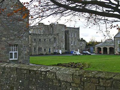
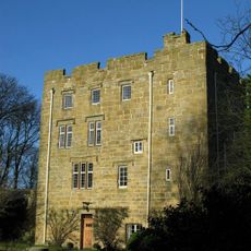
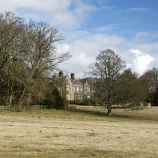
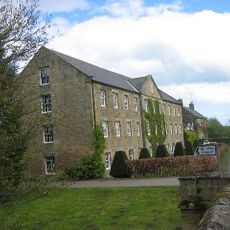
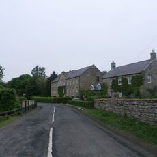
Netherwitton Hall, Grade I listed country house in Netherwitton, England.

Netherwitton Hall is an English country house with three storeys, distinguished by seven window bays and irregular window pediments along its front. A decorative balustrade runs across the facade, framing the elegant proportions of the building.

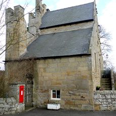
The current building was designed around 1685 by architect Robert Trollope, who incorporated elements from older structures on the site. A stairway tower from medieval fortifications was preserved and integrated into the new design.

The family connected to this manor through Margaret Thornton's marriage in 1772 shaped its character and role in local society for centuries. The household became part of the region's gentry life in ways that visitors can still sense today.

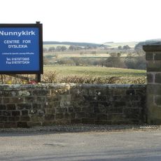
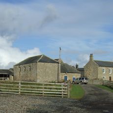
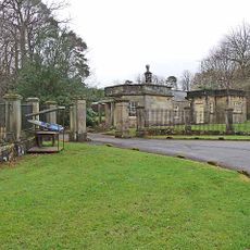
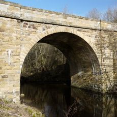
The hall sits in a rural setting in northwestern Northumberland, roughly 8 miles from Morpeth, accessible via local roads through the countryside. The surroundings offer a quiet, open landscape typical of this part of northern England.

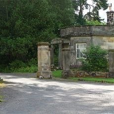
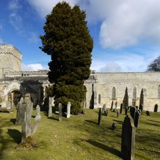
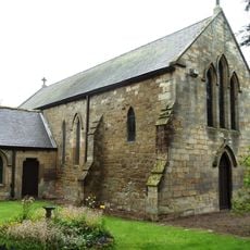
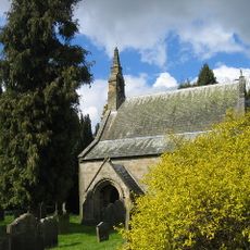
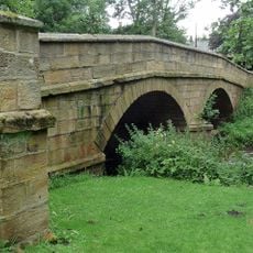
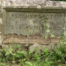
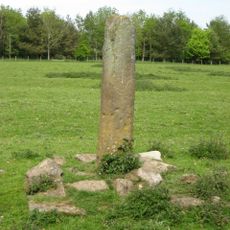
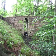
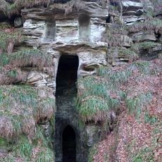
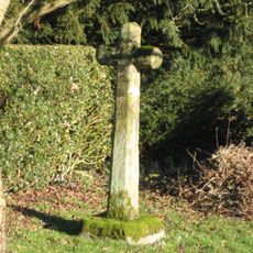
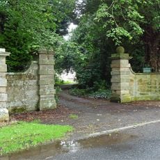
Within the house stands a former Catholic chapel that served earlier residents of the family. The surrounding gardens feature a decorative folly with listed stone masonry that adds character to the grounds.

The community of curious travelers

AroundUs brings together thousands of curated places, local tips, and hidden gems, enriched daily by 60,000 contributors worldwide.

Start exploring
Location
GPS coordinates
55.20830,-1.84100
Latest update
December 8, 2025 19:52
Around this place
Meldon Park
United Kingdom

Meldon Park

5 km
Nunnykirk Hall
United Kingdom

Nunnykirk Hall

2.9 km
Hartburn War Memorial
United Kingdom

Hartburn War Memorial

4.6 km
Church of St Andrew
United Kingdom

Church of St Andrew

4.6 km
Church of St Thomas of Canterbury (Rc)
United Kingdom

Church of St Thomas of Canterbury (Rc)

6.1 km
Church of St Helen
United Kingdom

Church of St Helen

6.1 km
Church of St Giles
United Kingdom

Church of St Giles

80 m
Milestone Circa A Quarter Of A Mile West Of Coltpark
United Kingdom

Milestone Circa A Quarter Of A Mile West Of Coltpark

4.8 km
Lodge At Entrance To Meldon Park
United Kingdom

Lodge At Entrance To Meldon Park

4.9 km
Horsley Tower And Adjacent Outbuilding
United Kingdom

Horsley Tower And Adjacent Outbuilding

6.1 km
Crossford Bridge Over River Font
United Kingdom

Crossford Bridge Over River Font

1.2 km
Netherwitton War Memorial
United Kingdom

Netherwitton War Memorial

354 m
Angerton Hall And Attached Wall To North-East
United Kingdom

Angerton Hall And Attached Wall To North-East

5.4 km
Netherwitton Bridge Over River Font
United Kingdom

Netherwitton Bridge Over River Font

342 m
Old Schoolhouse
United Kingdom

Old Schoolhouse

4.5 km
Bridge Over Nun Burn 200 Metres South Of Nunriding Hall
United Kingdom

Bridge Over Nun Burn 200 Metres South Of Nunriding Hall

4.3 km
Claverings Cross
United Kingdom

Claverings Cross

3.4 km
Footbridge Over Small Stream 15 Metres East Of B 6343
United Kingdom

Footbridge Over Small Stream 15 Metres East Of B 6343

4.4 km
Needlesshallmoor Farmhouse
United Kingdom

Needlesshallmoor Farmhouse

2.7 km
Milestone At Ewesley Station
United Kingdom

Milestone At Ewesley Station

4.8 km
Grotto On South Bank Of Hart Burn
United Kingdom

Grotto On South Bank Of Hart Burn

4.2 km
Netherwitton Mill
United Kingdom

Netherwitton Mill

312 m
Netherwitton Village Cross In Garden Of Font House
United Kingdom

Netherwitton Village Cross In Garden Of Font House

302 m
Piers And Screen Walls At Entrance To Meldon Park
United Kingdom

Piers And Screen Walls At Entrance To Meldon Park

4.9 km
Hartburn Bridge, Over The Hart Burn
United Kingdom

Hartburn Bridge, Over The Hart Burn

4.6 km
Netherwitton Farmhouse
United Kingdom

Netherwitton Farmhouse

305 m
Gate Piers And Screen Walls To South-East Of Netherwitton Hall
United Kingdom

Gate Piers And Screen Walls To South-East Of Netherwitton Hall

76 m
Milestone, Codger Fort
United Kingdom

Milestone, Codger Fort

5.8 km
Show the full map
Reviews
Share your experience

No review yet

Discussions
Start a discussion...

No discussion yet

« Netherwitton Hall - Grade I listed country house in Netherwitton, England » is provided by Around Us (aroundus.com). Images and texts are derived from Wikimedia project under a Creative Commons license. You are allowed to copy, distribute, and modify copies of this page, under the conditions set by the license, as long as this note is clearly visible.

Discover hidden gems everywhere you go!

From secret cafés to breathtaking viewpoints, skip the crowded tourist spots and find places that match your style. Our app makes it easy with voice search, smart filtering, route optimization, and insider tips from travelers worldwide. Download now for the complete mobile experience.

Around Us App Screenshot

A unique approach to discovering new places

Le Figaro

All the places worth exploring

France Info

A tailor-made excursion in just a few clicks

20 Minutes

Around Us
Travel Guide & Maps
Download

Send to your phone

QR Code
1

Open the camera app on your mobile.

2

Point at the QR code with your camera. A notification will appear.

3

Tap the notification to open the link.