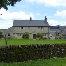
Pilsbury Castle, Motte-and-bailey castle in Hartington Town Quarter, England.
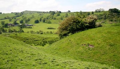
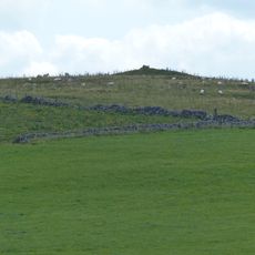
Pilsbury Castle is a Norman fortification with a raised mound and two surrounding earthwork enclosures positioned above the River Dove in Derbyshire. The surviving earthwork structures clearly show where wooden buildings once stood and how the fort was organized.
The castle was founded during the Norman period, likely by Henry de Ferrers who received land grants from King William after 1066. It was one of many fortifications built to establish Norman control over newly conquered English territory.
The site shows how Norman lords expressed their authority through fortified earthworks. Walking across the mounds, visitors can sense how these structures dominated the local landscape.
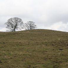
The site is accessible via public footpaths and remains open without restrictions for visitors to explore. Since only earthworks survive, you can walk around freely and examine the layout from different vantage points.
Excavations between 1880 and 1885 uncovered medieval artifacts beneath the earthworks, including a coin from the 13th century. These discoveries reveal the long span of human activity preserved in the soil beneath your feet.
Location: Hartington Town Quarter
GPS coordinates: 53.17170,-1.83109
Latest update: December 8, 2025 19:51
St Bartholomew's Church, Longnor
2.7 km
Church of St Luke
2.4 km
Parrots Restaurant
2.8 km
8, Chapel Street
2.7 km
Horseshoe Inn
2.8 km
Knowsley Cross
1.1 km
The Market Hall
2.7 km
Broadmeadow Hall
514 m
Over Boothlow Farmhouse
1.7 km
Mile Post, Longnor 1/2 Mile
2.7 km
New House Farm and attached gate piers
2.9 km
Milestone south of Longnor market place
2.8 km
Mile Post 34 Metres North-West Of Middle Street Farm At Ngr Sk 136 653
2.6 km
Crewe and Harpur Arms
2.7 km
Hurdlow Hall and attached garden wall and gates
2.9 km
Fox Hole Cave
2.7 km
Pilsbury Farmhouse
547 m
The Cross 7 metres west of Crewe And Harpur Arms
2.8 km
School and attached School House
2.4 km
Folds End Farmhouse
2.5 km
Cotesfield Farmhouse
2.1 km
Hurdlow Manor and attached barn
2.9 km
Village cross and corner posts approximately 50 metres west of school
2.4 km
Ridge End Farmhouse
2 km
Cronkston Low bowl barrow
2.5 km
Bowl barrow 170m north of The Low
2.6 km
Milepost, Ridge Farm
3 km
Milepost, E of Longnor, on road to Crowdecote
2.4 kmVisited this place? Tap the stars to rate it and share your experience / photos with the community! Try now! You can cancel it anytime.
Discover hidden gems everywhere you go!
From secret cafés to breathtaking viewpoints, skip the crowded tourist spots and find places that match your style. Our app makes it easy with voice search, smart filtering, route optimization, and insider tips from travelers worldwide. Download now for the complete mobile experience.
A unique approach to discovering new places❞
— Le Figaro
All the places worth exploring❞
— France Info
A tailor-made excursion in just a few clicks❞
— 20 Minutes