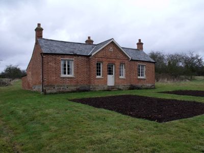
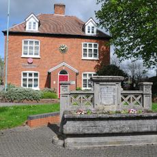
Rosedene, Historic house museum in Dodford, England
Rosedene is a house museum in Dodford with two bedrooms, a living room, and a back hall containing a well and pump. An attached piggery and coal house stand beside the main cottage, with a restored garden showing the plants that residents once grew.
Built in 1849, this cottage was part of the Great Dodford Chartist settlement, a scheme by the National Land Company to provide workers with farm properties. The project emerged from efforts to reshape how working people could earn their living.
The house reflects the nineteenth-century Chartist vision of helping factory workers gain self-sufficiency through small farms and market gardening. Walking through the rooms and garden shows how residents tried to balance industrial work with rural living.
This museum is typically open only for guided visits that need to be arranged in advance. Visitors should allow time to explore the main house, the outbuildings, and the garden properly.
The attached piggery was converted into a laundry room between 1915 and 1920 when vegetable growing became more profitable than raising pigs. This change reveals how residents adapted their buildings to match their changing income sources.
Location: Dodford with Grafton
Address: Victoria Road, Dodford, near Bromsgrove, Worcestershire, B61 9BU
Email: rosedene@nationaltrust.org.uk
Website: https://nationaltrust.org.uk/rosedene
GPS coordinates: 52.35600,-2.10425
Latest update: December 14, 2025 17:02
Church of St John the Baptist, Bromsgrove
3.6 km
Church of the Holy Trinity, Belbroughton
3.9 km
Christ Church
2.9 km
Church of St Cassian, Chaddesley Corbett
3.9 km
Congregational Chapel
3.9 km
Church View
3.8 km
Church of the Holy Trinity and St Mary
672 m
Haynes Memorial About 10 Metres South Of Chancel Of Church Of St Cassian
3.9 km
Edwards Memorial About 15 Metres South Of Chancel Of Church Of St Cassain
3.9 km
Four Pratt Memorials About 5 Metres South-East Of Chancel Of Church Of St Cassian
3.9 km
Talbot Inn
3.8 km
The Post Office
3.8 km
Churchyard Cross About 25 Yards South Of Thee Church Of The Holy Trinity
3.9 km
Chaddesley Corbett War Memorial
3.9 km
Georgian House
3.8 km
Lychgate House
3.8 km
The Old School House
3.8 km
The Malt House
3.8 km
The Swan Inn
3.8 km
2, Stourbridge Road
3.8 km
Churchyard Cross About 10 Metres South Of Church Of St Cassian
3.9 km
Urban District Council Offices
3.7 km
Charity Houses
3.8 km
K6 Telephone Kiosk Outside Primary School
3.8 km
Monsieurs Hall
2.1 km
1 and 3, New Road
3.8 km
Tudor House
3.8 km
Beam's End
3.8 kmVisited this place? Tap the stars to rate it and share your experience / photos with the community! Try now! You can cancel it anytime.
Discover hidden gems everywhere you go!
From secret cafés to breathtaking viewpoints, skip the crowded tourist spots and find places that match your style. Our app makes it easy with voice search, smart filtering, route optimization, and insider tips from travelers worldwide. Download now for the complete mobile experience.
A unique approach to discovering new places❞
— Le Figaro
All the places worth exploring❞
— France Info
A tailor-made excursion in just a few clicks❞
— 20 Minutes