·

Enable Location

We need your location to show you interesting places around you

Discover nearby places

Find interesting locations and hidden gems around you

Precise directions

Get accurate directions and distances to places

Your location is never shared with other users. It's only used when you tap the location button.

Wistlandpound Reservoir

Log in to your account

Start exploring — it's free

Trusted by 62,675 travelers worldwide

Continue with Google
Continue with Apple
or

We will send you a code to connect

By continuing, you accept our Terms and Conditions and our Privacy Policy

Check your inbox

We've sent a pincode in your inbox. Please enter the code below.

Wistlandpound Reservoir

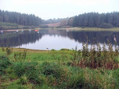
Wistlandpound Reservoir, reservoir in Devon, England, UK

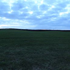
Wistlandpound Reservoir is a body of water in North Devon covering about 40 acres with depths exceeding 20 meters in places. Two trails encircle it: a wide, flat path suitable for wheelchairs and pushchairs, and a more rugged woodland route for experienced walkers seeking a wilder experience.

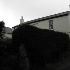
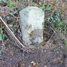
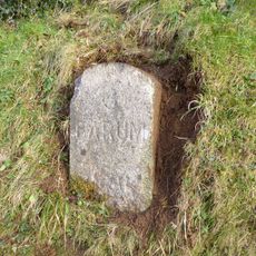
The reservoir was built in 1957 to supply water to nearby towns and improve local water management. Beneath the current water lie remnants of an old railway that once ran through the valley before the area was flooded.

The site is open from dawn to dusk year-round with no restrictions or admission fees, and a pay car park in the southwest area accommodates visitors with assistance dogs. The South West Lakes Trust maintains the grounds, keeping trails well-kept and facilities accessible for all visitors.

Many visitors overlook the submerged remains of the old railway line that once ran through the valley before the reservoir was created. This hidden element adds an intriguing layer of discovery for those aware of the lake's submerged history.

The community of curious travelers

AroundUs brings together thousands of curated places, local tips, and hidden gems, enriched daily by 60,000 contributors worldwide.

Start exploring
Location
Elevation above the sea
242 m
GPS coordinates
51.15839,-3.94333
Latest update
February 9, 2026 08:22
Around this place
Arlington Court
United Kingdom

Arlington Court

3.3 km
Exmoor Zoo
United Kingdom

Exmoor Zoo

1.6 km
National Trust - Arlington Court and the National Trust Carriage Museum
United Kingdom

National Trust - Arlington Court and the National Trust Carriage Museum

3.3 km
St Petrock's Church, Parracombe
United Kingdom

St Petrock's Church, Parracombe

4.6 km
Christ Church
United Kingdom

Christ Church

4.2 km
Church of St John the Baptist
United Kingdom

Church of St John the Baptist

4.1 km
Church of St Peter
United Kingdom

Church of St Peter

4 km
Church of St James
United Kingdom

Church of St James

3.1 km
Church of St Michael
United Kingdom

Church of St Michael

3.9 km
Church of St Thomas
United Kingdom

Church of St Thomas

2.9 km
Church of Holy Trinity
United Kingdom

Church of Holy Trinity

3.9 km
Kentisbury War Memorial
United Kingdom

Kentisbury War Memorial

2.9 km
Church House Used For Storage, Adjacent To North West Corner Of Church Of St Thomas
United Kingdom

Church House Used For Storage, Adjacent To North West Corner Of Church Of St Thomas

2.9 km
Railings, Gates And Gatepiers 5 Metres South West Of Woolley Lodge
United Kingdom

Railings, Gates And Gatepiers 5 Metres South West Of Woolley Lodge

5 km
Footbridge Circa 30 Metres North East Of Town Farmhouse
United Kingdom

Footbridge Circa 30 Metres North East Of Town Farmhouse

5.1 km
Cattle Shelters Approximately 15 Metres East Of Middle Beccott Farmhouse
United Kingdom

Cattle Shelters Approximately 15 Metres East Of Middle Beccott Farmhouse

2.4 km
Kentisbury Village Hall
United Kingdom

Kentisbury Village Hall

2.8 km
Shippon And Barn Approximately 5 Metres East Of Penberthys Farmhouse
United Kingdom

Shippon And Barn Approximately 5 Metres East Of Penberthys Farmhouse

2.4 km
Woolley Lodge, 1600 Metres South West Of Arlington Court
United Kingdom

Woolley Lodge, 1600 Metres South West Of Arlington Court

5 km
Penberthys Farmhouse
United Kingdom

Penberthys Farmhouse

2.4 km
Kentisbury Barton
United Kingdom

Kentisbury Barton

2.9 km
Middle Beccott Including Attached Lofted Stable, And Shippon Range Extending To West
United Kingdom

Middle Beccott Including Attached Lofted Stable, And Shippon Range Extending To West

2.4 km
Sand Park With Stable Range Attached At West End
United Kingdom

Sand Park With Stable Range Attached At West End

2.6 km
East Down Manor
United Kingdom

East Down Manor

4.1 km
Four bowl barrows and a standing stone 330m west of Higher Mattocks Down
United Kingdom

Four bowl barrows and a standing stone 330m west of Higher Mattocks Down

4.7 km
Milestone, opp. lane to Chumhill, 50m W of Bratton Cross
United Kingdom

Milestone, opp. lane to Chumhill, 50m W of Bratton Cross

5.2 km
Milestone, Loxhore Cott, S of village triangle
United Kingdom

Milestone, Loxhore Cott, S of village triangle

4.8 km
Bratton Fleming War Memorial
United Kingdom

Bratton Fleming War Memorial

4 km
Show the full map
« Wistlandpound Reservoir - reservoir in Devon, England, UK » is provided by Around Us (aroundus.com). Images and texts are derived from Wikimedia project under a Creative Commons license. You are allowed to copy, distribute, and modify copies of this page, under the conditions set by the license, as long as this note is clearly visible.

Discover hidden gems everywhere you go!

From secret cafés to breathtaking viewpoints, skip the crowded tourist spots and find places that match your style. Our app makes it easy with voice search, smart filtering, route optimization, and insider tips from travelers worldwide. Download now for the complete mobile experience.

Around Us App Screenshot

A unique approach to discovering new places

Le Figaro

All the places worth exploring

France Info

A tailor-made excursion in just a few clicks

20 Minutes

Around Us
Travel Guide & Maps
Download

Send to your phone

QR Code
1

Open the camera app on your mobile.

2

Point at the QR code with your camera. A notification will appear.

3

Tap the notification to open the link.