Ringsbury Camp, Iron Age contour fort in Purton, England
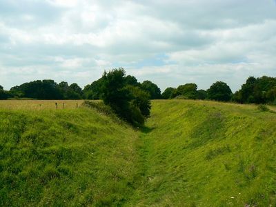
Ringsbury Camp is a prehistoric fortification in Purton featuring a series of concentric banks and ditches arranged to protect its interior space. The structure follows the natural contours of the land, creating a distinctive circular pattern that is clearly visible from above.
The fortification was built around the middle of the 1st century BC, when widespread conflicts between local communities created the need for defensive structures. It was abandoned later, yet its banks remained intact over thousands of years, bearing signs of earlier settlement activity.
The site shows traces of activity spanning thousands of years, from early hunters who left behind flint tools to Iron Age people who occupied and defended the space. This layering of human presence makes it a window into how different communities used the same landscape over time.
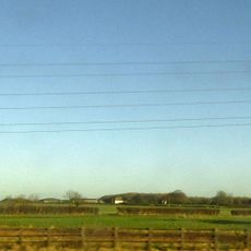
Access is on foot via field paths west of Battlewell and Restrop Road in Purton, with the route crossing open countryside. Sturdy footwear and weather protection are recommended, as the ground is hilly and can be muddy depending on the season.
The fort was built on a stone platform that gave its defenders a commanding view for spotting approaching visitors from great distances. The builders deliberately cleared surrounding forest to maintain unobstructed sight lines in all directions.
Location: Purton
GPS coordinates: 51.57980,-1.89317
Latest update: December 14, 2025 13:06
St Mary's Church, Purton
2.2 km
Church of All Saints, Lydiard Millicent
2 km
Prower Monument In Churchyard , 45 Metres South East Of South East Corner Of South Chapel, Church Of St Mary
2.2 km
Maskeylne Monument In Churchyard Against South Trancept Wall, Church Of St Mary
2.2 km
3, Church End
2.2 km
Purton War Memorial
1.8 km
Group Of 16 Plummer And Large Monuments 12 Metres South West Of South Porch, Church Of St Mary
2.2 km
Lydiard Tregoze Parish War Memorial
1.9 km
Purton Court
2 km
Purton House
2.4 km
The Maltster Public House
1.9 km
Manor House
2.2 km
Granary, East Of College Farmhouse And Against Road
1.8 km
College Farmhouse
1.8 km
Medieval cross in St Mary's churchyard
2.2 km
Railings And Piers To Churchyard Church Of St Mary
3.5 km
88, 89 And 89A, High Street
2.1 km
The Butt Hay
2.2 km
Miletone On Corner Of Mud Lane
579 m
Milestone 140 Metres North Of Pound Farm
3 km
Tithe Barn At Manor House
2.1 km
Lower Hook Farmhouse
2.3 km
The Close
1.5 km
Milestone Opposite Number 15 High Street
1.8 km
Collins Lane Gate
2.2 km
Hallidays
1.6 km
Walled Garden North West Of Lydiard Park
3.4 km
Gateway To College Farm
1.8 kmVisited this place? Tap the stars to rate it and share your experience / photos with the community! Try now! You can cancel it anytime.
Discover hidden gems everywhere you go!
From secret cafés to breathtaking viewpoints, skip the crowded tourist spots and find places that match your style. Our app makes it easy with voice search, smart filtering, route optimization, and insider tips from travelers worldwide. Download now for the complete mobile experience.
A unique approach to discovering new places❞
— Le Figaro
All the places worth exploring❞
— France Info
A tailor-made excursion in just a few clicks❞
— 20 Minutes